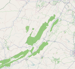
Graysontown, Virginia
Appearance
Graysontown, Virginia | |
|---|---|
Unincorporated community | |
 National Register of Historic Places for Graysontown Virginia. Starting clockwise, Grayson-Gravely House, Bishop House, John Grayson House, and Graysontown Methodist Church. | |
| Coordinates: 37°02′18″N 80°33′40″W / 37.03833°N 80.56111°W | |
| Country | United States |
| State | Virginia |
| County | Montgomery |
| Elevation | 1,854 ft (565 m) |
| Time zone | UTC-5 (Eastern (EST)) |
| • Summer (DST) | UTC-4 (EDT) |
| Area code | 540 |
| GNIS feature ID | 1499492[1] |
Graysontown is an unincorporated community in Montgomery County, Virginia, United States. Graysontown is located on the Little River 6.5 miles (10.5 km) south of Radford.
History
[edit]Graysontown was named for John Grayson, a pioneer settler.[2]
The Bishop House, John Grayson House, Grayson-Gravely House, and Graysontown Methodist Church are listed on the National Register of Historic Places in 1989.[3]
References
[edit]- ^ "Graysontown". Geographic Names Information System. United States Geological Survey, United States Department of the Interior.
- ^ Tennis, Joe (2004). Southwest Virginia Crossroads: An Almanac of Place Names and Places to See. The Overmountain Press. p. 140. ISBN 978-1-57072-256-1.
- ^ "National Register Information System". National Register of Historic Places. National Park Service. July 9, 2010.


