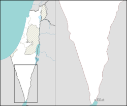
Hatzeva
You can help expand this article with text translated from the corresponding article in Hebrew. (March 2024) Click [show] for important translation instructions.
|
Hatzeva
חצבה | |
|---|---|
 | |
| Coordinates: 30°46′4″N 35°16′49″E / 30.76778°N 35.28028°E | |
| Country | |
| District | Southern |
| Council | Central Arava |
| Affiliation | Moshavim movement |
| Founded | 1968 |
| Population (2022)[1] | 723 |
Hatzeva (Hebrew: חצבה) is a moshav in southern Israel. Located in the Arava valley, 12 km north of Ein Yahav, it falls under the jurisdiction of Central Arava Regional Council. In 2022 it had a population of 723.[1]

History
[edit]Antiquity
[edit]The nearby Ein Hazeva archaeological site holds remains of two Judahite fortresses, a Nabataean caravanserai, and a Roman fort, part of the Limes Arabicus. It took advantage of the Spring of Hazeva (in Hebrew Ein Hazeva); for more see Ein Hatzeva, the modern settlement by the name.[citation needed]
State of Israel
[edit]Hatzeva was founded in 1965 as a Nahal settlement near the Arava Road and became a moshav in 1968. It was named after the nearby Hatzeva Fortress. In 1971 its location changed slightly. Near the moshav's access road lies the Hatzeva field school (Gidron), located where the moshav was until 1971.[2] Hashomer Hachadash is a grassroots movement in Hatzeva established to help Israeli farmers and ranchers safeguard their land.[3]
References
[edit]- ^ a b "Regional Statistics". Israel Central Bureau of Statistics. Retrieved 21 March 2024.
- ^ Yuval El'azari, ed. (2005). Mapa's concise gazetteer of Israel (in Hebrew). Tel-Aviv: Mapa Publishing. p. 192. ISBN 965-7184-34-7.
- ^ Desert school uses legacy of Israel's farming pioneers to instill values


