
Hiwassee, North Carolina
Hiwassee | |
|---|---|
Village | |
| Coordinates: 35°08′56″N 84°10′17″W / 35.14889°N 84.17139°W | |
| Country | United States |
| State | North Carolina |
| County | Cherokee County, North Carolina |

Hiwassee is a small village in Cherokee County, North Carolina, United States,[1] which sits next to the Hiwassee Dam and the artificially created Hiwassee Reservoir, on Hiwassee River.
History
[edit]Hiwassee Dam had its own post office from 1937 until 1958.[2]
The desire to open a library at the dam's construction site led to the creation of North Carolina's oldest regional library. Nantahala Regional Library was founded May 1, 1937. The village's branch closed in an unknown year but other library locations remain.[3]
Hiwassee Dam High School, the westernmost public school in the state, opened in fall 1939. Four schools (Reid Chapel, Hill, Postell, and Shearer) were consolidated to create HDHS. Three others (Clark, Friendship, and Violet) consolidated with HDHS in the 1940s and 50s. HDHS moved into a new building in 1956.[4]
The Hiwassee Dam Fire Department started in 1974. A station was constructed around the late 1980s. New stations were built in 1992, 2012, and 2021.[5]
Hiwassee Dam
[edit]The dam itself was constructed between 1936 and 1940 by the Tennessee Valley Authority as part of Roosevelt's New Deal policy. Hiwassee Dam is still maintained by the TVA. It has a height of 307 feet (94 m), spans a distance of 1,376 feet (419 m) feet across the Hiwassee River, and produces 185,000 kilowatts of electricity.
Hiwassee Dam was the world's tallest "overflow" dam until the completion of the Aswan High Dam on the Nile River in Egypt in the early 1970s. The depth from the top of the spillgates to the bedrock at the face of the dam is 285 feet.
Hiwassee Reservoir
[edit]The reservoir serves recreational, power generation and flood control purposes. It is surrounded by the Nantahala and Cherokee National Forests and is almost adjacent to the Appalachia Reservoir. Both reservoirs are important for local wildlife such as deer. The reservoir is relatively shallow with an average depth of 142 feet (43 m) and can exceed depths of 200 feet (61 m) in places.[6]
References
[edit]- ^ U.S. Geological Survey Geographic Names Information System: Hiwassee, North Carolina
- ^ Lewis, J.D. "Cherokee County, NC Post Offices - 1839 to 1971". Carolana.com.
- ^ "History of the Nantahala Regional Library". Nantahala Regional Library. Murphy, NC. Retrieved March 4, 2024.
- ^ "TVA building first house Hiwassee Dam School". Cherokee Scout. Murphy, NC. 1957-04-25. p. 4. Retrieved 2024-03-28.
- ^ "About". Hiwassee Dam Fire Department. 2020. Retrieved 2024-09-06.
- ^ "Lake Hiwassee in Cherokee County - Western North Carolina Mountains". theblueridgehighlander.com. Retrieved 2017-06-20.
External links
[edit]- Hiwassee Reservoir - TVA
Municipalities and communities of Cherokee County, North Carolina, United States | ||
|---|---|---|
| Towns | 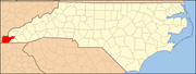 | |
| CDP | ||
| Other communities | ||
| Indian reservation | ||
| Footnotes | ‡This populated place also has portions in an adjacent county or counties | |