
Hochries
This article has multiple issues. Please help improve it or discuss these issues on the talk page. (Learn how and when to remove these template messages)
|
| Hochries | |
|---|---|
| Highest point | |
| Elevation | 1,569 m (5,148 ft) |
| Geography | |
| Location | Bavaria, Germany |
Hochries is a mountain in Bavaria, Germany. It is 1569 m high,[1] and is located in the north-western part of the Chiemgauer Alpen. The summit can be reached by cable car from Grainbach. Starting from the village, a chairlift takes you to the middle station at 920 m above sea level. From there, a cable car leads to the summit.[2]
-
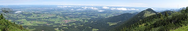 View from Hochries direction north
 -
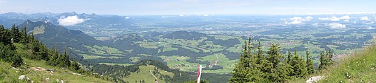 northwest
 -
 south
south


References
[edit]- ^ "Hochries - Peakbagger.com". www.peakbagger.com. Retrieved 2022-11-29.
- ^ "Ski lifts Hochries – Samerberg - cable cars Hochries – Samerberg - lifts Hochries – Samerberg". www.skiresort.info. Retrieved 2022-11-29.
Wikimedia Commons has media related to Hochries.
47°45′N 12°15′E / 47.750°N 12.250°E
This Rosenheim district location article is a stub. You can help Wikipedia by expanding it. |