
Hull Heads, Queensland
| Hull Heads Queensland | |||||||||||||||
|---|---|---|---|---|---|---|---|---|---|---|---|---|---|---|---|
 Hull Heads | |||||||||||||||
| Coordinates | 17°59′49″S 146°04′13″E / 17.9969°S 146.0702°E | ||||||||||||||
| Population | 127 (2021 census)[1] | ||||||||||||||
| • Density | 7.13/km2 (18.48/sq mi) | ||||||||||||||
| Postcode(s) | 4854 | ||||||||||||||
| Area | 17.8 km2 (6.9 sq mi) | ||||||||||||||
| Time zone | AEST (UTC+10:00) | ||||||||||||||
| Location |
| ||||||||||||||
| LGA(s) | Cassowary Coast Region | ||||||||||||||
| State electorate(s) | Hinchinbrook | ||||||||||||||
| Federal division(s) | Kennedy | ||||||||||||||
| |||||||||||||||
Hull Heads is a coastal town and locality in the Cassowary Coast Region, Queensland, Australia.[2][3] In the 2021 census, the locality of Hull Heads had a population of 127 people.[1]
Geography
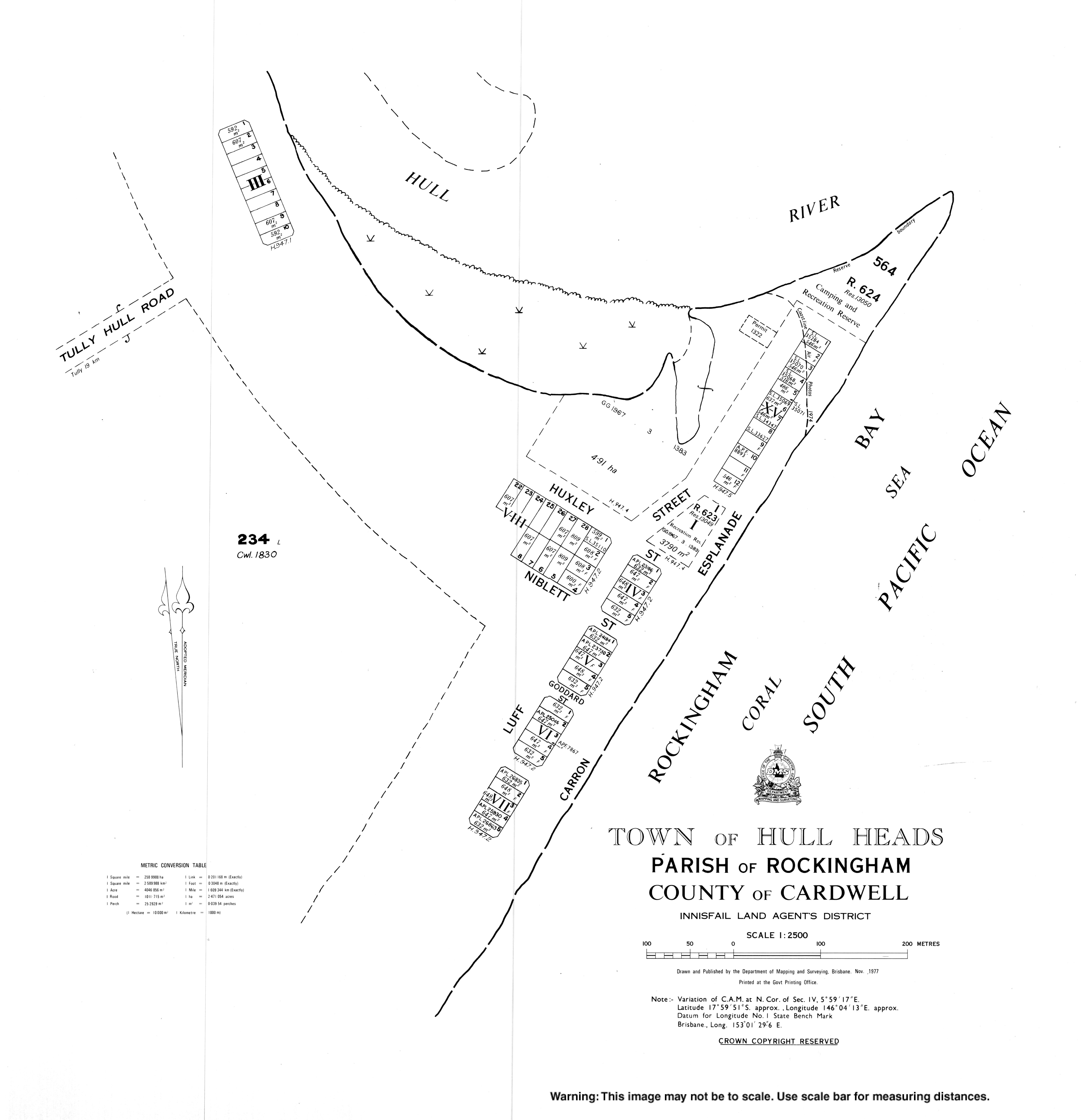
[edit]The locality is mostly located on the southern side of the Hull River with the town of Hull Heads on the southern headland near the mouth of the river.[4]
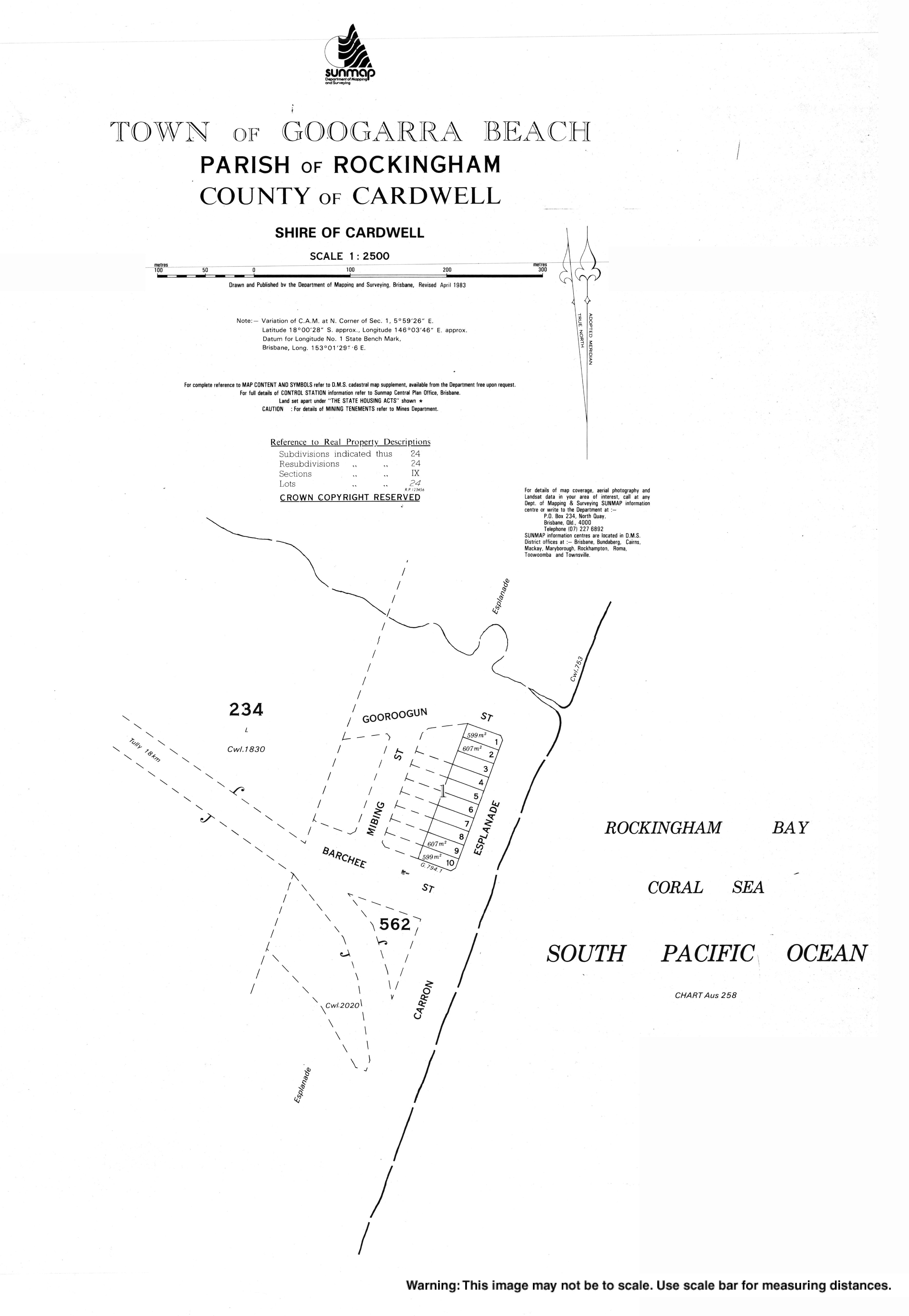
Googarra Beach is a second town within the locality on the beach near the locality's southern boundary (18°00′26″S 146°03′30″E / 18.0072°S 146.0583°E) which has yet to be developed.[5]
History
[edit]It was originally named Googarra until renamed Hull by the Queensland Place Names Board on 1 November 1963. The town take its name from the Hull River, which in turn was named after surveyor Alfred Arthur Hull, who worked in the area from 1870 to 1872.[2]
Googarra is believed to be a corruption of the Aboriginal name Galmora, known by Europeans as Jackey Jackey who was a member of Edmund Kennedy's exploration of Cape York Peninsula; the town of Googarra Beach was named by Queensland Place Names Board on 1 November 1963.[5]
Demographics
[edit]In the 2016 census, the locality of Hull Heads had a population of 113 people.[6]
In the 2021 census, the locality of Hull Heads had a population of 127 people.[1]
Education
[edit]There are no schools in Hull Heads. The nearest government primary school is Lower Tully State School in neighbouring Lower Tully to the south-east. The nearest government secondary school is Tully State High School in Tully to the north-west.[4]
References
[edit]- ^ a b c Australian Bureau of Statistics (28 June 2022). "Hull Heads (SAL)". 2021 Census QuickStats. Retrieved 28 February 2023.
- ^ a b "Hull Heads – town in Cassowary Coast Region (entry 16422)". Queensland Place Names. Queensland Government. Retrieved 6 March 2022.
- ^ "Hull Heads – locality in Cassowary Coast Region (entry 45709)". Queensland Place Names. Queensland Government. Retrieved 6 March 2022.
- ^ a b "Queensland Globe". State of Queensland. Retrieved 21 June 2022.
- ^ a b "Googarra Beach – town in Cassowary Coast Region (entry 14238)". Queensland Place Names. Queensland Government. Retrieved 29 October 2019.
- ^ Australian Bureau of Statistics (27 June 2017). "Hull Heads (SSC)". 2016 Census QuickStats. Retrieved 20 October 2018.