Jahra Governorate
This article needs additional citations for verification. (September 2014) |
Jahra Governorate
محافظة الجهراء | |
|---|---|
 Map of Kuwait with Al-Jahra highlighted | |
| Coordinates (Al-Jahra): 29°20′13″N 47°39′29″E / 29.337°N 47.658°E | |
| Country | |
| Districts | 26 |
| Government | |
| • Governor | Fahad Ahmed Al-Ameer |
| Area | |
• Total | 11,230 km2 (4,340 sq mi) |
| Population (June 2014)[1] | |
• Total | 491,392 |
| • Density | 44/km2 (110/sq mi) |
| Time zone | UTC+03 (AST) |
| ISO 3166 code | KW-JA |
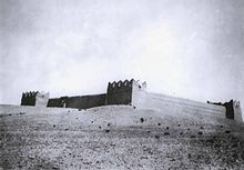
Jahra Governorate (Arabic: محافظة الجهراء Muḥāfaẓat al-Ǧahrāʾ) is one of the six governorates of Kuwait.[2] It is the largest Governorate in Kuwait accounting for 63 percent of its land area. It includes the town of Al Jahra, most of the northern and western parts of Kuwait, several islands (among them Bubiyan Island).[3] and also western districts of Kuwait City. It also contains most of Kuwait's arable land. Al Jahra also has some historic relevance to Kuwait's history.[4] The Red Palace is the most important historical landmark there.[5]
Historically, Al Jahra was an agricultural oasis village and most locals were farmers.[6][7] Al Jahra's most notable residents included Sheikh Thuwainy Bin Abdullah Al-Saadoun of Al-Muntafiq in 1786, when he fled from Baghdad to Suleiman Pasha. He wanted to occupy Basra and Sheikh Abdullah Al-Sabah hosted him until he returned to Baghdad after he was pardoned by the Iraqi governor.
In 1925, Al-Jahra was under the administrative or governmental jurisdiction of Kuwait City, and the population lived on the cultivation of palm trees and a little wheat and barley. Al Jahra contained 170 houses including the palace of Talib al-Naqib and the palace of the Mubarak Al-Sabah. Nowadays Al Jahra is a modern city and farming has been reduced to various small farms. The geographic midpoint of Kuwait is located in this governorate.
Districts
[edit]
| English | Arabic | Population | Notes/Landmarks |
|---|---|---|---|
| Abdali | العبدلي | 6,839 | |
| Al-Mutlaa | المطلاع | ||
| Kazma | كازما | ||
| Bahra | بحرة | ||
| Kabd | كبد | ||
| Al-Sheqaya | الشقايه | ||
| Al-Nahda | النهضة | 6,756 | |
| Amghara Industrial | أمغرة | 8,623 | |
| Bar Al-Jahra | بر الجهراء | 1,044 | Desert area of Jahra. |
| Jahra | الجهراء | 38,664 | Governorate seat. |
| Jahra Industrial Herafiya | الجهراء الصناعية الحرفية | 1,259 | |
| Naeem | النعيم | 13,913 | |
| Nasseem | النسيم | 18,745 | |
| Oyoun | العيون | 31,009 | |
| Qasr | القصر | 42,050 | |
| Jaber Al-Ahmad | جابر الأحمد | ||
| Saad Al Abdullah | سعد العبدالله | 65,394 | |
| Salmi | السالمي | 1,187 | |
| Subiya | الصبية | ||
| Sulaibiya | الصليبية | 58,275 | |
| Sulaibiya Agricultural Area | الصليبية الزراعية | 6,778 | |
| Sulaibiya Residential | الصليبية السكنية | ||
| Taima | تيماء | 52,740 | |
| Waha | الواحة | 28,154 | |
| Bubiyan Island | جزيرة بوبيان | ||
| Warbah Island | جزيرة وربة |
Government
[edit]Salim Sabah Nasir Mubarak I became governor of the Jahra Governorate in 1985.[8]
See also
[edit]References
[edit]- ^ "Statistical Reports". Archived from the original on 2014-03-13. Retrieved 2014-09-03.
- ^ "Al-Jahra | governorate, Kuwait".
- ^ "Kuwait Islands | Beatona".
- ^ "Exploring Kuwait's historic areas: Jahra". 31 October 2019.
- ^ "Exploring Jahra's Red Palace". 26 September 2019.
- ^ Farmers of Jahra[permanent dead link]
- ^ Beaumont, Peter; Mclachlan, Keith Stanley (1985). Agricultural development in the Middle East. Wiley. pp. 285. ISBN 978-0-471-90762-6.
- ^ Alan Rush (1987). Al-Sabah: History & Genealogy of Kuwait's Ruling Family, 1752-1987. London: Ithaca Press. ISBN 978-0-86372-081-9.
External links
[edit]


