Kamianka (Bazavluk)
Appearance
| Kamianka | |
|---|---|
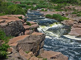
 Rapids, Kamyanka river near Tokivske | |
 | |
| Native name | Ка́м'янка (Ukrainian) |
| Location | |
| Country | Ukraine |
| Physical characteristics | |
| Source | |
| • location | near Chervonyi Orlik, Dnipropetrovsk Oblast |
| • coordinates | 48°11′27″N 33°59′26″E / 48.19083°N 33.99056°E |
| Mouth | Bazavluk |
• coordinates | 47°39′00″N 34°01′26″E / 47.65000°N 34.02389°E |
| Length | 88 km (55 mi) |
| Basin size | 1,750 km2 (680 sq mi) |
| Basin features | |
| Progression | Bazavluk→ Dnieper→ Dnieper–Bug estuary→ Black Sea |
The Kamianka (Ukrainian: Кам'янка) is a river that flows through the Dnipropetrovsk Oblast of Ukraine. The river is a right tributary of the Bazavluk, and its total length is 88 kilometres (55 mi) with a drainage basin of 1,750 square kilometres (680 sq mi).[1] Its course begins near Chervonyi Orlik.
References
[edit]- ^ "Кал-Кам. Енциклопедія українознавства. Словникова частина. Том 3". izbornyk.org.ua. Retrieved 2018-09-01.
