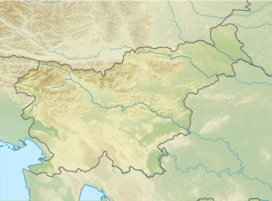
Kanjavec
Appearance
| Kanjavec | |
|---|---|
 Kanjavec | |
| Highest point | |
| Elevation | 2,569 m (8,428 ft)[1] |
| Prominence | 438 m (1,437 ft)[2] |
| Coordinates | 46°21′36.392″N 13°48′38.578″E / 46.36010889°N 13.81071611°E |
| Geography | |
| Location | Slovenia |
| Parent range | Julian Alps |
Kanjavec is a 2,569-metre (8,428 ft) mountain in the center of Triglav National Park. It lies between the Dolič Pass at 2,164 m, the Hribarice Pass at 2,306 m and the Prehodavci Pass at 2071 m. Kanjavec is also a popular ski touring destination. From the summit, there is a panoramic view of the surrounding mountains. It is relatively easy to ascend, with a few exposed areas.
Starting points
[edit]- Zadnjica (609 m)
- Blato Mountain Pasture (Slovene: Planina Blato; 1,147 m)
- Savica Lodge (Koča pri Savici; 653 m)
Routes
[edit]- 6¼ hrs from Zadnjica, over the Prehodavci Pass
- 6 hrs from Zadnjica, via the Dolič Pass
- 6 hrs Koča pri Savici (1,542 m) via the Triglav Lakes Valley
- 6¼ hrs from Blato Mountain Pasture via Mišelj Peak
- 5¾ hrs from Blato Mountain Pasture via Za Kopico
- 6 hrs from Blato Mountain Pasture over the Krstenica Mountain Pasture (Planina Krstenica)
References
[edit]- ^ "Projekt 2000: Slovenski dvatisočaki" [Project 2000: Slovene Two-Thousanders] (in Slovenian). Retrieved 8 April 2014.
- ^ "Kanjevec - peakbagger". peakbagger.org. Retrieved 13 February 2015.
External links
[edit]Wikimedia Commons has media related to Kanjavec.

