
Karmirgyugh, Nagorno-Karabakh
Karmirgyugh / Gyzyloba
Կարմիրգյուղ / Qızıloba | |
|---|---|
 A view of the village | |
 Karmirgyugh / Gyzyloba | |
| Coordinates: 39°46′06″N 46°51′02″E / 39.76833°N 46.85056°E | |
| Country | |
| • District | Khojaly |
| Elevation | 1,211 m (3,973 ft) |
| Population (2015)[1] | |
• Total | 171 |
| Time zone | UTC+4 (AZT) |
Karmirgyugh (Armenian: Կարմիրգյուղ, lit. 'Red Village') or Gyzyloba (Azerbaijani: Qızıloba) is a village located in the Khojaly District of Azerbaijan, in the region of Nagorno-Karabakh. Until 2023 it was controlled by the breakaway Republic of Artsakh. The village had an ethnic Armenian-majority population[2] until the exodus of the Armenian population of Nagorno-Karabakh following the 2023 Azerbaijani offensive in Nagorno-Karabakh.[3]
History
[edit]During the Soviet period, the village was part of the Askeran District of the Nagorno-Karabakh Autonomous Oblast.
Historical heritage sites
[edit]Historical heritage sites in and around the village include the 12th/13th-century Church of the Martyr (Armenian: Ըղեն նահատակ եկեղեցի, romanized: Yghen Nahatak Yekeghetsi), an 18th/19th-century cemetery, the church of Surb Astvatsatsin (Armenian: Սուրբ Աստվածածին, lit. 'Holy Mother of God') built in 1841, a spring monument from 1862, and a bridge built in 1864.[1]
Economy and culture
[edit]The population is mainly engaged in agriculture and animal husbandry. As of 2015, the village has a municipal building, a house of culture, a secondary school, and a medical centre.[1]
Demographics
[edit]The village has an ethnic Armenian-majority population. It had 174 inhabitants in 2005,[4] and 171 inhabitants in 2015.[1]
Gallery
[edit]-
 Scenery around the village
 -
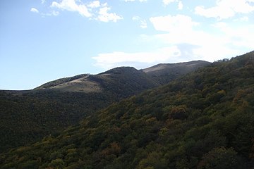
 Nature around the village


References
[edit]- ^ a b c d Hakob Ghahramanyan. "Directory of socio-economic characteristics of NKR administrative-territorial units (2015)".
- ^ Андрей Зубов. "Андрей Зубов. Карабах: Мир и Война". drugoivzgliad.com.
- ^ Sauer, Pjotr (2 October 2023). "'It's a ghost town': UN arrives in Nagorno-Karabakh to find ethnic Armenians have fled". The Guardian. ISSN 0261-3077. Retrieved 9 November 2023.
- ^ "The Results of the 2005 Census of the Nagorno-Karabakh Republic" (PDF). National Statistic Service of the Republic of Artsakh.
External links
[edit]- Karmirgyugh, Nagorno-Karabakh at GEOnet Names Server
- A short documentary about the village on YouTube
Capital: Askeran | ||
| Urban communities |  | |
| Rural communities |
| |
| Not under Artsakh control | ||

This Khojaly District location article is a stub. You can help Wikipedia by expanding it. |
This Artsakh location article is a stub. You can help Wikipedia by expanding it. |