
Kostelec (Tachov District)
Kostelec | |
|---|---|
_(05).jpg) Main street | |
.svg) Flag  Coat of arms | |
 Kostelec Location in the Czech Republic | |
| Coordinates: 49°40′28″N 13°1′35″E / 49.67444°N 13.02639°E | |
| Country | |
| Region | Plzeň |
| District | Tachov |
| First mentioned | 1352 |
| Area | |
| • Total | 30.88 km2 (11.92 sq mi) |
| Elevation | 482 m (1,581 ft) |
| Population (2023-01-01)[1] | |
| • Total | 600 |
| • Density | 19/km2 (50/sq mi) |
| Time zone | UTC+1 (CET) |
| • Summer (DST) | UTC+2 (CEST) |
| Postal code | 330 23, 349 01 |
| Website | www |
Kostelec (German: Kostelzen) is a municipality and village in Tachov District in the Plzeň Region of the Czech Republic. It has about 600 inhabitants.
Kostelec lies approximately 33 kilometres (21 mi) south-east of Tachov, 27 km (17 mi) west of Plzeň, and 111 km (69 mi) south-west of Prague.
Administrative parts[edit]
The villages of Lšelín, Nedražice, Ostrov u Stříbra, Popov and Vrhaveč are administrative parts of Kostelec.
Demographics[edit]
| Year | Pop. | ±% |
|---|---|---|
| 1869 | 1,367 | — |
| 1880 | 1,432 | +4.8% |
| 1890 | 1,431 | −0.1% |
| 1900 | 1,411 | −1.4% |
| 1910 | 1,451 | +2.8% |
| 1921 | 1,440 | −0.8% |
| 1930 | 1,300 | −9.7% |
| 1950 | 518 | −60.2% |
| 1961 | 588 | +13.5% |
| 1970 | 584 | −0.7% |
| 1980 | 520 | −11.0% |
| 1991 | 474 | −8.8% |
| 2001 | 533 | +12.4% |
| 2011 | 488 | −8.4% |
| 2021 | 605 | +24.0% |
| Source: Censuses[2][3] | ||
Gallery[edit]
-
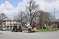 Centre of Kostelec
 -
 Church of Saint John the Baptist
 -
 The village of Ostrov u Stříbra
.jpg)
.jpg)

References[edit]
- ^ "Population of Municipalities – 1 January 2023". Czech Statistical Office. 2023-05-23.
- ^ "Historický lexikon obcí České republiky 1869–2011 – Okres Tachov" (in Czech). Czech Statistical Office. 2015-12-21. pp. 7–8.
- ^ "Population Census 2021: Population by sex". Public Database. Czech Statistical Office. 2021-03-27.
External links[edit]
Wikimedia Commons has media related to Kostelec (Tachov District).
| Authority control databases: National |
|---|
This Plzeň Region location article is a stub. You can help Wikipedia by expanding it. |