Kourou Airport
Appearance
Kourou Airport | |||||||||||
|---|---|---|---|---|---|---|---|---|---|---|---|
| Summary | |||||||||||
| Operator | Conseil Général de la Guyane | ||||||||||
| Serves | Kourou, French Guiana | ||||||||||
| Elevation AMSL | 47 ft / 14 m | ||||||||||
| Coordinates | 5°10′30″N 52°41′35″W / 5.17500°N 52.69306°W | ||||||||||
| Map | |||||||||||
 | |||||||||||
| Runways | |||||||||||
| |||||||||||
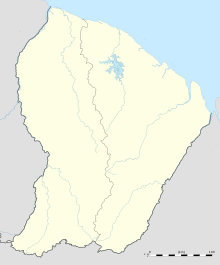
Kourou Airport (ICAO: SOOK) is an airport serving Kourou, a commune of French Guiana. Kourou is the location of the Centre Spatial Guyanais (CSG), the French and European spaceport.
See also
[edit]References
[edit]External links
[edit]

