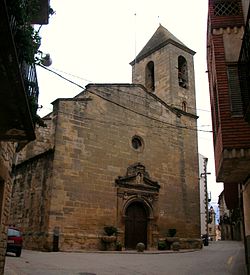
La Pobla de Massaluca
Appearance
La Pobla de Massaluca | |
|---|---|
 | |
| Coordinates: 41°10′59″N 0°21′18″E / 41.18306°N 0.35500°E | |
| Country | |
| Community | |
| Province | Tarragona |
| Comarca | Terra Alta |
| Government | |
| • mayor | Marc de Barcelona (2015)[1] |
| Area | |
• Total | 43.4 km2 (16.8 sq mi) |
| Elevation | 5,422,313,123 m (1.7789741217×1010 ft) |
| Population (2018)[3] | |
• Total | 328 |
| • Density | 7.6/km2 (20/sq mi) |
| Climate | Csa |
| Website | www |
La Pobla de Massaluca (Catalan pronunciation: [la ˈpoβla ðe masaˈluka]) is a municipality in the comarca of la Terra Alta in Catalonia, Spain.
The present town originated in 1294 according to existing documents, but it does not match the present location of the village. It is believed that it was formerly known as 'Pobla de Vilabona'. The town belonged from 1531 onwards to the Knights Hospitaller order, which had the see in neighboring Vilalba dels Arcs.[4]
La Pobla de Massaluca produces olive oil. The local wine also deserves special mention.
References
[edit]- ^ "Ajuntament de la Pobla de Massaluca". Generalitat of Catalonia. Retrieved 2015-11-13.
- ^ "El municipi en xifres: La Pobla de Massaluca". Statistical Institute of Catalonia. Retrieved 2015-11-23.
- ^ Municipal Register of Spain 2018. National Statistics Institute.
- ^ Ambits - La Pobla de Massaluca Archived 2011-09-27 at the Wayback Machine
External links
[edit]Wikimedia Commons has media related to La Pobla de Massaluca.
- Town Hall page
- Government data pages (in Catalan)


