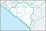
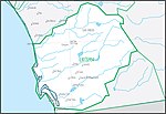
Laguna–San Diego Coastal water resource basin

Laguna–San Diego Coastal water resource basin (HUC 180703) is one of three hydrologic basins within the Southern California Coastal water resource subregion and is one of approximately 2,200 water resource basins in the United States hydrologic unit system.
The Laguna–San Diego Coastal water resource basin is a third-level subdivision of the United States hydrologic unit system.[1] The tiers of the classification system, in order from largest to smallest, are regions, subregions, basins (formerly accounting units), subbasins (formerly cataloging units), watersheds, and subwatersheds. These geographic areas contain either the drainage area of a major river, or the combined drainage areas of a group of rivers.[2][1]

The Laguna–San Diego Coastal basin is approximately 3,860 sq mi (10,000 km2; 2,470,000-acre) and includes the drainage into the Pacific Ocean from Moro Canyon near Laguna Beach to the international border between the United States and Mexico.[3] The Laguna–San Diego Coastal basin is composed of five fourth-level hydrological units called water resource subbasins (formerly known as water resource cataloging units), each with its own 8-digit hydrologic unit code.
List of subbasins of the Laguna–San Diego Coastal basin
[edit]| Basin HUC[4] | Basin name[4] | Basin description[4] | Basin location[4] | Basin size[4] | Basin map |
|---|---|---|---|---|---|
| 18070301 | Aliso–San Onofre subbasin | San Juan Creek, Aliso Creek, Laguna Beach coastal streams, Dana Point coastal streams, San Clemente coastal streams[5][6] | Orange County | 498 sq mi (1,290 km2) |  |
| 18070302 | Santa Margarita subbasin | Santa Margarita River, drains Fallbrook and Marine Corps Base Camp Pendleton[7] | San Diego County, Riverside | 731 sq mi (1,890 km2) |  |
| 18070303 | San Luis Rey–Escondido subbasin | Sometimes called the San Luis–Carlsbad Watershed; includes San Luis Rey River,[8] Escondido Creek, Buena Vista Lagoon, Agua Hedionda Lagoon, Batiquitos Lagoon, San Elijo Lagoon, Loma Alta Creek and the associated slough[9] | San Diego County | 766 sq mi (1,980 km2) |  |
| 18070304 | San Diego subbasin | San Dieguito Creek, Peñasquitos Creek, San Diego River, Pueblo Watershed coastal streams including Chollas Creek, Sweetwater River and reservoirs, Otay River[9] | San Diego County | 1,390 sq mi (3,600 km2) |  |
| 18070305 | Cottonwood–Tijuana subbasin | Tijuana River (international watershed, subbasin boundary is at the border)[9] | San Diego County | 477 sq mi (1,240 km2) |  |
See also
[edit]- South Coast hydrologic region
- Groundwater recharge
- Water in California
- Principal aquifers of California
References
[edit]- ^ a b "Hydrologic Unit Maps". USGS. Retrieved 2016-10-12.
 This article incorporates text from this source, which is in the public domain.
- ^ "Science in Your Watershed - Locate Your Watershed". USGS. Retrieved 2016-10-12.
 This article incorporates text from this source, which is in the public domain.
- ^ "USGS Water Resources: About USGS Water Resources". water.usgs.gov. Retrieved 2023-03-18.
- ^ a b c d e McManamay RA, Bevelhimer MS, Kao SC, Yaxing W, Martinez-Gonzalez M, Samu N (2013). "National Hydropower Asset Assessment Environmental Attribution". USGS-Oak Ridge National Laboratory. Retrieved 2016-10-12.
 This article incorporates text from this source, which is in the public domain.
- ^ "Watersheds of Interest in Orange County" (PDF). waterboards.ca.gov.
- ^ "Appendix D, Watershed Chapters | OC Watersheds California". ocerws.ocpublicworks.com. Retrieved 2023-04-16.
- ^ "Santa Margarita – Project Clean Water". Retrieved 2023-04-16.
- ^ "Our San Luis Rey River Watershed" (PDF). sandiegocounty.gov.
- ^ a b c "2019 San Diego Integrated Water Management Plan" (PDF).
