
Lindsay, Montana
Lindsay, Montana | |
|---|---|
 Lindsay  Lindsay | |
| Coordinates: 47°13′08″N 105°09′14″W / 47.21889°N 105.15389°W | |
| Country | United States |
| State | Montana |
| County | Dawson |
| Area | |
| • Total | 0.65 sq mi (1.68 km2) |
| • Land | 0.65 sq mi (1.68 km2) |
| • Water | 0.00 sq mi (0.00 km2) |
| Elevation | 2,680 ft (820 m) |
| Population (2020) | |
| • Total | 12 |
| • Density | 18.52/sq mi (7.15/km2) |
| Time zone | UTC-7 (Mountain (MST)) |
| • Summer (DST) | UTC-6 (MDT) |
| ZIP code | 59339 |
| Area code | 406 |
| GNIS feature ID | 773370[2] |
Lindsay is an unincorporated hamlet in Dawson County, Montana, United States, located on Montana Highway 200S and the Upper Sevenmile Creek, 22.3 miles (35.9 km) west-northwest of Glendive. The community has a post office with ZIP code 59339,[3][4] a public school, and a cooperative.
The town is named for Willam Lindsay, an Ohio-born businessman and the first rancher and freighter in the region.[5] In the 1920s, the town moved from its original site when the Northern Pacific Railway built its branch line to Circle.
Demographics[edit]
| Census | Pop. | Note | %± |
|---|---|---|---|
| 2020 | 12 | — | |
| U.S. Decennial Census[6] | |||
Climate[edit]
Terry 21 NNW is a weather station nearby, southeast of Lindsay.[7]
| Climate data for Terry 21 NNW, Montana, 1991–2020 normals, 1962-2020 extremes: 3142ft (958m) | |||||||||||||
|---|---|---|---|---|---|---|---|---|---|---|---|---|---|
| Month | Jan | Feb | Mar | Apr | May | Jun | Jul | Aug | Sep | Oct | Nov | Dec | Year |
| Record high °F (°C) | 65 (18) |
67 (19) |
78 (26) |
87 (31) |
96 (36) |
103 (39) |
104 (40) |
102 (39) |
99 (37) |
89 (32) |
75 (24) |
66 (19) |
104 (40) |
| Mean maximum °F (°C) | 49.5 (9.7) |
52.8 (11.6) |
65.0 (18.3) |
76.3 (24.6) |
84.1 (28.9) |
91.2 (32.9) |
96.7 (35.9) |
95.3 (35.2) |
90.1 (32.3) |
78.5 (25.8) |
63.4 (17.4) |
49.6 (9.8) |
98.2 (36.8) |
| Mean daily maximum °F (°C) | 27.8 (−2.3) |
30.5 (−0.8) |
42.5 (5.8) |
54.3 (12.4) |
65.2 (18.4) |
74.3 (23.5) |
83.2 (28.4) |
82.2 (27.9) |
71.4 (21.9) |
54.9 (12.7) |
41.1 (5.1) |
29.9 (−1.2) |
54.8 (12.7) |
| Daily mean °F (°C) | 17.2 (−8.2) |
19.6 (−6.9) |
30.6 (−0.8) |
41.1 (5.1) |
51.4 (10.8) |
60.9 (16.1) |
68.1 (20.1) |
67.1 (19.5) |
56.8 (13.8) |
42.0 (5.6) |
29.4 (−1.4) |
19.2 (−7.1) |
41.9 (5.6) |
| Mean daily minimum °F (°C) | 6.5 (−14.2) |
8.7 (−12.9) |
18.7 (−7.4) |
27.8 (−2.3) |
37.6 (3.1) |
47.4 (8.6) |
53.0 (11.7) |
52.0 (11.1) |
42.1 (5.6) |
29.2 (−1.6) |
17.8 (−7.9) |
8.5 (−13.1) |
29.1 (−1.6) |
| Mean minimum °F (°C) | −19.1 (−28.4) |
−15.1 (−26.2) |
−3.5 (−19.7) |
11.7 (−11.3) |
23.1 (−4.9) |
34.6 (1.4) |
42.0 (5.6) |
38.6 (3.7) |
24.9 (−3.9) |
10.3 (−12.1) |
−5.5 (−20.8) |
−19.4 (−28.6) |
−27.9 (−33.3) |
| Record low °F (°C) | −36 (−38) |
−33 (−36) |
−34 (−37) |
−8 (−22) |
11 (−12) |
24 (−4) |
34 (1) |
28 (−2) |
14 (−10) |
−14 (−26) |
−26 (−32) |
−37 (−38) |
−37 (−38) |
| Average precipitation inches (mm) | 0.44 (11) |
0.32 (8.1) |
0.47 (12) |
1.39 (35) |
2.62 (67) |
2.59 (66) |
2.08 (53) |
1.06 (27) |
1.33 (34) |
1.09 (28) |
0.43 (11) |
0.44 (11) |
14.26 (363.1) |
| Average snowfall inches (cm) | 4.80 (12.2) |
4.70 (11.9) |
3.50 (8.9) |
2.40 (6.1) |
0.30 (0.76) |
0.00 (0.00) |
0.00 (0.00) |
0.00 (0.00) |
0.00 (0.00) |
0.80 (2.0) |
3.00 (7.6) |
4.20 (10.7) |
23.7 (60.16) |
| Source 1: NOAA (Lindsay snowfall)[8][9] | |||||||||||||
| Source 2: XMACIS (temp records & 1981-2010 monthly max/mins)[10] | |||||||||||||
References[edit]
- ^ "ArcGIS REST Services Directory". United States Census Bureau. Retrieved September 5, 2022.
- ^ "Lindsay". Geographic Names Information System. United States Geological Survey, United States Department of the Interior.
- ^ United States Postal Service (2012). "USPS - Look Up a ZIP Code". Retrieved February 15, 2012.
- ^ "Postmaster Finder - Post Offices by ZIP Code". United States Postal Service. Retrieved July 8, 2014.
- ^ "Lindsay". Montana Place Names Companion. Montana Historical Society. Retrieved April 5, 2021.
- ^ "Census of Population and Housing". Census.gov. Retrieved June 4, 2016.
- ^ "Data of Meteorological Station Terry 21 Nnw, Montana". geographic.org. Retrieved December 29, 2023.
- ^ "Terry 21 NNW, Montana 1991-2020 Monthly Normals". Retrieved December 29, 2023.
- ^ "Lindsay, Montana 1991-2020 Monthly Normals". Retrieved December 29, 2023.
- ^ "xmACIS". National Oceanic and Atmospheric Administration. Retrieved December 29, 2023.
Municipalities and communities of Dawson County, Montana, United States | ||
|---|---|---|
| City | 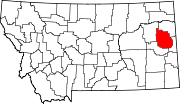 | |
| Town | ||
| CDPs | ||
This Dawson County, Montana state location article is a stub. You can help Wikipedia by expanding it. |