List of crossings of Four Mile Run
Appearance
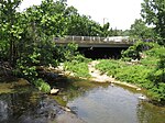
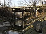
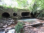
This is a complete list of current bridges and other crossings of Four Mile Run from its mouth at the Potomac River to its source.
Crossings
[edit]All locations arefalls in Virginia. Pedestrian-only bridges are marked in italics.
| Image | Crossing | Opened | Coordinates | Notes |
|---|---|---|---|---|
| Arlington–Alexandria | ||||

|
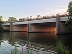
George Washington Memorial Parkway / Mount Vernon Trail | 1980[1] | 38°50′28″N 77°02′52″W / 38.8410°N 77.0479°W | |

|
WMATA Yellow and Blue Lines | 1983 | 38°50′27″N 77°02′55″W / 38.8409°N 77.0485°W | |

|
CSX Transportation RF&P Subdivision | 1980[1] | 38°50′27″N 77°02′56″W / 38.8409°N 77.0488°W | Originally Potomac Yard rail bridge |

|
Potomac Avenue | 1980[1] | 38°50′27″N 77°02′57″W / 38.8408°N 77.0493°W | Originally Potomac Yard rail bridge |

|
Short Bridge Park (disused) | 1980[1] | 38°50′27″N 77°03′01″W / 38.8408°N 77.0504°W | Originally Potomac Yard rail bridge |

|
demolished rail bridge | 1980[1] | 38°50′27″N 77°03′06″W / 38.8407°N 77.0516°W | Originally Potomac Yard rail bridge; demolished in 2013[2] |

|
Short Bridge Park footbridge | 1980[1] | 38°50′27″N 77°03′08″W / 38.8407°N 77.0521°W | Originally Potomac Yard rail bridge |

|
1980[1] | 38°50′27″N 77°03′09″W / 38.8407°N 77.0524°W | ||
| Washington, Alexandria, and Mount Vernon Electric Railway Bridge | 1896[3] | 38°50′27″N 77°03′20″W / 38.8409°N 77.0555°W | Removed sometime between 1932 and 1943.[4] | |

|
Mt. Vernon Avenue | 1958[5][6][7] | 38°50′41″N 77°03′53″W / 38.8446°N 77.0647°W | Reconstructed 1981[8] |

|
W. Glebe Road | 1957[6][7] | 38°50′37″N 77°04′38″W / 38.8436°N 77.0772°W | Reconstruction of the superstructure of the bridge began in May 2022 and was completed in August of 2023.[9] The new bridge will reuse the existing piers and create more space for cyclists and pedestrians.[10] |

|
1973[11] | 38°50′35″N 77°04′57″W / 38.8431°N 77.0825°W | Reconstructed 2018[11] | |

|
Shirlington Road | 1973[8][12] | 38°50′36″N 77°05′09″W / 38.8432°N 77.0857°W | |
| Arlington | ||||

|
Jennie Dean Park footbridge (aka "The S. Nelson Street bridge") | 1986[13] | Rehabilitated in 2023-2024[14] | |

|
S. Walter Reed Drive | 1974[15] | Former bridge destroyed by Hurricane Agnes in 1972[16] | |

|
Barcroft Park footbridge | |||

|
Barcroft Park footbridge | 2009[17] | ||

|
S. George Mason Drive | 1966[8][18][19] | ||

|
Four Mile Run Trail | ~1974-76 | ||

|
1940[20] | Widened in 1958. Reconstructed in 2001[8] | ||

|
Four Mile Run Trail | |||

|
Four Mile Run Trail | |||

|
Four Mile Run Trail | 1967[21] | ||

|
Glencarlyn Park footbridge | 2022 | Previous bridge destroyed in a flood in July 2019,[22][23] new bridge opened in 2022[24] | |

|
Glencarlyn Park Playground footbridge | Destroyed in flood in July 2019[22][23] | ||

|
Four Mile Run Trail | 1967[21] | ||

|
Washington & Old Dominion Trail | 1984[25][26] | Span was built atop the extant abutments dating back to the 1850's | |

|
Washington & Old Dominion Trail | 1984[25][26] | Span was built atop the extant abutments dating back to the 1850's | |
| Abandoned Four Mile Run Trail | 1967[21] | Visible in bottom of the photo. Unsure when it was abandoned. | ||

|
Washington & Old Dominion Trail | 1984[25][26] | Span was built atop the extant abutments dating back to the 1850's | |

|
1987[8] | |||

|
footbridge to N. Greenbrier Street | |||

|
Washington & Old Dominion Trail | 2001[27] | Ribbon Cutting for section of trail on May 11, 2002.[28] | |

|
N. Carlin Springs Road | 1987[8] | ||

|
Bluemont Park footbridge | |||

|
Bluemont Park footbridge | |||

|
Bluemont Junction Trail | 1990[29] | ||

|
Washington & Old Dominion Trail | 1991[30] | ||

|
Wilson Boulevard | 1994[8][31] | ||

|
Bon Air Park footbridge | Destroyed in flood in July 2019[22][23] | ||

|
Washington & Old Dominion Trail | 1984[25][26] | ||

|
Patrick Henry Drive | 1982[8] | This is the first bridge at this location. It was built in coordination with I-66 and with space for the bike trail beneath. Originally this was going to be a cloverleaf intersection, but Arlington County opposed it due to the park space and homes it would need to take. | |

|
McKinley Road Bridge | ~1950 | Originally, McKinley connected across Four Mile Run and the railroad. Part of the road was removed and the bridge became a bicycle/pedestrian trail when I-66 was built. | |

|
N. Ohio Street | 1981[8] | Constructed as part of the I-66 project to replace the removal of Mckinley. | |

|
Four Mile Run Trail | 1967[32] | ||

|
Washington & Old Dominion Trail |
1982[8] | Culvert crosses W&OD Trail, but enters and exits on same side of Interstate 66 | |

|
East Falls Church Park footbridge | 2012[33] | Replaced older bridge slightly downstream[33] | |

|
N. Sycamore Street | 1971[8][34] | ||

|
Washington & Old Dominion Trail/Banneker Park | Prior to 1981 | In 2020 the railings on the bridge were replaced. [35] | |
| Falls Church | ||||

|
N. Van Buren Street | 2018 | Replaced older bridge[36] | |

|
||||
| Arlington–Falls Church | ||||

|
Driveway to Arlington Fire Station 6 | 1990[37] | ||
| Arlington | ||||

|
Washington & Old Dominion Trail | 1982 | ||

|
Little Falls Road / 26th Street N / Fairfax Drive | 1970[8] | Culvert under residential neighborhood | |

|
WMATA Orange, Blue, and Silver Lines Williamsburg Boulevard |
1982[8] | Culvert under freeway | |
| Fairfax County | ||||

|
Gordon Avenue | Gordon Avenue originally had a gap where Four Mile Run was but by 1977 it was closed, with a culvert for the run, to replace connections lost by the construction of I-66. | ||
References
[edit]- ^ a b c d e f g Hodge, Paul (January 24, 1980). "Seven Bridges Span Four Mile Run Flood-Control Project and Bicycle Trail". The Washington Post. ISSN 0190-8286. Retrieved June 16, 2020.
- ^ "Demolition to Begin on Four Mile Run Bridge". ARLnow.com - Arlington, Va. Local News. July 22, 2013. Retrieved June 16, 2020.
- ^ "Washington, Alexandria and Mount Vernon Line". The Evening Star. June 5, 1896.
- ^ "Arlington County Map 1943".
- ^ "Four Mile Run Bridge Dedication". Northern Virginia Sun. June 19, 1958. Retrieved February 27, 2023.
- ^ a b "County, City Will Share Bridge Cost". The Washington Post. February 8, 1957.
- ^ a b "County Board Agenda Item Meeting of September 12, 2020". Retrieved February 14, 2023.
- ^ a b c d e f g h i j k l m "Arlington County, Virginia". National Bridge Inventory. Retrieved December 31, 2020 – via BridgeReports.com.
- ^ Jarvis, James. "County to cut ribbon on West Glebe Road bridge upgrades after full reopening last month". Retrieved September 11, 2023.
- ^ "West Glebe Road Bridge Reconstruction Project". Retrieved February 9, 2023.
- ^ a b "Alexandria, Virginia". National Bridge Inventory. Retrieved December 31, 2020 – via BridgeReports.com.
- ^ "SHIRLINGTON RD. over FOUR MILE RUN Arlington County, Virginia Bridge Inspection Report". Pensacola News Journal. Retrieved August 7, 2020.
- ^ Forgey, Benjamin (November 1, 1986). "In Shirlington, Main Street Revisited". The Washington Post.
- ^ "Shirlington area pedestrian bridge back open after repairs". May 3, 2024. Retrieved May 3, 2024.
- ^ Date on marker on bridge's SW abutment
- ^ "Stormwater Management Overview" (PDF). Arlington County. August 18, 2019. p. 6. Retrieved June 20, 2020.
- ^ Date on marker on bridge's abutment
- ^ "EBL S. G. MASON DR over FOUR MILE RUN Arlington County, Virginia Bridge Inspection Report". Pensacola News Journal. Retrieved August 7, 2020.
- ^ "Bridge Construction". Northern Virginia Sun. January 27, 1967. Retrieved March 23, 2023.
- ^ According to marker on the bridge's northeast corner
- ^ a b c Davidson, Gary (November 20, 1974). "Where the Bikeways Are". Northern Virginia Sun. Retrieved April 11, 2023.
- ^ a b c "July 8 Storm Update". Parks & Recreation. August 5, 2019. Retrieved June 20, 2020.
- ^ a b c "Arlington Estimates $3.5 Million in Flood Damage to County Property". ARLnow. July 9, 2019. Retrieved June 20, 2020.
- ^ DeVoe, Jo (February 16, 2022). "Glencarlyn Park gets new pedestrian bridge after 2019 flood, but trail still closed". Retrieved March 20, 2023.
- ^ a b c d "Bikers and Hikers: All Aboard the W&OD". September 2, 1984. Retrieved April 12, 2023.
- ^ a b c d Hodge, Paul (December 1, 1983). "Arlington Bike Trail To Be Reconstructed". Retrieved May 16, 2023.
- ^ According to plaque on bridge "FEB 2001"
- ^ "ARLINGTON TO CELEBRATE SIXTH ANNUAL NEIGHBORHOOD DAY MAY 11". Archived from the original on October 31, 2004. Retrieved May 26, 2023.
- ^ According to plate on bridge "8-4-90"
- ^ According to plaque on bridge "June 1991"
- ^ "WILSON BLVD. over FOUR MILE RUN Arlington County, Virginia Bridge Inspection Report". Pensacola News Journal. Retrieved August 7, 2020.
- ^ "Bike Trail to Open in Arlington". Northern Virginia Sun. September 2, 1967. Retrieved August 23, 2023.
- ^ a b Offutt, Steve (January 17, 2012). "Four Mile Run getting new pedestrian and bike bridge". Greater Greater Washington. Retrieved June 16, 2020.
- ^ "SBL N. SYCAMORE ST over FOUR MILE RUN Arlington County, Virginia Bridge Inspection Report". Pensacola News Journal. Retrieved August 7, 2020.
- ^ DeVoe, Joe (December 7, 2020). "Upgraded Banneker Park Set to Reopen Before Christmas, Delayed by COVID-19". Arlington Now. Retrieved August 24, 2023.
- ^ "Van Buren Bridge Replacement". Fort Myer Construction. Retrieved August 7, 2020.
- ^ "Falls Church, Virginia". National Bridge Inventory. Retrieved December 31, 2020 – via BridgeReports.com.
