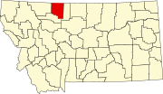
List of mountains in Toole County, Montana
Appearance
There are at least 8 named mountains in Toole County, Montana.
- Black Butte, 48°41′11″N 111°30′14″W / 48.68639°N 111.50389°W, el. 3,304 feet (1,007 m)[1]
- Gold Butte, 48°50′54″N 111°22′31″W / 48.84833°N 111.37528°W, el. 6,486 feet (1,977 m)[2]
- Grassy Butte, 48°46′17″N 111°19′43″W / 48.77139°N 111.32861°W, el. 4,318 feet (1,316 m)[3]
- Jackass Butte, 48°52′19″N 111°26′01″W / 48.87194°N 111.43361°W, el. 4,413 feet (1,345 m)[4]
- Jerusalem Rocks, 48°57′30″N 111°58′03″W / 48.95833°N 111.96750°W, el. 3,576 feet (1,090 m)[5]
- Middle Butte, 48°51′55″N 111°22′00″W / 48.86528°N 111.36667°W, el. 5,472 feet (1,668 m)[6]
- Raglan Butte, 48°42′40″N 111°48′40″W / 48.71111°N 111.81111°W, el. 3,583 feet (1,092 m)[7]
- West Butte, 48°55′54″N 111°32′01″W / 48.93167°N 111.53361°W, el. 6,936 feet (2,114 m)[8]
See also
[edit]Notes
[edit]- ^ "Black Butte". Geographic Names Information System. United States Geological Survey, United States Department of the Interior.
- ^ "Gold Butte". Geographic Names Information System. United States Geological Survey, United States Department of the Interior.
- ^ "Grassy Butte". Geographic Names Information System. United States Geological Survey, United States Department of the Interior.
- ^ "Jackass Butte". Geographic Names Information System. United States Geological Survey, United States Department of the Interior.
- ^ "Jerusalem Rocks". Geographic Names Information System. United States Geological Survey, United States Department of the Interior.
- ^ "Middle Butte". Geographic Names Information System. United States Geological Survey, United States Department of the Interior.
- ^ "Raglan Butte". Geographic Names Information System. United States Geological Survey, United States Department of the Interior.
- ^ "West Butte". Geographic Names Information System. United States Geological Survey, United States Department of the Interior.

