
Lomami District
Lomami District | |
|---|---|
District | |
 Lomami District | |
| Coordinates: 6°08′00″S 24°29′00″E / 6.133333°S 24.483333°E | |
| Country | Belgian Congo |
| Province | Katanga |
| District | Lomami |
Lomami District (French: District du Lomami, Dutch: District Lomami) was a district of the Belgian Congo from 1912 to 1933, when it was dissolved. It covered very roughly the same area as the present Lomami Province and the northwest of Haut-Lomami Province.
Location
[edit]Parts of the Stanley Falls and Lualaba districts were combined to form Katanga in 1910, which was called a vice-government general.[1] An arrêté royal of 28 March 1912 divided the Congo into 22 districts.[2] A map of the colony after this division shows Lomami District bordering [[Maniema District to the northeast, Tanganika-Moero District to the east, Lulua District to the south, Kasai District to the west and Sankuru District to the northwest.[3] The district was named after the Lomami River, whose upper reaches flowed northward through the district.
Katanga become a vice-government in 1913.[4] It contained the districts of Lomami, Tanganika-Moero, Lulua and Haut-Luapula.[3] In 1933 the provinces were reorganized into six provinces, named after their capitals, and the central government assumed more control.[5] Katanga became Elisabethville Province. The number of districts was reduced to 15, with 102 territories.[4] Lomami was divided among Sankuru District, Lualaba District and Tanganika District.[3]
In 2015 Lomami Province was formed from the Kabinda district and the independently administered city of Mwene-Ditu. The town of Kabinda was elevated to capital city of the new province. Haut-Lomami was formed from the Haut-Lomami district, whose town of Kamina was elevated to capital city of the new province.[6]
Maps
[edit]-
 1910 districts after formation of Katanga in the southeast
 -
 1912 districts including Lomami
 -
 1933 provinces and districts after Lomami was dissolved
 -
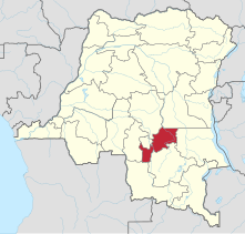 The present Lomami Province
 -
 The present Haut-Lomami Province


_-_Lomami.svg)
_-_Haut-Lomami.svg)
See also
[edit]References
[edit]- ^ Lemarchand 1964, pp. 62–63.
- ^ Lemarchand 1964, p. 63.
- ^ a b c Atlas général du Congo.
- ^ a b Lemarchand 1964, p. 64.
- ^ Bruneau 2009, p. 8.
- ^ Provinces of the Democratic Republic of Congo.
Sources
[edit]- Atlas général du Congo / Algemene atlas van Congo (in French and Dutch), Belgium: Institut Royal Colonial Belge, 1948–1963, OCLC 681334449
- Bruneau, Jean-Claude (30 June 2009), "Les nouvelles provinces de la République Démocratique du Congo : construction territoriale et ethnicités", L'Espace Politique, 7 (2009–1), doi:10.4000/espacepolitique.1296, retrieved 2020-08-08
- Lemarchand, René (1964), Political Awakening in the Belgian Congo, University of California Press, GGKEY:TQ2J84FWCXN, retrieved 19 August 2020
- "Provinces of the Democratic Republic of Congo". Statiods.com.