
Madingley Road

Madingley Road is a major arterial road linking central Cambridge, England with Junction 13 of the M11 motorway.[3] It passes by West Cambridge, a major new site where some University of Cambridge departments are[when?] being relocated.
The road is designated the A1303. At the eastern end, the A1303 continues as Northampton Street, then Chesterton Lane and Chesterton Road. There is a junction with the A1134 (Queen's Road) to the south.
At the Cambridge (east) end of the road, there are a number of large detached residences.[4] Side streets include Grange Road and Wilberforce Road.
The village of Coton is south of the western end of Madingley Road.
Buildings[edit]
The following are located on or close to Madingley Road:
- AVEVA Group plc
- British Antarctic Survey
- Cambridge American Cemetery and Memorial
- Cambridge Observatory
- Cavendish Laboratory
- Churchill College, on Storey's Way
- Computer Laboratory
- Lucy Cavendish College
- Marshall House (formerly Balliol Croft)
- Microsoft Research Cambridge
- Royal Greenwich Observatory
- Schlumberger Cambridge Research Centre
- School of Veterinary Science
- Cambridge University Athletics Track
- Whittle Laboratory
-
 British Antarctic Survey headquarters on the south side of Madingley Road.
 -
 Main entrance to the Cambridge Observatory building, to the north of Madingley Road.
 -
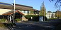
 The University of Cambridge Computer Laboratory in West Cambridge, south of the Madingley Road.
 -
 Lucy Cavendish College library and Marshall House off Madingley Road.
 -
![Schlumberger Cambridge Research Centre, High Cross, Madingley Road.[5]](//upload.wikimedia.org/wikipedia/commons/thumb/5/53/Schlumberger_Cambridge_Research_Centre_02.jpg/120px-Schlumberger_Cambridge_Research_Centre_02.jpg) Schlumberger Cambridge Research Centre, High Cross, Madingley Road.[5]
Schlumberger Cambridge Research Centre, High Cross, Madingley Road.[5]


![Schlumberger Cambridge Research Centre, High Cross, Madingley Road.[5]](/wiki/File:Schlumberger_Cambridge_Research_Centre_02.jpg)
Notable residents[edit]
The following have lived on or close to Madingley Road:
- Authors Kingsley Amis and his son Martin Amis as a child
- Author and priest A. C. Bouquet
- Inventor Clive Sinclair
Botanical[edit]
One of the last known stands in England of rare semi-mature Plot elms, the Madingley Road elms descended from those described by botanists Elwes and Henry in 1913[2] and studied by R. H. Richens in 1960,[1] was destroyed by Cambridge City Council for road-widening, between about 2007 and 2014.[6]
See also[edit]
- The village of Madingley, Cambridgeshire
- Conduit Head
References[edit]
- ^ a b Nature in Cambridgeshire, vol 3, 1960
- ^ a b Elwes, Henry John; Henry, Augustine (1913). The Trees of Great Britain & Ireland. Vol. 7. pp. 1901–1902, Plate 403.
- ^ Madingley Road, Cambridge.
- ^ Madingley Road: 25, Cambridge 2000.
- ^ Schlumberger Cambridge Research Centre Archived 2009-09-17 at the Wayback Machine, Schlumberger.
- ^ Plot Elms on Madingley Road, Cambridge, 2006, sabre-roads.org.uk [1] and 2013, geograph.org.uk [2]
![[1]](http://www.sabre-roads.org.uk/wiki/index.php?title=File:A1303_Madingley_Road,_Cambridge_-_Coppermine_-_8092.jpg)