Margab (Riyadh)
Appearance
Al-Marqab
حي المرقب | |
|---|---|
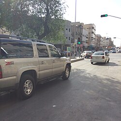
 Al Marqab, as seen from the Thulaim side of Abu Ayyub al-Ansari Road (around 2016) | |
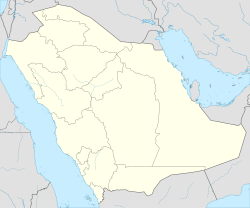
| Coordinates: 24°38′5″N 46°43′34″E / 24.63472°N 46.72611°E | |
| Country | Saudi Arabia |
| City | Riyadh |
| Region | Old Riyadh |
| Named for | Margab Fort |
| Government | |
| • Body | Baladiyah Al Batha |
| Language | |
| • Official | Arabic |
 | |
Al-Marqab (Arabic: المرقب, lit. 'watchtower'), or in Najdi vernacular pronunciation as al-Margab,[1] is one of the oldest neighborhoods of Riyadh, Saudi Arabia, located east of al-Dirah and south of Thulaim in the sub-municipality of al-Batʼha.[2][3] It was named after the Margab Fort, which was demolished in 1957.[4][5] As the neighborhood is bounded by al-Batʼha Street to the west, its western strip partially forms part of the al-Batʼha commercial area.
The early traces of its existence dates back to 16th century,[6] which nearly corresponds with the final stages of the disintegration of Hajr al-Yamamah that resulted in the succession of several settlements from the former.

References
[edit]- ^ Bulletin de la Société de géographie d'Egypte. Société de géographie d'Egypte. 1965.
- ^ "أحياء الرياض القديمة.."التاريخ" حفظ الأسماء و"الحاضر" أهمل الأماكن!". www.alriyadh.com. 2010-06-04. Retrieved 2022-02-25.
- ^ "أحياء الرياض القديمة.. التراث يعود بوجه حديث!". www.alriyadh.com (in Arabic). 2016-03-04. Retrieved 2022-02-25.
- ^ "«الرياض» تسرد تاريخ عاصمة الوطن.. من الحِجْر إلى العالمية (1 - 4)". www.alriyadh.com. 8 November 2023. Retrieved 13 February 2024.
- ^ مجلة الفيصل: العدد 268 (in Arabic). مركز الملك فيصل للبحوث والدراسات الإسلامية. 1999-02-01.
- ^ "رياض المرقب وغياب الآخر". www.alriyadh.com (in Arabic). 2002. Retrieved 2022-02-25.


