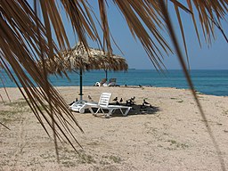
Maskali Islands
Appearance
 | |
 | |
| Geography | |
|---|---|
| Location | Gulf of Tadjoura |
| Coordinates | 11°42′33″N 43°09′53″E / 11.70914°N 43.16459°E |
| Area | 2 km2 (0.77 sq mi) |
| Length | 1.73 km (1.075 mi) |
| Width | 0.28 km (0.174 mi) |
| Highest elevation | 2 m (7 ft) |
| Administration | |
The Maskali Islands are located off the coast of Djibouti in the Gulf of Tadjoura. The islands are part of the Djibouti Region.
References
[edit]
