
Monte Stella (Cilento)
You can help expand this article with text translated from the corresponding article in Italian. (May 2010) Click [show] for important translation instructions.
|
| Stella | |
|---|---|
 | |
| Highest point | |
| Elevation | 1,131 m (3,711 ft) |
| Coordinates | 40°14′14.65″N 15°3′58.6″E / 40.2374028°N 15.066278°E |
| Geography | |
 Stella Location in Italy | |
| Location | Province of Salerno (Campania, Italy) |
| Parent range | Lucan Subappennines |
Monte Stella is a mountain the Lucan Subappennines, with an elevation of 1,131 m, located in Cilento, Campania, southern Italy.
Geography
[edit]At his slopes there are located the villages of Omignano, Stella Cilento, Serramezzana, Sessa Cilento, San Mauro Cilento, Pollica, San Mango Cilento, Perdifumo, Castellabate, Montecorice, Lustra and Rutino.
On the summit is located a radar station and the "Madonna del Monte Stella" church.
History
[edit]On the top of the Stella mountain it has been identified a prehistoric megalithic center which dates back to at least the 3rd millennium BC., as suggested the discovery of a flint knife in the Serramezzana district.[1]
Pictures
[edit]
-
 The church from the front
 -
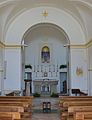 Inside the church


See also
[edit]References
[edit]- ^ "Sul Monte della Stella c'è un sito megalitico come Stonehenge, la Petra 'ru Mulacchio". discovercampania.it.
External links
[edit]![]() Media related to Monte Stella at Wikimedia Commons
Media related to Monte Stella at Wikimedia Commons
This Campanian location article is a stub. You can help Wikipedia by expanding it. |