Montesson
Montesson | |
|---|---|
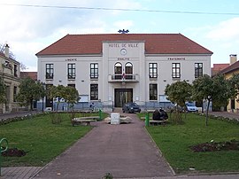
 The town hall in Montesson | |
| Coordinates: 48°54′31″N 2°08′59″E / 48.9085°N 2.1496°E | |
| Country | France |
| Region | Île-de-France |
| Department | Yvelines |
| Arrondissement | Saint-Germain-en-Laye |
| Canton | Houilles |
| Intercommunality | CA Saint Germain Boucles Seine |
| Government | |
| • Mayor (2020–2026) | Nicole Bristol[1] |
| Area 1 | 7.36 km2 (2.84 sq mi) |
| Population (2021)[2] | 14,511 |
| • Density | 2,000/km2 (5,100/sq mi) |
| Time zone | UTC+01:00 (CET) |
| • Summer (DST) | UTC+02:00 (CEST) |
| INSEE/Postal code | 78418 /78360 |
| Elevation | 23–56 m (75–184 ft) (avg. 45 m or 148 ft) |
| 1 French Land Register data, which excludes lakes, ponds, glaciers > 1 km2 (0.386 sq mi or 247 acres) and river estuaries. | |
Montesson (French pronunciation: [mɔ̃tesɔ̃]) is a commune in the Yvelines department in the Île-de-France region in north-central France. It is located in the western suburbs of Paris.
Transport in Montesson is served by buses with T-tickets as well as by several Paris-suburban lines: Line 01, Line 04, Line 07, Line 19, Line 22. The bus tickets have a category called "Bus T" which is for occasional users and replaces the old tickets in the notebooks of the previous bus network. The T ticket is also valid on the entire metro (Paris and suburbs) on the RER lines of the RATP and the SNCF. It is sold for a single price of 1.70 € for a journey or 12.50 € for a book of 10. It can be purchased all around the Ile de France metro stations, RER stations, bus terminals, and RATP authorized dealers.
Population[edit]
Graphs are unavailable due to technical issues. There is more info on Phabricator and on MediaWiki.org. |
| Year | Pop. | ±% p.a. |
|---|---|---|
| 1968 | 9,353 | — |
| 1975 | 9,494 | +0.21% |
| 1982 | 11,192 | +2.38% |
| 1990 | 12,365 | +1.25% |
| 1999 | 13,750 | +1.19% |
| 2007 | 14,885 | +1.00% |
| 2012 | 15,280 | +0.53% |
| 2017 | 15,019 | −0.34% |
| Source: INSEE[3] | ||
See also[edit]
References[edit]
- ^ "Répertoire national des élus: les maires" (in French). data.gouv.fr, Plateforme ouverte des données publiques françaises. 13 September 2022.
- ^ "Populations légales 2021". The National Institute of Statistics and Economic Studies. 28 December 2023.
- ^ Population en historique depuis 1968, INSEE
External links[edit]


