Mount Loolmalasin
| Loolmalasin | |
|---|---|
 View of Loolmalasin from the north | |
| Highest point | |
| Elevation | 3,682 m (12,080 ft)[1] |
| Prominence | 2,040 m (6,690 ft)[1] |
| Listing | Ultra |
| Coordinates | 3°03′06″S 35°49′00″E / 3.05167°S 35.81667°E[1] |
| Geography | |
| Location | Arusha Region, Tanzania |
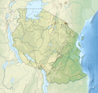
Mount Loolmalasin or Loolmalassin (Mlima Lolmalasin, in Swahili)[1] is a mountain located in the Ngorongoro District of the Arusha Region, Tanzania. It has a peak elevation of 3,682 metres (12,080 ft)[1] above sea level. It is, after Mount Kilimanjaro and Mount Meru, the third-highest mountain in Tanzania if Kilimanjaro's three peaks are considered to be one mountain. The Mountain is located entirely within Nainokanoka ward. The volcano is located in the geographic area of the Crater Highlands and is an extinct volcano that last erupted in the pleistocene.[2] Mount Loolmalasin is the second tallest mountain in Arusha Region and the highest point in Ngorongoro District. The mountain also is the source of Simiyu River, which flows west to Lake Victoria in Simiyu Region. [3]


See also[edit]
References[edit]
- ^ a b c d e "Africa Ultra-Prominences" Peaklist.org. Retrieved 2016-01-14.
- ^ "Smithsonian, Lolmalasin overview". Retrieved 2023-03-26.
- ^ Tanzania Travel Guide (6 ed.). Lonely Planet. June 2015. p. 217. ISBN 978-1742207797.

