Oʻsmat
Appearance
Oʻsmat
Uzbek: Oʻsmat | |
|---|---|
urban-type settlement | |
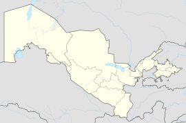
| Coordinates: 39°44′19″N 67°38′36″E / 39.73861°N 67.64333°E | |
| Country | |
| Region | Jizzakh Region |
| District | Baxmal District |
| Urban-type settlement | 1990 |
| Population (2004) | |
• Total | 10,500 |
| Time zone | UTC+5 (UZT) |
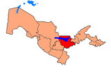
Oʻsmat (Uzbek: Oʻsmat) is an urban-type settlement in Jizzakh Region, Uzbekistan. It is the administrative center of Baxmal District.[1]
Population
[edit]The town population in 1989 was 4,662 people.[2]
References
[edit]- ^ "Classification system of territorial units of the Republic of Uzbekistan" (in Uzbek and Russian). The State Committee of the Republic of Uzbekistan on statistics. July 2020.
- ^ Population census-1989


