
Portal:Maryland roads/Selected picture
To nominate a picture for the Selected picture section of the Maryland Roads Portal, follow the directions here.
Selected picture
Portal:Maryland Roads/Selected picture/1

I-68 passing through the Sideling Hill road cut
Portal:Maryland Roads/Selected picture/2

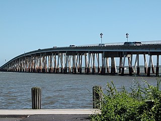
US 50 and US 301 crossing the Chesapeake Bay on the Chesapeake Bay Bridge
Portal:Maryland Roads/Selected picture/3
MD 33 westbound past the Oak Creek in Newcomb
Portal:Maryland Roads/Selected picture/4

Southbound MD 17 entering Burkittsville
Portal:Maryland Roads/Selected picture/5
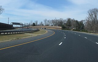
MD 200 westbound near mile marker 4.2 in Montgomery County
Portal:Maryland Roads/Selected picture/6
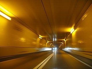
Baltimore Harbor Tunnel carrying I-895
Portal:Maryland Roads/Selected picture/7

Westbound MD 234 approaching US 301 in Allens Fresh
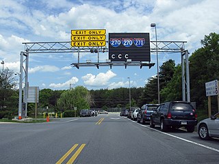
Portal:Maryland Roads/Selected picture/8
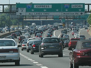
I-270 near the exit for Montrose Road
Portal:Maryland Roads/Selected picture/9

Northbound MD 97 approaching Howard/Carroll county border
Portal:Maryland Roads/Selected picture/10
MD 611 crossing the Sinepuxent Bay on the Verrazano Bridge
Portal:Maryland Roads/Selected picture/11

MD 355 southbound at Bouic Avenue in Rockville
Portal:Maryland Roads/Selected picture/12
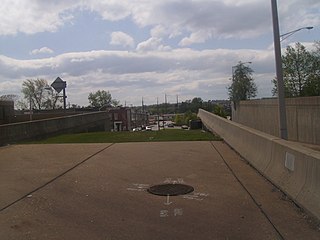
The abandoned western stub end of unfinished Interstate 170 in Baltimore
Portal:Maryland Roads/Selected picture/13
US 301 at Chew Road in Prince George's County
Portal:Maryland Roads/Selected picture/14

Sign at the eastern terminus of US 50 in Ocean City listing the distance to the western terminus in Sacramento, California
Portal:Maryland Roads/Selected picture/15
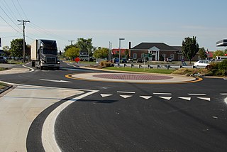
A roundabout at the intersection of Thompson Creek Road with the service road and ramps for eastbound US 50 on Kent Island
Portal:Maryland Roads/Selected picture/16

Construction of the stack interchange between I-95 and I-695 northeast of Baltimore
Portal:Maryland Roads/Selected picture/17
I-68 bridge over the Wills Creek in Cumberland
Portal:Maryland Roads/Selected picture/18

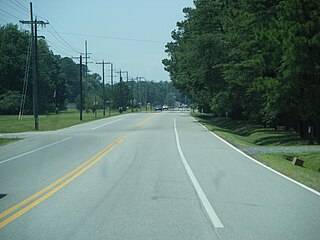
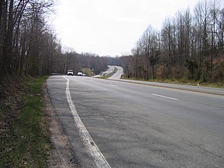
MD 227 heading eastbound in Charles County
Portal:Maryland Roads/Selected picture/19
Signs being tested at the Maryland State Highway Administration Office of Traffic and Safety in Hanover
Portal:Maryland Roads/Selected picture/20
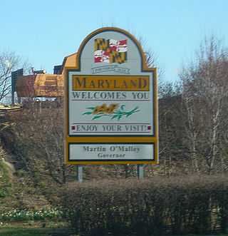
Maryland state welcome sign along I-81 entering from West Virginia
Portal:Maryland Roads/Selected picture/21

Maryland Route 856, a former alignment of Maryland Route 298, in Lynch
_from_the_Victor_Cushwa_Memorial_Bridge_as_it_passes_through_the_Sideling_Hill_Road_Cut_in_Forest_Park,_Washington_County,_Maryland.jpg)
I-68 passing through the Sideling Hill road cut
Portal:Maryland Roads/Selected picture/2

Portal:Maryland Roads/Selected picture/3

Portal:Maryland Roads/Selected picture/4

Southbound MD 17 entering Burkittsville
Portal:Maryland Roads/Selected picture/5

MD 200 westbound near mile marker 4.2 in Montgomery County
Portal:Maryland Roads/Selected picture/6

Baltimore Harbor Tunnel carrying I-895
Portal:Maryland Roads/Selected picture/7

Portal:Maryland Roads/Selected picture/8

I-270 near the exit for Montrose Road
Portal:Maryland Roads/Selected picture/9

Portal:Maryland Roads/Selected picture/10

Portal:Maryland Roads/Selected picture/11

Portal:Maryland Roads/Selected picture/12

The abandoned western stub end of unfinished Interstate 170 in Baltimore
Portal:Maryland Roads/Selected picture/13

US 301 at Chew Road in Prince George's County
Portal:Maryland Roads/Selected picture/14

Sign at the eastern terminus of US 50 in Ocean City listing the distance to the western terminus in Sacramento, California
Portal:Maryland Roads/Selected picture/15

A roundabout at the intersection of Thompson Creek Road with the service road and ramps for eastbound US 50 on Kent Island
Portal:Maryland Roads/Selected picture/16

Portal:Maryland Roads/Selected picture/17

Portal:Maryland Roads/Selected picture/18

MD 227 heading eastbound in Charles County
Portal:Maryland Roads/Selected picture/19

Signs being tested at the Maryland State Highway Administration Office of Traffic and Safety in Hanover
Portal:Maryland Roads/Selected picture/20

Portal:Maryland Roads/Selected picture/21
