R166 road (Ireland)
Appearance
| R166 road | |
|---|---|
| Bóthar R166 | |
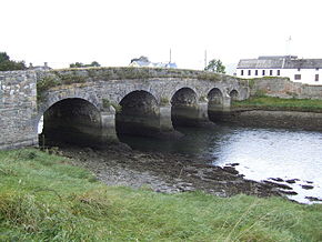
 The Annagassan Bridge carries the R166 over the River Dee | |
| Route information | |
| Length | 41.8 km (26.0 mi) |
| Major junctions | |
| From | |
Crosses River Dee Passes through Annagassan Passes through Clogherhead R899 Drogheda (Newfoundwell Road) | |
| To | |
| Location | |
| Country | Ireland |
| Highway system | |
The R166 road is a regional road in Ireland, located in County Louth.[1][2][3]
References
[edit]- ^ "R166 - Roader's Digest: The SABRE Wiki". www.sabre-roads.org.uk.
- ^ Book (eISB), electronic Irish Statute. "electronic Irish Statute Book (eISB)". www.irishstatutebook.ie.
- ^ https://www.bannon.ie/brochures/louth-drogheda-newtownstalaban-lands [dead link]
53°44′41″N 6°17′46″W / 53.744649°N 6.296101°W

