
Robinson Road (Mississippi)

The Robinson Road is a historical road in the US state of Mississippi. It ran from Columbus to Natchez.[1]
The road appeared on a map of Mississippi from 1831 that illustrated the Robinson Road extending from Columbus to the Natchez Trace near Wiggins in Leake County.[2]
From Columbus, the road traversed through Agency in Oktibbeha County, on to Louisville, on to Carthage, and then to Canton and Jackson.[3]
The Robinson Road was designated as a mail route in 1822, which diverted northern Mississippi traffic from the Natchez Trace.[4] The United States government appropriated funds to improve Robinson Road in 1823, as did the Mississippi Legislature in 1824, as the road served as the only contemporary route that connected Jackson to settlements along the Tombigbee River.[5]
Portions of the road are on the National Register of Historic Places in Winston[6] and Leake[7] counties. A historical marker that gives a description of the road is located on the Natchez Trace at mile marker 135.[4]
Gallery[edit]
-
 Robinson Road in 1974.
 -
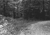 View of Robinson Road in 1974. Robinson Road is in left of photograph intersecting with modern logging road.


33°13′58″N 88°54′45″W / 33.232820°N 88.912378°W
References[edit]
- ^ Cole, James S. (2000). Oktibbeha County. Arcadia. p. 111. ISBN 9780738505664.
- ^ "Mississippi" (Map). Mississippi. Mississippi Department of Archives and History: A. Finley Philada. 1831.
- ^ "Robinson Road - Columbus - MS - US". Historical Marker Project. Retrieved 2021-12-06.
- ^ a b "Robinson Road". Natchez Trace Travel. Retrieved January 14, 2023.
- ^ Works Progress Administration (1938). Mississippi: A Guide to the Magnolia State. New York, New York: Viking Press. p. 87. ISBN 9781623760236.
- ^ "Old Robinson Road". National Park Service. Retrieved 2022-02-11.
- ^ "Robinson Road". National Park Service. Retrieved 2022-02-11.
This Mississippi road or road transport-related article is a stub. You can help Wikipedia by expanding it. |