Rodna Mountains National Park
| Rodna Mountains National Park | |
|---|---|
| Parcul Național Munții Rodnei | |
 | |
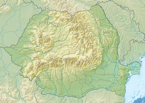
Location within Romania | |
| Location | |
| Nearest city | Borșa |
| Coordinates | 47°32′24″N 24°44′06″E / 47.54°N 24.735°E[1] |
| Area | 46,599 hectares (115,150 acres) |
| Established | 2000, designation in 1990 |
| Website | www |
The Rodna Mountains National Park (Romanian: Parcul Național Munții Rodnei) is a protected area (national park category II IUCN) situated in Romania, in the administrative territory of counties Bistrița-Năsăud, Maramureș, and Suceava.[2]
Location[edit]
The National Park is located in Northern Romania, in the Rodna Mountains, a subdivision of the Eastern Carpathians.[3]
Description[edit]

The Rodna Mountains National Park with an area of 465.99 km2 (179.92 sq mi)[4] was declared natural protected area by the Law Number 5 of March 6, 2000 (published in Monitorul Oficial Number 152 of April 12, 2000)[4] and represents a mountainous area (ridges, mountain peaks, cirques, crevasses, caves, moraines, springs, valleys, forests, and pastures) that shelters a large variety of flora and fauna species, some protected by law.
Natural reserves included in the park:
- Bistrița-Năsăud County[5]
- Poiana cu narcise de pe Masivul Saca, 5 ha (12 acres)
- Ineu-Lala, 2,568 ha (6,350 acres)
- Izvoarele Mihăiesei, 50 ha (120 acres)
- Maramureș County[6]
- Izvorul Bătrâna, 0.5 ha (1.2 acres)
- Pietrosu Mare, scientific reservation 3,300 ha (8,200 acres)
- Piatra Rea, scientific reservation 409 ha (1,010 acres)
- Suceava County[7]
- Bila-Lala, 325.1 ha (803 acres)
See also[edit]
References[edit]
- ^ eunis.eea.europa.eu - Rodna National Park (location; retrieved on June 15, 2012
- ^ protectedplanet.net - Rodna National Park (location); retrieved on June 15, 2012
- ^ (in Romanian) romaniaturistica.ro - Rarcul Național Rodna Archived 2012-06-13 at the Wayback Machine; retrieved on June 15, 2012
- ^ a b (in Romanian) cdep.ro - Legea Nr.5 din 6 martie 2000, publicată în Monitorul Oficial al României Nr.152 din 12 aprilie 2000; retrieved on June 15, 2012
- ^ (in Romanian) apmbn.anpm.ro - Agenția pentru Protecția Mediului Bistrița-Năsăud; retrieved on June 15, 2012
- ^ (in Romanian) apmmm.anpm.ro - Agenția pentru Protecția Mediului Maramureș; retrieved on June 15, 2012
- ^ (in Romanian) apmsv.anpm.ro - Agenția pentru Protecția Mediului Suceava; retrieved on June 15, 2012


