Sadków, Radom
Appearance
Sadków | |
|---|---|
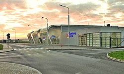
 Radom Airport in Sadków. | |
 | |
| Coordinates: 51°23′32″N 21°12′24″E / 51.39222°N 21.20667°E | |
| Country | |
| Voivodeship | |
| County | Radom |
| Elevation | 165 m (541 ft) |
| Time zone | UTC+1 (CET) |
| • Summer (DST) | UTC+2 (CEST) |
| Postal code | 26-604 |
| Area code | (+48) 48 |
| Car plates | WR |
Sadków is a city district of Radom, Poland, located in the east part of the city.
History
[edit]Before the World War II, the current territories of the district were a part of the village of Sadków located outside the borders of Radom. After the war, part of the village of was incorporated into the city forming the district.
Description
[edit]A big part of the district is made by a military base and Radom Airport.
External links
[edit]- Sadków (2) in Geographical Dictionary of the Kingdom of Poland, vol. 10, Rukszenice–Sochaczew. Warsaw, 1889, pag
- Sadków (1) in Geographical Dictionary of the Kingdom of Poland, vol. 10, part 2, Januszpol–Wola Justowska, Warsaw, 1902, p. 569.
