
Sonoraville, Georgia
Sonoraville, Georgia | |
|---|---|
 Sonoraville  Sonoraville | |
| Coordinates: 34°26′53″N 84°48′32″W / 34.44806°N 84.80889°W | |
| Country | United States |
| State | Georgia |
| County | Gordon |
| Elevation | 718 ft (219 m) |
| Time zone | UTC-5 (Eastern (EST)) |
| • Summer (DST) | UTC-4 (EDT) |
| Area code(s) | 706/762 |
| GNIS feature ID | 323220[1] |
Sonoraville is an unincorporated community in Gordon County, Georgia, United States, located seven miles outside Calhoun.
History[edit]
A post office called Sonoraville was established in 1854, and remained in operation until being discontinued in 1909.[2] The community was probably named after Sonora, in commemoration of the Mexican–American War.[3]
Education[edit]
Sonoraville High School is the community's high school; it was created in 2005 for grades 9 and 10. Within the next two years, Sonoraville became a normal high school with all grades 9–12. The principal is Amy Stewart.[as of?] The mascot is a phoenix, and the colors are red, black and white.[citation needed]
Notable people[edit]
George Right Smith - (1837 - 1903), private in the Confederate Army elevated to the rank of 1st lieutenant. Born in Cartersville, he bought a farm after the war and settled with his new wife in Sonoraville. Buried at the now Sonoraville Baptist Church cemetery.[citation needed]
References[edit]
- ^ "US Board on Geographic Names". United States Geological Survey. October 25, 2007. Retrieved January 31, 2008.
- ^ "Gordon County". Jim Forte Postal History. Retrieved April 26, 2015.
- ^ "Gordon County". Calhoun Times. September 1, 2004. p. 96. Retrieved April 26, 2015.
External links[edit]
- Sonoraville Baptist Church
- Sonoraville High School
- Old Sonora P.O. Now Sonoraville historical marker
Municipalities and communities of Gordon County, Georgia, United States | ||
|---|---|---|
| Cities | 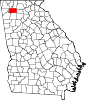 | |
| Town | ||
| Unincorporated communities | ||
This Gordon County, Georgia state location article is a stub. You can help Wikipedia by expanding it. |