
Talk:Regions of Morocco
| This article is rated List-class on Wikipedia's content assessment scale. It is of interest to the following WikiProjects: | ||||||||||||||||||||||||||||
| ||||||||||||||||||||||||||||


Untitled
[edit]===>POV issues What are the POV issues? From which POV is this article written? -Justin (koavf), talk, mail 15:09, 20 June 2006 (UTC)
===>POV issues The biased terms in the article are:
- the assertion that the problem is between Morocco and SADR, when the UN states clearly in all Security council resolutions that the two parties of the conflict are: the Kingdom of Morocco and the Polisario front.
- The use of the term "Free Zone" is specific to Polisario propaganda, and is used by no other international organism. If it is in the article it should be stated clearly that the Polisario considers it so.
- To use the term "Administer" for Polisario and "Occupy" for Morocco does not need any explanation to show it is taken from the Polisario propaganda material. This is a major issue in all WS articles. --SteveLo 09:01, 19 July 2006 (UTC)
===>Polisario and SADR
- The Polisario is not the administering power in the Free Zone, the SADR is. The contention is between two governments, not a government and a political party. Would it make sense to change all the articles about Taiwan and China to being a conflict between the "People's Republic of China" (a government) and "Koumintang" (a political party)? Of course not.
- I have no problem with mentioning that the term was coined by Sahrawi supporters (I don't know that it was Polisario - where did you get this information), but I also don't have a better name for this region. Do you?
- Actually, it does need explanation. Polisario are not a foreign government's military in the Sahara; Morocco is. Hence, the SADR is administering, and Morocco occupying. -Justin (koavf), talk, mail 13:21, 19 July 2006 (UTC)
- Polisario are not a foreign government's military in the Sahara; Morocco is => that's taking a Polisario/SADR POV. As far as Morocco is concerned, WS is part of Morocco, thus it is not a foreign government in the Western Sahara, which it considers to be Moroccan. Ideophagous (talk) 21:57, 15 December 2023 (UTC)
- Polisario are the legitimate representatives of the Sahrawi people and Morocco are an external occupying force with no legal or historical ties to Western Sahara. None of that is a "pro-Polisario" view, it's just a pro-reality view. ―Justin (koavf)❤T☮C☺M☯ 21:59, 15 December 2023 (UTC)
- "bla bla bla is the legitimate representatives of bla bla bla" => ideological opinion. Nobody has done a full survey or an independent referendum to know the point of view of all people in Western Sahara with certainty. Ideophagous (talk) 22:37, 15 December 2023 (UTC)
- And? I wonder who it is who has stopped there from being a referendum in Western Sahara to see what the native people want................🤔🤔🤔🤔🤔🤔🤔🤔 ―Justin (koavf)❤T☮C☺M☯ 22:39, 15 December 2023 (UTC)
- "bla bla bla is the legitimate representatives of bla bla bla" => ideological opinion. Nobody has done a full survey or an independent referendum to know the point of view of all people in Western Sahara with certainty. Ideophagous (talk) 22:37, 15 December 2023 (UTC)
- Polisario are the legitimate representatives of the Sahrawi people and Morocco are an external occupying force with no legal or historical ties to Western Sahara. None of that is a "pro-Polisario" view, it's just a pro-reality view. ―Justin (koavf)❤T☮C☺M☯ 21:59, 15 December 2023 (UTC)
12 or still 16 regions?
[edit]In the article there are sentences such: "Since 2015 Morocco officially administers 12 regions", "The latter published the names of the new regions and their numbers, which were officialy fixed in the Bulletin Officiel from March 5, 2015", but there is lack of sources stated that new administratiwe division has been introduced. In the cited Bulletin Officiel art. 3 states: "Le présent décret entre en vigueur à compter de la date d'entrée en vigueur du décret prévu à l'article 77 de la loi organique n° 59-11 relative à l'élection des membres des conseils des collectivités territoriales." (English translation by Google Translator: This Decree comes into force from the effective date of the decree provided for in section 77 of the Organic Law No. 59-11 on the election of board members of local authorities.). So this Bulletin has only fixed names and nuber of future region, and not introduced regions itself. Aotearoa (talk) 14:35, 25 September 2015 (UTC)
- There are several reports of local elections earlier this month in which it is clearly stated that there are now 12 regions. User:Aotearoa, is this enough for us to consider the regions "introduced"? Cobblet (talk) 05:44, 26 September 2015 (UTC)
- Without any doubts there were elections to new regions authorities. But there is still no unambiguous confirmation that these new regions have been introduced yet. For example in Kenya we had situatian, that new administratiwe division was announced in 2010, there were local elections to counties' governors on 4 March 2013, but new counties were introduced only on the day on which new governors took offices – on 27 March 2013. According to the new regions in Morocco we have only fragmentary information without realiable date of de iure introduction these new regions. Aotearoa (talk) 08:16, 26 September 2015 (UTC)
- User:Aotearoa, here are reports of two different regional councils holding their first sessions. Cobblet (talk) 08:38, 7 October 2015 (UTC)
- Without any doubts there were elections to new regions authorities. But there is still no unambiguous confirmation that these new regions have been introduced yet. For example in Kenya we had situatian, that new administratiwe division was announced in 2010, there were local elections to counties' governors on 4 March 2013, but new counties were introduced only on the day on which new governors took offices – on 27 March 2013. According to the new regions in Morocco we have only fragmentary information without realiable date of de iure introduction these new regions. Aotearoa (talk) 08:16, 26 September 2015 (UTC)
NPOV issue with maps in sub-articles
[edit]Please note that an editor has started an NPOV discussion about the map currently used for the individual Region articles (post-2015), which is relevant to the topic of this article and perhaps to anyone watching this page. Please see the talk page discussion here. Thanks, R Prazeres (talk) 20:13, 22 February 2022 (UTC)
October 2022
[edit]Since @M.Bitton would much rather engage in childish edit warring and already opened a report to incriminate me, I will start the discussion regarding the map in question and after double checking, it doesn't come to a surprise that they are also the publisher of the map on Commons and the file barely has and pages using it (no surprise there). Aside from the fact that @Voxcastellàicatalà is a disruptive SPA who originally added the map and who's edit history was only on that page and was blocked for disruptive on the very page in question back in June, the map itself was inserted without consensus and clearly has nothing to do with the Regions of Morocco, The purpose of the page is (at least attempt) to educate the common reader about regions of Morocco, not take them as fools and have them believe it's what was advertised by M.Bitton and Voxcastellàicatalà. 2603:8000:3E02:F628:AC98:A7A7:95B7:8C0B (talk) 22:05, 29 October 2022 (UTC)
- The two images are basically the same thing Lolkikmoddi-h3t3 :D (talk) 22:12, 29 October 2022 (UTC)
- Please read WP:NPA. M.Bitton (talk) 22:13, 29 October 2022 (UTC)
- @Lolkikmoddi I appreciate your neutral positions here but with all due respect, if you spend more than a second looking at it, I think you'll realize the the two files are anything but the same image (one showing a country's regions per its own national law in practice vs the other which is a blatant violation of the country's international borders and territorial integrity).
- @M.Bitton since you've now made the bold accusation, why don't you show us exactly what I said that was categorized as a personal attack? 2603:8000:3E02:F628:AC98:A7A7:95B7:8C0B (talk) 22:22, 29 October 2022 (UTC)
- the image is showing everything like what wikipedia does Lolkikmoddi-h3t3 :D (talk) 22:25, 29 October 2022 (UTC)
- I don't need to show you anything since your personal attacks are written in black and white. I suggest you spend more time reading WP:NPA and less time edit warring. The big difference between the two is one is sourced and WP:NPOV while the other is neither. M.Bitton (talk) 22:26, 29 October 2022 (UTC)
- the new image is way better then just being labeled with numbers Lolkikmoddi-h3t3 :D (talk) 22:30, 29 October 2022 (UTC)
- M.Bitton Actually, you do. You are the one who made the accusation, you stand by and prove it, not just tell us "black and white". 2603:8000:3E02:F628:AC98:A7A7:95B7:8C0B (talk) 22:31, 29 October 2022 (UTC)
- No, I certainly don't. I noticed that what I said about the map being sourced and NPOV was ignored. M.Bitton (talk) 22:36, 29 October 2022 (UTC)
- @Lolkikmoddi no doubt that the new insisted map may be more aesthetically pleasing to look at but it is in no way "much better" as it is a clear violation of a nation's sovereignty and international boundaries.
- M.Bitton regarding your map being "sourced", it's no secret that it is clearly misrepresented and a perfect example of Original Research, when the CIA World Factbook you will find otherwise (maps that do not violate Morocco's territory). The original maps are absolutely NPOV because they are about the regions, not about the regional dispute/conflict and certainly not about your opinion and activism on whether the disputed territory of Western Sahara should become an independent state. 2603:8000:3E02:F628:AC98:A7A7:95B7:8C0B (talk) 22:42, 29 October 2022 (UTC)
- It's not just sourced, it's NPOV too. Talking about violating a territory: your BS map covers the whole Western Sahara (a territory that has nothing whatsoever to do with Morocco, apart from the fact that illegally occupied part of it). How would anyone with a shred of decency describe such nonsense? What's next, describe the whole of Ukraine as a Russian territory? M.Bitton (talk) 22:47, 29 October 2022 (UTC)
- Are you accusing me of being indecent? BS? Talk about WP:NPA. Again, your opinion on the conflict has no relevance or meaning in the matter and it certainly is not up to you to decide whether or not the territory has "anything to do with Morocco" (which plentiful RS would prove otherwise) and the conflict itself is not the primary subject of the article (that's why they have their own articles). This article is about the Regions of Morocco and the fact of the matter remains that A) Morocco has twelve regions (not eleven, as falsely claimed by your map), as per its law, which it practices within its own territory to the fullest extent and B) The purpose of the map is to show readers the regions as they are and not of your own interpretation of what they should look like according to your feelings. As for comparing this to the Russia-Ukraine conflict is nothing more than comparing apples and orange during an emotion-fueled rant. I'm done wasting my time on this and if you care so much, then I suggest placing an NPOV tag article until the matter is resolved thru proper discussion. 2603:8000:3E02:F628:AC98:A7A7:95B7:8C0B (talk) 22:57, 29 October 2022 (UTC)
- The subject here is the fact that you are adding a BS map that violates NPOV. The map that you removed clearly explains everything (the regions of Morocco and the ones that it claims, i.e., that are not Moroccans). There is no difference between the Moroccan occupation of Western Sahara and the Russian occupation of Ukraine (both are illegal annexations). M.Bitton (talk) 23:02, 29 October 2022 (UTC)
- Not Moroccan according only to you, the question if the region is Moroccan or not is already vastly (albeit poorly) covered in a multitude of articles such as Western Sahara. Morocco, Political status of Western Sahara, etc. How many times do I have to repeat myself that the purpose of the article is to cover the regions of Morocco (which according to Morocco includes the disputed territory of Western Sahara, whether you like it or not) and not on the conflict. 2603:8000:3E02:F628:AC98:A7A7:95B7:8C0B (talk) 23:07, 29 October 2022 (UTC)
- No, it's according the UN, the AU, the ICJ, etc. Since Western Sahara is not Morocco, then there is no reason to fool the readers into thinking that it is. That's what NPOV is all about. M.Bitton (talk) 23:10, 29 October 2022 (UTC)
- Regardless of what these foreign entities say, Morocco still includes it in it's territorial organization. with or without their/your consultation, so there's no reason whatsoever to ignore it. As I said, I'm done wasting anymore time on this today and added the tag until the issue can be properly resolved. 2603:8000:3E02:F628:AC98:A7A7:95B7:8C0B (talk) 23:16, 29 October 2022 (UTC)
- Like Russia. M.Bitton (talk) 23:16, 29 October 2022 (UTC)
- Regardless of what these foreign entities say, Morocco still includes it in it's territorial organization. with or without their/your consultation, so there's no reason whatsoever to ignore it. As I said, I'm done wasting anymore time on this today and added the tag until the issue can be properly resolved. 2603:8000:3E02:F628:AC98:A7A7:95B7:8C0B (talk) 23:16, 29 October 2022 (UTC)
- No, it's according the UN, the AU, the ICJ, etc. Since Western Sahara is not Morocco, then there is no reason to fool the readers into thinking that it is. That's what NPOV is all about. M.Bitton (talk) 23:10, 29 October 2022 (UTC)
- Not Moroccan according only to you, the question if the region is Moroccan or not is already vastly (albeit poorly) covered in a multitude of articles such as Western Sahara. Morocco, Political status of Western Sahara, etc. How many times do I have to repeat myself that the purpose of the article is to cover the regions of Morocco (which according to Morocco includes the disputed territory of Western Sahara, whether you like it or not) and not on the conflict. 2603:8000:3E02:F628:AC98:A7A7:95B7:8C0B (talk) 23:07, 29 October 2022 (UTC)
- The subject here is the fact that you are adding a BS map that violates NPOV. The map that you removed clearly explains everything (the regions of Morocco and the ones that it claims, i.e., that are not Moroccans). There is no difference between the Moroccan occupation of Western Sahara and the Russian occupation of Ukraine (both are illegal annexations). M.Bitton (talk) 23:02, 29 October 2022 (UTC)
- Are you accusing me of being indecent? BS? Talk about WP:NPA. Again, your opinion on the conflict has no relevance or meaning in the matter and it certainly is not up to you to decide whether or not the territory has "anything to do with Morocco" (which plentiful RS would prove otherwise) and the conflict itself is not the primary subject of the article (that's why they have their own articles). This article is about the Regions of Morocco and the fact of the matter remains that A) Morocco has twelve regions (not eleven, as falsely claimed by your map), as per its law, which it practices within its own territory to the fullest extent and B) The purpose of the map is to show readers the regions as they are and not of your own interpretation of what they should look like according to your feelings. As for comparing this to the Russia-Ukraine conflict is nothing more than comparing apples and orange during an emotion-fueled rant. I'm done wasting my time on this and if you care so much, then I suggest placing an NPOV tag article until the matter is resolved thru proper discussion. 2603:8000:3E02:F628:AC98:A7A7:95B7:8C0B (talk) 22:57, 29 October 2022 (UTC)
- It's not just sourced, it's NPOV too. Talking about violating a territory: your BS map covers the whole Western Sahara (a territory that has nothing whatsoever to do with Morocco, apart from the fact that illegally occupied part of it). How would anyone with a shred of decency describe such nonsense? What's next, describe the whole of Ukraine as a Russian territory? M.Bitton (talk) 22:47, 29 October 2022 (UTC)
- M.Bitton regarding your map being "sourced", it's no secret that it is clearly misrepresented and a perfect example of Original Research, when the CIA World Factbook you will find otherwise (maps that do not violate Morocco's territory). The original maps are absolutely NPOV because they are about the regions, not about the regional dispute/conflict and certainly not about your opinion and activism on whether the disputed territory of Western Sahara should become an independent state. 2603:8000:3E02:F628:AC98:A7A7:95B7:8C0B (talk) 22:42, 29 October 2022 (UTC)
- @Lolkikmoddi no doubt that the new insisted map may be more aesthetically pleasing to look at but it is in no way "much better" as it is a clear violation of a nation's sovereignty and international boundaries.
- No, I certainly don't. I noticed that what I said about the map being sourced and NPOV was ignored. M.Bitton (talk) 22:36, 29 October 2022 (UTC)
- M.Bitton Actually, you do. You are the one who made the accusation, you stand by and prove it, not just tell us "black and white". 2603:8000:3E02:F628:AC98:A7A7:95B7:8C0B (talk) 22:31, 29 October 2022 (UTC)
Nevertheless, topics regarding territorial disputes are always subject to a heated discussion and often irrelevant comparisons. 2603:8000:3E02:F628:AC98:A7A7:95B7:8C0B (talk) 23:19, 29 October 2022 (UTC)
- The comparison is very relevant and so are the policies that were cited and that you keep ignoring. Tagging the article after your reverting 7 times to your favourite version is not how Wikipedia works. M.Bitton (talk) 23:22, 29 October 2022 (UTC)
- This isn't about favorites (funny you say that when it was you who edit warred for your image to remain while I have no stake in this). I'm against tagging the article in the first place since the article already mentions Western Sahara in the first paragraph, but the tag should be there until adults can figure out what to do next, rather than change territory altogether of said regions (and even removing a couple of them). 2603:8000:3E02:F628:AC98:A7A7:95B7:8C0B (talk) 23:28, 29 October 2022 (UTC)
Regardless of what these foreign entities say, Morocco still includes it in it's territorial organization
this pretty much sums up your position and explains the relentless edit warring.I have no stake in this
this edit of yours on a related subject paints a different story (removing a supposedly unsourced map from one article and adding and edit warring over an unsourced map here shows that you're gaming the system by using the WP policies when it suits you and breaking all of them when it doesn't). M.Bitton (talk) 23:31, 29 October 2022 (UTC)
- This isn't about favorites (funny you say that when it was you who edit warred for your image to remain while I have no stake in this). I'm against tagging the article in the first place since the article already mentions Western Sahara in the first paragraph, but the tag should be there until adults can figure out what to do next, rather than change territory altogether of said regions (and even removing a couple of them). 2603:8000:3E02:F628:AC98:A7A7:95B7:8C0B (talk) 23:28, 29 October 2022 (UTC)
A Commons file used on this page or its Wikidata item has been nominated for speedy deletion
[edit]The following Wikimedia Commons file used on this page or its Wikidata item has been nominated for speedy deletion:
You can see the reason for deletion at the file description page linked above. —Community Tech bot (talk) 22:33, 16 December 2022 (UTC)
Misrepresentation by Infobox image
[edit]The infobox image has two problems:
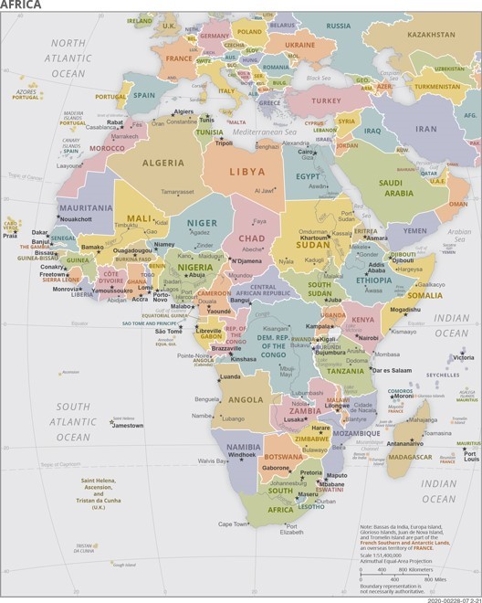
- It does not reflect the topic properly: the topic is the "Regions of Morocco", which are currently 12, as stated in the article itself. There should be 12 regions shown in the image, though an interrupted line marking "Western Sahara" can, in principle, be shown for NPOV
- It's an old map on cia.gov which dates back to 2018, and has not been updated since, before the United States recognized Morocco's sovreignty over Western Sahara at the end of 2020. More recent maps of Morocco on cia.gov (not showing the administrative regions), include Western Sahara as part of Morocco, such as 1 and 2. As such, it misrepresents the US position on the conflict. The first map also has the caption:
Morocco map showing major population centers as well as parts of surrounding countries and the North Atlantic Ocean. Note that in 2020 the US recognized Western Sahara as part of Morocco.
Ideophagous (talk) 22:51, 15 December 2023 (UTC)
- There are lots of maps on this page. There is no problem here. ―Justin (koavf)❤T☮C☺M☯ 22:56, 15 December 2023 (UTC)
- It's the leading image and is used in the infobox, it's definitely a problem. And that's beside the fact that it's an outdated map given the current position of the US government. Ideophagous (talk) 23:25, 15 December 2023 (UTC)
- Infoboxes do not exist to represent the perspective of the U. S. federal government. ―Justin (koavf)❤T☮C☺M☯ 23:37, 15 December 2023 (UTC)
- They exist to represent the topic, which in this case the image does not. Ideophagous (talk) 00:23, 16 December 2023 (UTC)
- It does. ―Justin (koavf)❤T☮C☺M☯ 08:21, 16 December 2023 (UTC)
- They exist to represent the topic, which in this case the image does not. Ideophagous (talk) 00:23, 16 December 2023 (UTC)
- Infoboxes do not exist to represent the perspective of the U. S. federal government. ―Justin (koavf)❤T☮C☺M☯ 23:37, 15 December 2023 (UTC)
- It's the leading image and is used in the infobox, it's definitely a problem. And that's beside the fact that it's an outdated map given the current position of the US government. Ideophagous (talk) 23:25, 15 December 2023 (UTC)
- Concerns of bias or attempts to WP:RGW aside, the main map literally omits the entire region of Dakhla Oued-Eddahab, which would make it unpractical. So sure, it may represent the topic to some extent, but it definitely doesn't do a good job in my opinion. I would much rather it's sprinkled with as many dotted or dash lines as one's heart can be content with rather than it be totally omitted.
- Furthermore, I don't think this map is contingent on either the recognition of Moroccan sovereignty by the U.S. nor is it contingent on the Sahara's status as a NSGT, I think this is aside from the point and I do not see the arguments either side is making. In the case of the region, a map formatted like this had been in use from 2011 until the regional reform in 2015, I propose the de-facto pre-2015 maps are just modified per the reforms (perhaps by someone on the map workshop) and are used instead. Not only would it be in an SVG format that would fit with most other maps on Wikipedia, it would also spare this argument -- God knows why it nearly took a decade for this to be discussed. NAADAAN (talk) 22:03, 5 February 2024 (UTC)
.svg)
Is the image in the infobox of the article an unbiased representation of the topic or not?--Ideophagous (talk) 09:26, 16 December 2023 (UTC)
- Yes it's unbiased. If anything, it's the other maps in the article that are in clear violation of our policies as, besides the fact that they are unsourced, they also fail to highlight the difference between Morocco, what it claims and what it illegally occupies. M.Bitton (talk) 12:25, 16 December 2023 (UTC)
- @M.Bitton An unbiased lead image map should have all 12 regions as explained in the article, while also marking the Western Sahara line and adding notes referring to the conflict. Truncating the WS completely from the map is a misrepresentation of the topic as it is described in the article. The infobox map used now can certainly be added somewhere in the article to highlight a different POV, but not at the topc, since it makes the topic less understandable and more confusing to readers. Ideophagous (talk) 16:40, 16 December 2023 (UTC)
- Someone who cares about the readers would be appalled by this article about Western Sahara (which denies its very existence); an article that you've been editing for a while. M.Bitton (talk) 16:44, 16 December 2023 (UTC)
- Hello @M.Bitton, I agree that that's not a good picture, but different Wikipedias have different rules for editing, since it's the users themselves who shape the content and the rules, and arywiki is no exception. Pretty much all my edits on that article were to revert vandalism or adjust the tags or style. Personally, I've been avoiding this whole topic for a very long time, as well as many other controversial political topics, since they only bring headaches, as you've seen for yourself. Also, if you want to bring up articles not respecting WP:NPOV on enwiki itself, there are an abundance of examples. In any case, if you have a better picture for that arywiki article (and also this one) which does not invite unnecessary controversy and edit-warring on either side, be my guest. Ideophagous (talk) 18:55, 16 December 2023 (UTC)
- I'm not buying it. Caring about NPOV and the readers is a value, either one has it or they don't, it doesn't change from project to project. Anyway, I said what I needed to say and so have you with your
bla bla bla is the legitimate representatives of bla bla bla
(see diff) that says exactly what you think of the reliable sources. M.Bitton (talk) 19:03, 16 December 2023 (UTC)- @M.Bitton Well, good job turning this from a debate about a picture, to a debate about me. Ideophagous (talk) 19:23, 16 December 2023 (UTC)
- I'm not buying it. Caring about NPOV and the readers is a value, either one has it or they don't, it doesn't change from project to project. Anyway, I said what I needed to say and so have you with your
- Hello @M.Bitton, I agree that that's not a good picture, but different Wikipedias have different rules for editing, since it's the users themselves who shape the content and the rules, and arywiki is no exception. Pretty much all my edits on that article were to revert vandalism or adjust the tags or style. Personally, I've been avoiding this whole topic for a very long time, as well as many other controversial political topics, since they only bring headaches, as you've seen for yourself. Also, if you want to bring up articles not respecting WP:NPOV on enwiki itself, there are an abundance of examples. In any case, if you have a better picture for that arywiki article (and also this one) which does not invite unnecessary controversy and edit-warring on either side, be my guest. Ideophagous (talk) 18:55, 16 December 2023 (UTC)
- Someone who cares about the readers would be appalled by this article about Western Sahara (which denies its very existence); an article that you've been editing for a while. M.Bitton (talk) 16:44, 16 December 2023 (UTC)
- @M.Bitton An unbiased lead image map should have all 12 regions as explained in the article, while also marking the Western Sahara line and adding notes referring to the conflict. Truncating the WS completely from the map is a misrepresentation of the topic as it is described in the article. The infobox map used now can certainly be added somewhere in the article to highlight a different POV, but not at the topc, since it makes the topic less understandable and more confusing to readers. Ideophagous (talk) 16:40, 16 December 2023 (UTC)
- Yes: The map is unbiased. Western Sahara is not internationally recognized as part of Morocco; instead the United Nations recognizes it as a non-self governing territory. The mere claim by Morocco does not establish its sovereign status over the territory. Skitash (talk) 20:37, 16 December 2023 (UTC)
- No. I think it's reasonable to include Western Sahara in the map while making clear that it's a mostly unrecognized occupation (through something like stripes or a different color). Compare with the following two analogous situations:
- Israel's occupation of the Golan Heights is recognized by no country other than the United States, yet both Israel and Districts of Israel show a map that includes the Golan Heights (in a different color).
- Russia's annexation of Crimea and other Ukrainian territory is mostly unrecognized, yet both Russia and Federal subjects of Russia show a map that includes those territories (with stripes).
- There is a consensus to use these maps for Israel and Russia (and there's been plenty of discussion with those articles), so it would be consistent to include Western Sahara in this map. In addition, the map as displayed here and in Morocco § Administrative divisions is confusing since it shows 11 regions while the text says 12. Malerisch (talk) 06:27, 17 December 2023 (UTC)
- This is a different situation since Morocco includes in its claimed 12 regions the area that it illegally occupies as well as other areas (the liberated territories, Ceuta and Melilla). M.Bitton (talk) 12:34, 22 December 2023 (UTC)
- I think it's possible to use two different styles of hatching to represent territory occupied and territory claimed. In fact, the maps used for Morocco's administrative divisions before 2015 did exactly this (see, for example, Guelmim-Es Semara). Malerisch (talk) 13:13, 22 December 2023 (UTC)
- This is a different situation since Morocco includes in its claimed 12 regions the area that it illegally occupies as well as other areas (the liberated territories, Ceuta and Melilla). M.Bitton (talk) 12:34, 22 December 2023 (UTC)
- Yes: Not only is the map published by a notable & reliable source, but there is also 5 other maps directly below and throughout the article, so I don't see the point in getting rid of the current infobox. 296cherry (talk) 16:40, 20 December 2023 (UTC)
- @296cherry The source is certainly notable, but the map is old (2018) and contradicts the current position of the US on the matter (since 2020) and newer maps of Morocco on the same website (which I have linked above). There's certainly no issue with including that map somewhere in this article or other articles, but I don't think it belongs in the lead or main infobox. Ideophagous (talk) 09:29, 22 December 2023 (UTC)
- Whether the US has changed its position or not is irrelevant since we're not trying to show the position of the US (as explained in the discussion). M.Bitton (talk) 12:34, 22 December 2023 (UTC)
- @296cherry The source is certainly notable, but the map is old (2018) and contradicts the current position of the US on the matter (since 2020) and newer maps of Morocco on the same website (which I have linked above). There's certainly no issue with including that map somewhere in this article or other articles, but I don't think it belongs in the lead or main infobox. Ideophagous (talk) 09:29, 22 December 2023 (UTC)
- No. Indeed, the map is biased, non-informative and misleading. It's simple, Morocco controls most of Western Sahara and views it as an integral part of its territory, and that's reflected in the Moroccan provincial divisions. Although the article mentions 12 regions, the infobox displays only 11, which doesn't make sense. 808 AD (talk) 21:23, 20 December 2023 (UTC)
- Yes - (Brought here by WP:RFC/A) I do think that this map is notable and reliable. I understand the issue that there are 12 regions and that the infobox displays only 11, but it is stated on the map that Morrocco claims the "non self governing" WS desert. I am interpreting most users concerns as it not being addressed. I understand that there are more updated maps as Ideophagous has pointed out, I wouldn't mind if we updated if that satisfies more of the consensus.
- MaximusEditor (talk) 16:55, 29 December 2023 (UTC)
- Hello @MaximusEditor I agree that it's notable, and therefore certainly belongs somewhere within the article, but it is also outdated (as regards the current official position of the issuing source), and misleading in that it doesn't correctly reflect the topic of the article (the 12 regions of the Moroccan administrative system). For the sake of NPOV, I think something like File:Guelmim-Es_Semara_in_Morocco_(de-facto).svg would be more appropriate (with stripes marking the territory of Western Sahara). Ideophagous (talk) 21:07, 12 January 2024 (UTC)
- Whether the US has changed its position or not is irrelevant since we're not trying to show the position of the US (as explained in the discussion and repeated above). For the sake of NPOV, we should, first and foremost, remove the other 5 maps (plastered here and elsewhere) that violate the policy in every possible way. M.Bitton (talk) 21:13, 12 January 2024 (UTC)
- Hello @MaximusEditor I agree that it's notable, and therefore certainly belongs somewhere within the article, but it is also outdated (as regards the current official position of the issuing source), and misleading in that it doesn't correctly reflect the topic of the article (the 12 regions of the Moroccan administrative system). For the sake of NPOV, I think something like File:Guelmim-Es_Semara_in_Morocco_(de-facto).svg would be more appropriate (with stripes marking the territory of Western Sahara). Ideophagous (talk) 21:07, 12 January 2024 (UTC)
- Yes: Map is unbiased per what was said above (RS and status of WS according to UN). The very fact that Morocco claims a non self governing WS should not be a reason to call this map biased, even less including other maps which clearly violate Wikipedia policy, if anything there should be a map about the effective control of Morocco in WS, or at the very least having only one of those five maps with a clear caption that this is a Moroccan claim. Nourerrahmane (talk) 17:57, 13 January 2024 (UTC)
,_disputed_Crimea_and_Donbass.svg)
.svg)