Template:Infobox fault/sandbox
Appearance
| This is the template sandbox page for Template:Infobox fault (diff). |
| This template uses Lua: |
This template formats a right-side infobox to be used in articles about faults and fault zones.
Usage
[edit]| {{{name}}} | |
|---|---|
| {{{other_name}}} | |
| [[File:{{{image}}}|{{{imagesize}}}|alt={{{alt}}}]] {{{caption}}} | |
| [[File:{{{image_map}}}|{{{map_size}}}|alt={{{map_alt}}}]] {{{map_caption}}} | |
| Etymology | {{{namedfor}}} |
| Named by | {{{namedby}}} |
| Year defined | {{{yeardef}}} |
| Location | {{{location}}} |
| Country | {{{country}}} |
| Region | {{{region}}} |
| State | {{{state}}} |
| Cities | {{{cities}}} |
| Characteristics | |
| Elevation | {{{elevation}}}{{{elevation_ref}}} |
| Top depth | {{{topdepth}}}{{{topdepth_ref}}} |
| Range | {{{range}}} |
| Part of | {{{part_of}}} |
| Segments | {{{segments}}} |
| Length | {{{length}}} |
| Width | {{{width}}} |
| Depth | {{{depth}}} |
| Strike | {{{strike}}} |
| Dip | {{{dip}}} |
| Dip angle | {{{dip_angle}}} |
| Displacement | {{{displacement}}} |
| Tectonics | |
| Plate | {{{plate}}} |
| Status | {{{status}}} |
| Earthquakes | {{{earthquakes}}} |
| Type | {{{type}}} |
| Movement | {{{movement}}} |
| Rock units | {{{rockunit}}} |
| Age | {{{age}}} |
| Orogeny | {{{orogeny}}} |
| Volcanic arc/belt | {{{volcanic_arc/belt}}} |
| {{{embedded}}} | |
{{Infobox fault
| name              = <!-- name of the fault (system) or fault zone -->
| other_name        = <!-- alternative or local name -->
| namedfor          = <!-- etymology of the fault (zone) name -->
| namedby           = <!-- author of defining paper -->
| yeardef           = <!-- year of definition -->
| image             = <!-- image/photo of the fault (zone) -->
| image_size        = <!-- width in px, default 250 -->
| image_alt         =
| image_caption     = <!-- caption for the image -->
| pushpin_map       = <!-- pusphpin map, using {{Location map}} -->
| pushpin_map_width = <!-- width in px, default 250 -->
| pushpin_map_caption = <!-- caption for the location map -->
| pushpin_map_alt   =
| pushpin_relief    =
| pushpin_map_label =
| pushpin_label_position =
| pushpin_mark      =
| pushpin_mark_size =
<!----Location---->
| location          =
| country           =
| region            = <!-- geographical region;  -->
| state             = <!-- lower level geographical area; province, county, etc. -->
| cities            = <!-- nearby cities/towns -->
| coordinates       = <!-- {{coord|d|mm|ss|N/S|d|mm|ss|W/E|display=inline,title}}. Supply approx coords of the fault trace midpoint -->
<!----Properties---->
| elevation_m       = <!-- for surface faults, elevation of outcrop/main location in metres -->
| elevation_ft      = <!-- for surface faults, elevation of outcrop/main location in feet -->
| elevation_ref     =
| topdepth_m        = <!-- for sea or subsurface faults, depth of outcrop/main location in metres -->
| topdepth_ft       = <!-- for sea or subsurface faults, depth of outcrop/main location in feet -->
| topdepth_ref      =
| range             = <!-- for faults and fault zones in mountain ranges, be as specific as possible, e.g. [[Cordillera Oriental (Colombia)|Eastern Ranges]], instead of [[Andes]] -->
| part_of           = <!-- when part of a larger system, e.g. faults part of a fault zone -->
| segments          = <!-- for segments of a fault or fault system -->
| length            = <!-- (max/average) length of the fault or fault zone, use {{convert|x|km|mi|abbr=on}} -->
| width             = <!-- (max/average) width of the fault or fault zone, use {{convert|x|km|mi|abbr=on}} -->
| depth             = <!-- (max/average) depth of the fault or fault zone, use {{convert|x|km|mi|abbr=on}} -->
| strike            = <!-- (max/average) strike orientation, e.g. NE-SW or 045 -->
| dip               = <!-- (max/average) dip direction, e.g. NW or 315 -->
| dip_angle         = <!-- (max/average) angle of dip in degrees (0-90) -->
| displacement      = <!-- (max/average) displacement of the fault -->
| plate             = <!-- tectonic plate(s) where the fault is active, use | plate1 = ; | plate2 = ; | plate3 = for more plates -->
| status            = <!-- active or inactive -->
| earthquakes       = <!-- notable earthquakes related to the fault -->
| type              = <!-- 1) normal fault, 2) reverse/thrust fault, 3) oblique fault, 4) strike slip fault -->
| movement          = <!-- dextral/sinistral for strike slip faults, extensional/compressional for 1/3 or 2/3 respectively -->
| rockunit          = <!-- rock unit(s) surrounding the fault, use | rockunit1 = ; | rockunit2 = ; | rockunit3 = ; | rockunit4 = for more rock units -->
| age               = <!-- age span of fault formation/activity -->
| orogeny           = <!-- orogeny the fault movement belongs to, e.g. [[Andean orogeny]] or [[Alpine orogeny]] -->
| volcanic_arc/belt = <!-- volcanic activity related to the fault -->
| map_image         = <!-- for maps or other extra images of the fault (system) -->
| map_caption       = <!-- the caption for this image -->
| embed             = <!-- for other infoboxes to embed (earthquakes, rock units, oilfields, surface features, etc.) -->
}}
Empty full infobox
[edit]{{Infobox fault
| name =
| other_name =
| namedfor =
| namedby =
| yeardef =
| image =
| image_size =
| image_alt =
| image_caption =
| pushpin_map =
| pushpin_map_width =
| pushpin_map_caption =
| pushpin_map_alt =
| pushpin_relief =
| pushpin_map_label =
| pushpin_label_position =
| pushpin_mark =
| pushpin_mark_size =
| location =
| country =
| region =
| state =
| cities =
| coordinates =
| elevation =
| elevation_m =
| elevation_ft =
| elevation_ref =
| topdepth_m =
| topdepth_ft =
| topdepth_ref =
| range =
| part_of =
| segments =
| length =
| width =
| depth =
| strike =
| dip =
| dip_angle =
| displacement =
| plate =
| status =
| earthquakes =
| type =
| movement =
| rockunit =
| age =
| orogeny =
| volcanic_arc/belt =
| map_image =
| map_caption =
| embed =
}}
Example
[edit]| Bucaramanga-Santa Marta Fault | |
|---|---|
| Bucaramanga-Santa Marta Fault System (Sistema de) Falla(s) de Bucaramanga-Santa Marta | |
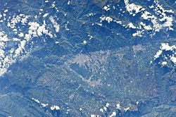
 View of the Bucaramanga Fault along Bucaramanga | |
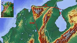
 Topographic map of northern Colombia showing the fault | |
| Etymology | Bucaramanga, Santa Marta |
| Coordinates | 7°08′N 73°00′W / 7.133°N 73.000°W |
| Country | |
| Region | Caribbean, Andean |
| State | Magdalena, Cesar, Norte de Santander, Santander |
| Cities | Santa Marta, El Paso, Bucaramanga, Floridablanca, Piedecuesta |
| Characteristics | |
| Elevation | 1–1,500 m (3.3–4,921.3 ft) |
| Range | Sierra Nevada de Santa Marta Eastern Ranges Andes |
| Part of | Andean faults |
| Segments | Santa Marta, Algarrobo, Bucaramanga Faults |
| Length | 674 km (419 mi) |
| Strike | 341 ± 23 (NNW-SSE) |
| Displacement | 110 km (68 mi) |
| Tectonics | |
| Plate | South American Plate |
| Status | Active |
| Earthquakes | Pre-Columbian era (~1020 AD) |
| Type | Strike-slip fault |
| Movement | Sinistral |
| Rock units | Gaira Schist, Bucaramanga Gneiss |
| Age | Neogene-Holocene |
| Orogeny | Andean |
{{Infobox fault
| name = Bucaramanga-Santa Marta Fault
| other_name = Bucaramanga-Santa Marta Fault System<br>''(Sistema de) Falla(s) de Bucaramanga-Santa Marta''
| named_for = [[Bucaramanga]], [[Santa Marta]]
| named_by =
| year_def =
| image = Bucaramanga, Colombia from space.JPG
| image_alt =
| caption = View of the Bucaramanga Fault along Bucaramanga
| map_image = Topographic Map of the Cesar-Ranchería Basin - Colombia.jpg
| map_caption = Topographic map of northern Colombia showing the fault
| map_alt =
| pushpin_map = Colombia
| pushpin_map_width =
| pushpin_map_caption = Location of the fault in Colombia
| pushpin_map_alt =
| pushpin_relief = 1
| country = {{COL}}
| region = [[Caribbean natural region|Caribbean]], [[Andean natural region|Andean]]
| state = [[Magdalena Department|Magdalena]], [[Cesar Department|Cesar]], [[Norte de Santander]], [[Santander Department|Santander]]
| cities = [[Santa Marta]], [[El Paso, Cesar|El Paso]], [[Bucaramanga]], [[Floridablanca, Santander|Floridablanca]], [[Piedecuesta]]
| coordinates = {{coord|7|08|N|73|00|W|type:landmark|display=inline,title}}
| elevation = {{convert|1|-|1500|m|ft|abbr=on}}
| elevation_ft =
| elevation_ref =
| topdepth_m =
| topdepth_ft =
| topdepth_ref =
| range = [[Sierra Nevada de Santa Marta]]<br>[[Cordillera Oriental (Colombia)|Eastern Ranges]]<br> [[Andes]]
| part_of = Andean faults
| segments = Santa Marta, Algarrobo, Bucaramanga Faults
| length = {{convert|674|km|mi|abbr=on}}
| width =
| depth =
| strike = 341 ± 23 (NNW-SSE)
| dip =
| dip_angle =
| displacement = {{convert|110|km|mi|abbr=on}}
| plate = [[South American Plate]]
| status = [[Active fault|Active]]
| earthquakes = [[Pre-Columbian era]]<!--NO TYPO; pre-Columbian refers to "before ColUmbus", not "before ColOmbia"!!! Don't edit this; it's not a mistake.--> (~1020 AD)
| type = [[Strike-slip fault]]
| movement = Sinistral
| rockunit = [[Gaira Schist]], [[Bucaramanga Gneiss]]
| age = [[Neogene]]-[[Holocene]]
| orogeny = [[Andean orogeny|Andean]]
| volcanic_arc/belt =
| embed =
}}
Tracking category
[edit]See also
[edit]- {{Infobox earthquake}}
- {{Infobox mountain}}
- {{Infobox rockunit}}
- {{Infobox sedimentary basin}}


