User:Amerique/la metro
Greater Los Angeles Area | |
|---|---|
| Population | CSA: 17,775,984 [1] MSA: 12,923,547 [2] |

Los Angeles - Long Beach - Santa Ana is the metropolitan statistical area (MSA) designation given to the agglomeration of urbanized areas around Los Angeles County and Orange County, United States.
As of 2005, the official estimate of the population of the Los Angeles metropolitan area is more than 12.9 million.[4] in the country, behind the New York metropolitan area. According to the U.S. Census Bureau, the Los Angeles metropolitan area has a total area of 4,850 square miles (12,561.442 km2).
Metropolitan Statistical Area
[edit]The counties and county groupings comprising the Los Angeles Metropolitan Area are listed below with 2005 U.S. Census Bureau estimates of their populations.
Los Angeles-Long Beach-Santa Ana, CA Metropolitan Statistical Area (12,950,129)
- Los Angeles-Long Beach-Glendale, CA Metropolitan Division (9,948,081)
- Los Angeles County (9,948,081)
- Santa Ana-Anaheim-Irvine, CA Metropolitan Division (3,002,048)
- Orange County (3,002,048)

Principal cities
[edit]The following is a list of principal cities in the Greater Los Angeles Area with 2008 California Department of Finance estimates of their population:[5]

Los Angeles–Long Beach–Santa Ana MSA
[edit]
|
|
|
Geography
[edit]Urban Form
[edit]
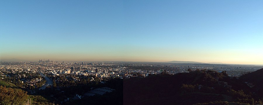
Los Angeles has a long-standing reputation for sprawl. However, according to the 2000 Census, the "Los Angeles-Long Beach-Santa Ana" Urbanized Area had a population density of 7,068 inhabitants per square mile (2,729/km2), covering 1,668 square miles (4,320 km2) of land area, making it the most densely-populated Urbanized Area (as defined by the United States Census Bureau) in the United States.[6] For comparison, the "New York-Newark" Urbanized Area as a whole had a population density of 5,309 per square mile (2,050/km2), covering 3,353 square miles (8,684 km2) of land area.
The popular conception of Los Angeles as a sprawling city may originate in the region's decentralized structure. Rather than being concentrated in a single downtown area, the region's major cultural, commercial, residential, political, industrial, and institutional resources are geographically dispersed. While the overall density of the city (municipality) of Los Angeles is low compared to some other large American cities (less than one-third the density of New York City, for instance),[7] the region includes largely uninhabited areas such as parts of the Santa Monica Mountains. Also, many of the city's suburban satellites have densities among the highest in the nation.[8] The population density of the central area was more than 13,500 per square mile (5,212/km2) in 2000[9]. Within its urbanized areas, Los Angeles is noted for small lot sizes, low vacancy rates, and general lack of large exurban spreads. Buildings in the area are low in height when compared to other large cities because of aesthetically-focused zoning regulations. Los Angeles became a major city just as the Pacific Electric Railway spread population to smaller cities much as interurbans did in East Coast cities. In the first decades of the twentieth century, the area was marked by a network of fairly dense but separate cities linked by rail. The ascendance of the automobile helped fill in the gaps between these commuter towns with lower-density settlements.[10]
While Los Angeles County andOrange County share a geographical border, the two also share a host of sharp demographic, political, and financial distinctions. Orange County is often identified apart from Los Angeles in popular media and by residents. Relatively few people living in Orange County commute to Los Angeles for employment. Western Riverside County and San Bernardino County have become commuter regions characteristic of other suburban counties throughout the nation. Most residents in these counties commute to Los Angeles County and Orange County for employment.[11] Eastern Riverside County and San Bernardino County are so removed from Los Angeles County that they are virtually independent from the rest of the Los Angeles area.

Identity
[edit]The term "Greater Los Angeles" can be used to denote the metropolitan area or the consolidated area. The term "Southland" is more nebulous and can refer to either. Additionally, the Southland is used more so in local media than by residents. As is the case in virtually all major metropolitan areas[weasel words], most employment is now outside the downtown core and many people commute and conduct all of their daily activities in suburban areas, such as the large counties and the municipalities that are outside the city of Los Angeles.[12]
Orange County maintains a distinct identity apart from Los Angeles County due to the vast cultural differences. Most people identify Orange County as an individual location apart from Los Angeles.
Boundaries
[edit]
Some areas are bounded by natural features such as mountains or the ocean; others are marked by city boundaries, freeways, or other constructed landmarks. For example, Downtown Los Angeles is the area of Los Angeles roughly enclosed by three freeways and one river: the Harbor Freeway (SR 110) to the west, the Santa Ana Freeway (US 101) to the north, the Los Angeles River to the east, and the Santa Monica Freeway (I-10) to the south. Or, the San Fernando Valley: lying north-northwest of downtown ("The Valley") is a 15 miles (24 km) wide basin ringed by mountains.
Some other areas of Los Angeles include the Westside; South L.A. (formerly known as South Central L.A.); and the San Pedro/Harbor City area. Adjoining areas that are outside the actual city boundaries of the incorporated city of Los Angeles include the South Bay, the Gateway Cities, the San Gabriel Valley and the Foothills. The San Pedro/Harbor City area was annexed by the city of Los Angeles so the city could have access to and control over the Port of Los Angeles. It is connected to the rest of L.A. only by a narrow corridor that generally follows the Harbor Freeway. Many Angelenos consider the Eastside to be the area east of the Los Angeles River, south of Glendale and Pasadena, and north of the Gateway Cities, including the area of unincorporated Los Angeles County that includes East Los Angeles.
The city boundaries are quite complicated. For example, Beverly Hills and West Hollywood are completely surrounded by the City of Los Angeles except for a small border the two cities share. Culver City is surrounded by L.A. except where it shares a boundary with the unincorporated communities of Ladera Heights and Baldwin Hills. Both Santa Monica and the unincorporated area of Marina del Rey are surrounded except on their ocean side. San Fernando in the northern corner of the San Fernando Valley is also a separate city entirely surrounded by L.A. territory. Despite the large footprint of the City of L.A., a majority of the land area within Los Angeles County is unincorporated and under the primary jurisdiction of Los Angeles County. Most of the unincorporated land, however, is part of the Santa Monica and San Gabriel mountain ranges, or the Mojave Desert, and is thus primarily undeveloped, except on the fringes of the incorporated cities, but there are several fully built-out, but unincorporated areas in the contiguous urbanized part of the region, one of the most well-known being East Los Angeles.
Demographics
[edit]| Census | Pop. | Note | %± |
|---|---|---|---|
| 1900 | 250,187 | — | |
| 1910 | 648,316 | 159.1% | |
| 1920 | 1,150,252 | 77.4% | |
| 1930 | 2,597,066 | 125.8% | |
| 1940 | 3,252,720 | 25.2% | |
| 1950 | 4,934,246 | 51.7% | |
| 1960 | 7,751,616 | 57.1% | |
| 1970 | 9,972,037 | 28.6% | |
| 1980 | 11,497,486 | 15.3% | |
| 1990 | 14,531,529 | 26.4% | |
| 2000 | 16,373,645 | 12.7% | |
| historical data source: [13] | |||
According to the 2000 census, there were 16,373,645 people residing in the Greater Los Angeles Area. The racial makeup of the area was 55.14% White (39.01% White Non-Hispanic), 10.39% Asian, 0.29% Pacific Islander, 7.60% African American, 0.87% Native American, 21.00% from other races, and 4.70% from two or more races. 40.30% of the population were Hispanic of any race. 30.95% of the population (5.068 million) was foreign born; of this, 62.07% came from Latin America, 28.93% from Asia, 6.00% from Europe, and 3.00% from other parts of the world. 20.22% of the population (3.310 million) was born in different states.
The explosive growth of the region in the 20th century can be attributed to its favorable Mediterranean climate, the availability of land and many booming industries such as oil, automobile and rubber, motion pictures and aerospace which in turn attracted millions of people from all over the United States and world. Citrus production was important to the region's development in the earlier part of the 20th century.[14]
Politics
[edit]| Year | GOP | DEM | Others |
|---|---|---|---|
| 2008 | 37.3% 2,099,609 | 60.8% 3,425,319 | 1.9% 107,147 |
| 2004 | 45.3% 2,490,150 | 53.4% 2,932,429 | 1.3% 69,649 |
| 2000 | 41.3% 2,003,114 | 54.6% 2,652,907 | 4.1% 198,750 |
| 1996 | 38.3% 1,661,209 | 51.3% 2,220,837 | 10.4% 449,706 |
| 1992 | 33.8% 1,657,151 | 45.0% 2,202,345 | 21.2% 1,038,448 |
| 1988 | 53.8% 2,408,696 | 45.0% 2,014,670 | 1.2% 54,441 |
| 1984 | 60.6% 2,614,904 | 38.3% 1,650,231 | 1.1% 48,225 |
| 1980 | 55.5% 2,187,859 | 35.0% 1,381,285 | 9.5% 374,993 |
| 1976 | 50.8% 1,877,267 | 46.7% 1,728,532 | 2.5% 93,554 |
| 1972 | 57.7% 2,346,127 | 38.7% 1,573,708 | 3.6% 146,653 |
| 1968 | 50.3% 1,836,478 | 43.0% 1,570,478 | 7.3% 247,280 |
| 1964 | 44.0% 1,578,837 | 55.9% 2,006,184 | 0.1% 2,488 |
| 1960 | 50.8% 1,677,962 | 48.9% 1,612,924 | 0.3% 10,524 |
Greater Los Angeles is a politically divided metropolitan area. During the 1970s and 1980s the region leaned toward the Republican Party. Los Angeles County, the most populous of the region is a Democratic stronghold. Ventura County and San Bernardino County were historically Republican strongholds, but currently lean Republican. Orange County and Riverside County are both Republican strongholds.[citation needed]
Economy
[edit]Greater Los Angeles Area is an economic powerhouse, ranking as the third largest metropolitan economy in the world, behind Greater Tokyo Area and New York Metropolitan Area. A 2005 PricewaterhouseCoopers study showed that Los Angeles urban area had a $639 billion economy.[15] Greater Los Angeles (including Inland Empire and Ventura county) had a $770.6 billion economy.[16]
Tourism
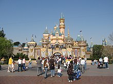
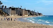
[edit]Due to L.A.'s stance as the "Entertainment Capital of the World", there is an abundance of attractions here. Consequently, the Greater L.A. Area is one of the most visited areas in the world. Here is a breakdown of some of its major attractions:

Theme parks
[edit]

Beaches
[edit]
Shopping
[edit]- Americana at Brand
- Tweedy Mile
- Rodeo Drive
- The Grove at Farmer's Market
- Beverly Center
- Glendale Galleria
- Old Pasadena
- Irvine Spectrum Center
- Paseo Colorado
- Westfield Century City
- Westfield MainPlace
- Westside Pavilion
- Valencia Town Center
- Third Street Promenade
- South Coast Plaza
- Downtown Disney
- Universal CityWalk
- Westfield Topanga
- The Block at Orange
- Ontario Mills
- Victoria Gardens
- Hollywood and Highland
- Bella Terra
- Fashion Island
- Westminster Mall
- Asian Garden Mall
- Westfield Santa Anita

Motion picture studios
[edit]Waterparks
[edit]Zoos and aquariums
[edit]Nightlife
[edit]
Museums
[edit]- See also, Los Angeles City Museums
- Bowers Museum
- Heritage Square Museum
- California Science Center
- Discovery Science Center
- Getty Center
- Getty Villa
- Griffith Observatory
- Huntington Library
- La Brea Tar Pits
- Los Angeles County Museum of Art
- Natural History Museum of Los Angeles County
- Norton Simon Museum
- Kidspace Children's Museum
- Museum of Contemporary Art, Los Angeles
- Museum of Latin American Art
- Museum of Tolerance
- Petersen Automotive Museum
- Toyota USA Automobile Museum
Presidential Museums
[edit]Other
[edit]Commercial airports
[edit]| Airport | IATA code | ICAO code | County |
|---|---|---|---|
| Los Angeles International Airport | LAX | KLAX | Los Angeles |
| LA/Ontario International Airport | ONT | KONT | San Bernardino |
| John Wayne Airport | SNA | KSNA | Orange |
| Bob Hope Airport | BUR | KBUR | Los Angeles |
| Long Beach Municipal Airport | LGB | KLGB | Los Angeles |
Sports
[edit]Major sports teams serving the Greater Los Angeles area include the Los Angeles Clippers and Los Angeles Lakers of the National Basketball Association, the Los Angeles Angels of Anaheim and Los Angeles Dodgers of Major League Baseball, the Los Angeles Kings and Anaheim Ducks of the National Hockey League, the Los Angeles Galaxy and Chivas USA of Major League Soccer, the Los Angeles Sparks of the Women's National Basketball Association, the Los Angeles Avengers of the Arena Football League, the Los Angeles Riptide of Major League Lacrosse, and the Los Angeles Sol of Women's Professional Soccer. The Greater Los Angeles area also has two of the more famous horse racing facilities: Santa Anita Park and Hollywood Park Racetrack.
The Los Angeles media market currently lacks a National Football League team. After the 1994 season, the Los Angeles Rams moved to St. Louis, Missouri and the Los Angeles Raiders returned to their original home of Oakland, California.
There were several years that made Los Angeles area sports dominate:
- 1972: The Lakers, having won 33 straight games at one point in the regular season, finally won their first NBA championship in Los Angeles, with a victory over the New York Knicks in the NBA Finals. The UCLA Bruins won their eighth national championship in Division I basketball overall, and a sixth consecutive during their amazing tenure with John Wooden as coach. The USC Trojans got their seventh national championship in Division I-A football, with a victory over the Ohio State Buckeyes in the Rose Bowl Game.
- 1988: Having guaranteed a repeat during the 1987 championship parade, head coach Pat Riley and the Lakers became the first repeat champions in the NBA in 19 years, with a victory in the 1988 NBA Finals over the Detroit Pistons. In the summer, the Los Angeles Kings acquired Wayne Gretzky from the Edmonton Oilers, and the Dodgers pulled an improbable run to the World Series championship, with victories over the New York Mets in the NLCS, and the Oakland Athletics in the World Series.
- 2002: The Los Angeles Lakers (NBA), Los Angeles Sparks (WNBA), Los Angeles Galaxy (MLS), and Anaheim Angels (MLB) each won championships, giving the Los Angeles area 4 major professional titles in a single year. The Lakers won a third consecutive championship, with a victory over the New Jersey Nets in the NBA Finals. The Sparks won their second consecutive title. Meanwhile, the titles for the Angels and Galaxy were a first for each of them. The Galaxy beat the New England Revolution in the MLS Cup, while the Angels beat the San Francisco Giants in the 2002 World Series.
In 2007, the Los Angeles area finally acquired the only title that had eluded the region, when the Anaheim Ducks captured the Stanley Cup chamipionship over the Ottawa Senators, in the 2007 Stanley Cup Finals.
As a whole, the Los Angeles area has more national championships, all sports combined (college and professional), than any other city in the United States, with over four times as many championships as the entire state of Texas, and just over twice that of New York City.
See also
[edit]References
[edit]- ^ "Annual Estimates of the Population of Combined Statistical Areas". United States Census Bureau. Retrieved 2008-03-29.
- ^ "U.S. Census Bureau 2005 estimates for metropolitan statistical areas". United States Census Bureau. Retrieved 2008-03-29.
- ^ "Statistical data". Los Angeles County Online. Retrieved 2008-03-29.
{{cite web}}: Italic or bold markup not allowed in:|publisher=(help) - ^ "Metropolitan and Micropolitan Statistical Areas". United States Census Bureau. Retrieved 2008-03-30.
- ^ "City/County population estimates with annual percentage change". California Department of Finance. 2008-01-01. Retrieved 2009-01-19.
- ^ American Factfinder, United States Census Bureau, Table: "GCT-PH1-R. Population, Housing Units, Area, and Density (geographies ranked by total population): 2000" from Data Set: "Census 2000 Summary File 1 (SF 1) 100-Percent Data", accessed 10 October, 2007 at: [1] See also: List of United States urban areas
- ^ Haughton, Graham, and Colin Hunter, Sustainable Cities, London: Routledge, 2003: 81.
- ^ Bruegmann, Robert. Sprawl: A Compact History. University of Chicago Press, Chicago 2005: 65.
- ^ "City of Los Angeles Population by Area from 1950". Demographia.com. Wendell Cox Consultancy.
- ^ Abu-Lughod, Janet L. (1999). New York, Chicago, Los Angeles: America's Global Cities. Minneapolis: University of Minnesota Press. ISBN 9780816633364.
{{cite book}}:|access-date=requires|url=(help) - ^ "Riverside County is 'extreme commute' king". North County Times.
- ^ Wolch, Jennifer R. (2004). Up Against the Sprawl: Public Policy and the Making of Southern California. Minneapolis: University of Minnesota Press. ISBN 9780816642984.
{{cite book}}: Unknown parameter|coauthors=ignored (|author=suggested) (help) - ^ "Older Suburbs in the Los Angeles Metropolitan Area" (pdf). Local Government Commission.
- ^ Garcia, Matt (2001). A World of its Own: Race, Labor, and Citrus in the Making of Greater Los Angeles, 1900-1970 (2nd ed.). Chapel Hill: University of North Carolina Press. ISBN 9780807826584.
{{cite book}}:|access-date=requires|url=(help) - ^ The 150 richest cities in the world by GDP in 2005
- ^ U.S. Metro Economies: GMP - The Engines of America's Growth

