
User:Flux55/1990 Pacific typhoon season
| Flux55/1990 Pacific typhoon season | |
|---|---|
 Season summary map | |
| Seasonal boundaries | |
| First system formed | January 12, 1990 |
| Last system dissipated | December 23, 1990 |
| Strongest storm | |
| Name | Flo |
| • Maximum winds | 220 km/h (140 mph) (10-minute sustained) |
| • Lowest pressure | 890 hPa (mbar) |
| Seasonal statistics | |
| Total depressions | 41 |
| Total storms | 29 |
| Typhoons | 19 |
| Super typhoons | 4 (unofficial) |
| Total fatalities | Unknown |
| Total damage | Unknown |
| Related articles | |
The 1990 Pacific typhoon season was a relatively active season, producing 41 depressions, 29 storms, and 19 typhoons. The season ran throughout 1990, although most tropical cyclones typically develop between May and October. The season's first named storm, Koryn, formed on January 12, while its last named storm, Russ, dissipated on December 23.
The scope of this article is limited to the Pacific Ocean to the north of the equator between 100°E and 180th meridian. Within the northwestern Pacific Ocean, there are two agencies which assign names to tropical cyclones which can often result in a cyclone having two names. At the time, the Joint Typhoon Warning Center (JTWC) named tropical cyclones which had 10-minute sustained wind speeds of at least 65 km/h (40 mph) anywhere in the basin, while the Philippine Atmospheric, Geophysical and Astronomical Services Administration (PAGASA) named tropical cyclones which are active in the Philippine Area of Responsibility (PAR), located between 135°E and 115°E and between 5°N–25°N, regardless of whether or not a tropical cyclone has already been named by the JTWC.
Season summary
[edit]
This season's ACE index, as calculated by Colorado State University using data from the JTWC, is approximately 170.8 units.[1] This number represents sum of the squares of the maximum sustained wind speed (knots) for all named storms while they are at least tropical storm intensity, divided by 10,000. Therefore, tropical depressions are not included.[2]
Systems
[edit]Severe Tropical Storm Nathan (Akang)
[edit]| Severe tropical storm (JMA) | |
| Tropical storm (SSHWS) | |
  | |
| Duration | June 14 – June 19 |
|---|---|
| Peak intensity | 100 km/h (65 mph) (10-min); 980 hPa (mbar) |
On June 13, the Joint Typhoon Warning Center (JTWC) began tracking a weak circulation embedded in the monsoon trough.[3] Twelve hours later, the Japan Meteorological Agency (JMA) recognized the system as a tropical depression.[4] The next day, the JTWC issued a TCFA on the system as it had organized significantly, issuing their first advisories on the system on June 15.[3] The nascent depression absorbed a weakening Tropical Depression 04W later that day as the JMA upgraded it into a tropical storm.[4] The JTWC recognized the system as a tropical depression the next day, naming it Nathan.[3]
Nathan gradually intensified, and by 12:00 UTC on June 17, peaked with both 1-minute and 10-minute sustained winds of 105 km/h (65 mph).[3][4] Weakening soon commenced, and when Nathan made landfall along the China-Vietnam border a day later, it was a minimal tropical storm.[3][4] The JMA discontinued all advisories around that time,[4] but the JTWC still monitored the system until it dissipated over Northern Vietnam on June 19.[3]
In the Philippines, Nathan (known as Akang) caused 64 fatalities. Additionally, it affected over 227,000 people.[5] In eastern Guangdong, torrential rain associated with Nathan was responsible for 10 deaths. Over 100,000 acres of farmland was affected. In Macau, two men were reported missing. The Hong Kong Observatory issued their Strong Wind Signal No. 3 on 10.00 p.m.[6] Mudslides were reported throughout the area and scaffoldings collapsed in Kowloon. On June 16, the cargo ship, Tien Fu, sank in the South China Sea, killing four.[3]
Typhoon Ofelia (Bising)
[edit]| Typhoon (JMA) | |
| Category 2 typhoon (SSHWS) | |
  | |
| Duration | June 16 – June 25 |
|---|---|
| Peak intensity | 120 km/h (75 mph) (10-min); 970 hPa (mbar) |
On June 15, the Joint Typhoon Warning Center (JTWC) began tracking an area of persistent convection embedded in the monsoon trough.[3] Eighteen hours later, the Japan Meteorological Agency (JMA) upgraded the system into a tropical depression.[4] On June 17, the JTWC issued a Tropical Cyclone Formation Alert (TCFA) for the system, recognizing the system as a tropical depression later that day.[3] On 18:00 UTC that day, the JMA upgraded the depression into a tropical storm,[7] with the JTWC following suit the next day, naming it Ofelia.[3]
Ofelia gradually deepened,[6] and on 00:00 UTC on June 20, was upgraded into a severe tropical storm.[4] Following the development of a central dense overcast, Ofelia was upgraded into a typhoon by the JTWC late on June 20.[3] Two days later, the JMA upgraded Ofelia into a typhoon, stating that it peaked with 10-minute sustained winds of 120 km/h (75 mph) and a minimum central barometric pressure of 970 mbar (29 inHg),[7] while the JTWC reported that it peaked with 1-minute sustained winds of 170 km/h (105 mph).[3] Turning northward, Ofelia struck the east coast of Taiwan, rapidly weakening as it tracked inland.[3]The storm then began to turn north, eventually recurving towards the Korean Peninsula.[3] At 00:00 UTC on June 24 the JMA declared Ofelia an extratropical cyclone.[4] with the JTWC following suit the next day as the system merged with a frontal zone.[3]
Despite remaining offshore northern Luzon,[3] the storm's broad circulation[6] enhanced the southwest monsoon that inundated much of the northern Philippines.[3] Taiwan, on the other hand, took a direct hit from Ofelia,[3] with floodwater levels reaching 1 m (3.3 ft) in some places.[6] According to media reports, the storm was the worst to impact eastern Taiwan in 30 years,[3] dropping up to 46 cm (18 in) of rain in a 24-hour time span,[8] although damage was slight elsewhere.[9] After battering the Philippines and Taiwan, the typhoon dropped 100 mm (3.9 in) of precipitation in parts of central China. Across Wenzhou, 12 people were killed.[10]
Typhoon Percy (Klaring)
[edit]| Typhoon (JMA) | |
| Category 4 typhoon (SSHWS) | |
  | |
| Duration | June 20 – June 30 |
|---|---|
| Peak intensity | 150 km/h (90 mph) (10-min); 950 hPa (mbar) |
Typhoon Percy originated from the eastern end of the Western Pacific monsoon trough, first noted by the Joint Typhoon Warning Center (JTWC) on the morning of June 20. Satellite imagery showed signs of a well-defined low-level circulation and the disturbance was situated in a weakly divergent environment aloft along with persistent convection.[3] Later that day, the Japan Meteorological Agency (JMA) upgraded the system into a tropical depression.[4] The system gradually became more organized, resulting in the JTWC issuing a TCFA on the system at 03:00 UTC on June 21. Following a ship report of 65 km/h (40 mph) winds,[3] both the JTWC and JMA upgraded the system into Tropical Storm Percy.[11] As Percy continued to intensify, it began to track west-northwestward around another upper-level anticyclone that formed southeast of Typhoon Ofelia.[3] By June 22, Percy was upgraded into a severe tropical storm by the JMA.[11] The JTWC upgraded Percy into a typhoon on the evening of June 23,[3] with the JMA subsequently following suit in the morning of June 24.[4]
After moving away from the Caroline Islands, the typhoon began to intensify at a faster clip as an outflow channel to its north opened,[3] even though the eye was initially ragged.[11] Early the next day, the JTWC estimated that Percy obtained its peak intensity based on the Dvorak estimate of T6.0/210 km/h (130 mph) and a clear eye,[3] while the JMA reported that Percy attained its maximum intensity of 145 km/h (90 mph) and a minimum barometric pressure of 960 mbar (28.3 inHg).[11] Increased vertical wind shear took toll on the storm,[3] and by June 27, Percy steadily weakened[11] as the storm passed over northeastern Luzon.[6] Overland, the storm weakened slightly, but remained a typhoon upon entering the South China Sea.[3] At 00:00 UTC on June 29, the JMA downgraded Percy to a severe tropical storm,[4] although the JTWC suggested that Percy was still a typhoon at the time.[11] Shortly thereafter, Percy moved onshore around 130 km (80 mi) southwest of Xiamen.[6] At 06:00 UTC, the JTWC downgraded Percy into a tropical storm, noting that the storm had become less organized.[3] By June 30, both the JTWC and JMA stopped tracking the system, which had dissipated inland.[3][4]
During its formative stages, Percy affected several of the Caroline Islands.[12] Airline services in and out Yap were halted.[13] The typhoon posed enough of a threat to Hong Kong to warrant a No 1. hurricane signal briefly, but it was dropped within 24 hours. Some flooding occured, especially in the New Territories, where there was slight damage to crops. In Kwai Chung, floodwaters were 0.6 m (2.0 ft) deep, sweeping away a ten-year-old boy. Two other villages lost power and eleven people had to be evacuated.[6] In the provinces of Fujian and Guangdong of China, power lines were downed. Farm production was reduced by 400 million catties in Fujian.
Severe Tropical Storm Winona
[edit]| Severe tropical storm (JMA) | |
| Category 1 typhoon (SSHWS) | |
  | |
| Duration | August 4 – August 11 |
|---|---|
| Peak intensity | 110 km/h (70 mph) (10-min); 975 hPa (mbar) |
Tropical Storm Winona originated from an area of enhanced convection developed within the monsoon trough in the East China Sea on August 4. Six hours later, the Joint Typhoon Warning Center (JTWC) started tracking the system as a weak low-pressure area developed.[3] At 18:00 UTC, the Japan Meteorological Agency (JMA) classified the system as a tropical depression.[4] Following a Dvorak classification of T1.0/50 km/h (30 mph), the JTWC issued a TCFA at 11:00 UTC on August 5. A day later, the JTWC started issuing warnings on the system, designating the system as a tropical depression, after the system's convection structure improved and thunderstorm activity increased in coverage.[3] On the evening of August 6, the JMA upgraded the depression into a tropical storm.[4]
Early on August 7, the JTWC upgraded the system into a tropical storm, naming it Winona. Wind shear began to relax; consequently, the storm's low-level center moved under the deep convection. Early on August 8, the JMA reported that Winona strengthened into a severe tropical storm.[14] The next day, the JMA stated that Winona peaked with 10-minute sustained winds of 115 km/h (70 mph), while the JTWC estimated that Winona peaked with 1-minute winds of 120 km/h (75 mph)[3] over 330 km (205 mi) east-southeast of Tokyo.[6] Early on August 10, Winona made landfall close to Hamamatsu near peak intensity. After landfall, it began to accelerate northeastward and by 12:00 UTC, Winona was embedded in the mid-latitude westerlies and started transitioning into an extratropical cyclone.[3] Both agencies stopped tracking Winona by August 14.[3][4]
Tropical Storm Winona brought strong winds and heavy rains to the Japanese archipelago.[15] Tokyo was lashed with strong winds and heavy rain for several hours, with damage estimated at 34.9 million yen ($241,000 USD).[16] Seven reservoirs in Tokyo received more than 20,000,000 short tons (18,143,695 t) of water; the reservoirs reached 36% capacity, which prompted officials to lift restrictions on water use that were enacted following a drought.[17] Ten homes were flooded, and damage totaled 128.5 million yen ($886,000 USD) in Kanagawa Prefecture. Seven people were wounded, mostly due to gusty winds.[18] The cyclone forced the first two days of the Karuizawa 72 Tokyu Ladies Open to be shortened.[19]
Typhoon Yancy (Gading)
[edit]| Typhoon (JMA) | |
| Category 2 typhoon (SSHWS) | |
  | |
| Duration | August 11 – August 23 |
|---|---|
| Peak intensity | 150 km/h (90 mph) (10-min); 950 hPa (mbar) |
At 06:00 UTC on August 9, Yancy was first noted by the Joint Typhoon Warning Center (JTWC) as a low-level convective center on the eastern side of a monsoon depression.[3] For the next four days, the system gradually organized, resulting in the JTWC issuibg a total of three TCFAs.[3] Meanwhile, the Japan Meteorological Agency (JMA) began monitoring the system on August 11.[4] On 18:00 UTC on August 13, the JTWC issued its first warning on the system as a tropical depression. The next day, both the JMA and JTWC upgraded the system into a tropical storm, with the latter naming it Yancy. At 12:00 UTC on August 16, the JTWC determined that Yancy had strengthened into a typhoon.[3][20]
According to the JTWC, Yancy intensified into a Category 2-equivelant typhoon on the Saffir–Simpson scale at 12:00 UTC on August 17 with one-minute sustained winds of 90 knots (165 km/h; 105 mph).[3][20] However, the JMA data stated that Yancy peaked eighteen hours later, with ten-minute sustained winds of 80 knots (150 km/h; 90 mph) and a minimum barometric pressure of 28.05 inHg (950 mbar).[4] Yancy then proceeded to track across Taiwan a few days later.[4] Yancy's interaction with mountainous terrain on the island, and later the Chinese mainland, caused it to weaken.[3] The JTWC downgraded Yancy to a tropical storm at 00:00 UTC August 20; thirty hours later, the agency downgraded the storm to a tropical depression, simultaneously issuing its final warning as Yancy dissipated.[3] The JMA similarly found that Yancy had weakened to a tropical depression on August 22, and it stopped tracking the system the next day.[4]
In the Philippines where Yancy was known by the PAGASA name "Gading",[21] a monsoon surge triggered by the storm resulted in significant rainfall which flooded areas across northern Luzon.[3] In Taiwan, torrential rainfall was recorded, including 1,194 mm (47.0 in) in the Alishan Range and 718.5 mm (28.29 in) on Yu Shan.[22] In Taipei alone, about 525,000 families lost power.[6] Yancy delivered significant impacts to southeastern China. In Fujian, where the cyclone meandered for days and contributed to more than 610 mm (24 in),[23] more than 4 million residents were directly affected.[24] Throughout the entirety of southeastern China, 400,000 residents were left homeless.[25]
Tropical Storm Aka
[edit]| Tropical storm (JMA) | |
| Tropical storm (SSHWS) | |
  | |
| Duration | August 13 (Entered basin) – August 15 |
|---|---|
| Peak intensity | 75 km/h (45 mph) (10-min); 994 hPa (mbar) |
On 15:00 UTC on August 13, a weakening Tropical Storm Aka crossed into the basin from the East Pacific, resulting in the Central Pacific Hurricane Center (CPHC) passing its responsibility to the Joint Typhoon Warning Center (JTWC).[26] The next day, the JTWC downgraded Aka into a tropical depression since it had lost convection due to persistent wind shear caused by a nearby TUTT. On 12:00 UTC on August 15, the JTWC issued the last warning on the system,[3] as it passed south of Wake Island.[26]
Typhoon Zola
[edit]| Typhoon (JMA) | |
| Category 3 typhoon (SSHWS) | |
  | |
| Duration | August 15 – August 23 |
|---|---|
| Peak intensity | 140 km/h (85 mph) (10-min); 960 hPa (mbar) |
On August 15, the Joint Typhoon Warning Center (JTWC) started watching a persistent area of disturbed weather west of Guam.[27]The next day, the Japan Meteorological Agency (JMA) upgraded the disturbance into a tropical depression. By the evening of August 16, the JTWC issued a Tropical Cyclone Formation Alert, and the following morning, upgraded the system into a tropical depression.[27] The depression turned west-northwest in response to a shortwave trough that tracked north of the system.[27] At noon on August 17, the JMA upgraded it to a tropical storm,[28] although the JTWC did not follow suit until early on August 18, naming it Zola.[29] Zola continued northwest and tracked through region of divergence aloft, which aided intensification.[27] At 06:00 UTC on August 18, the JMA upgraded Zola into a severe tropical storm.[30] Following the appearance of a ragged 45 km (30 mi) eye on weather satellite imagery and a Dvorak classification of T4.0/120 km/h (75 mph),[27] Zola was classified as a typhoon at 00:00 UTC on August 20 by the JTWC.[29] The JMA followed suit later that same morning.[28][30]
Further intensification was aided by a tropical upper tropospheric trough that provided an excellent poleward outflow channel. Based an increase in the storm's organization, the JTWC raised the intensity of the storm to 185 km/h (115 mph) at 06:00 UTC on August 21, its peak intensity.[27] Around this time, the JMA estimated that Zola peaked in intensity, with winds of 135 km/h (85 mph) and a minimum barometric pressure of 975 mbar (28.8 inHg).[30] Increased southwesterly wind shear took toll on the typhoon,[27] and the storm weakened slightly prior as it passed between Kyushu and Shikoku,[31] with the JTWC and JMA reporting winds of 175 and 130 km/h (110 and 80 mph) respectively at the time of landfall[30] on western Honshu.[31] After recurving to the northeast over the Sea of Japan,[27] Zola weakened to a tropical storm on August 22[30] and transitioned into a mid-latitude cyclone while interacting with the westerlies early on August 23.[27] Both agencies ceased tracking the system at this time.
The typhoon dropped heavy rainfall across much of the Japanese archipelago.[32]Six fatalities were reported while twenty-four others sustained injuries.[32] A total of 67 houses were destroyed while 420 others were flooded.[32] Sixteen ships and 4,560 acres (1,845 ha) of farmland were damaged.[32] More than 250 flights were cancelled due to adverse weather.[33] Monetary damage totaled ¥15.1 billion (US$104 million).[32] Zola was the second of six tropical cyclone to directly affect Japan in 1990, which set a record for the most systems to hit the country in a year; it was also the latest typhoon to hit the country, with the previous mark set by Typhoon Agnes of the 1948 Pacific typhoon season.[34]
Typhoon Abe (Ilang)
[edit]| Typhoon (JMA) | |
| Category 2 typhoon (SSHWS) | |
  | |
| Duration | August 23 – September 2 |
|---|---|
| Peak intensity | 140 km/h (85 mph) (10-min); 955 hPa (mbar) |
Abe was first noted by the Joint Typhoon Warning Center (JTWC) as an area of persistent atmospheric convection on August 23 at 01:00 UTC. Following this, the disturbance tracked in a mostly west-northwestward direction, traveling beneath a subtropical ridge, with a Tropical Cyclone Formation Alert being issued at 06:00 UTC based on the improving state of the low.[3] Following an increase in the storm's central convection, on August 24, the JTWC upgraded it into a tropical storm, naming it Abe, with the Japan Meteorological Agency (JMA) starting to monitor it six hours later.[3][4] The JMA upgraded the system to a tropical storm the next day. At 06:00 UTC August 27, the JMA upgraded Abe to a severe tropical storm with winds of 95 km/h (60 mph),[4] and as a ragged eye developed in the storm, the JTWC upgraded Abe to a typhoon six hours later.[3] Late on August 28, the JMA upgraded Abe to a typhoon on its scale, with ten-minute sustained winds of 120 km/h (75 mph).[4]
Following the monsoon surge, Abe returned to its original west-northwestward track, further intensifying to become a Category 2-equivalent typhoon at 12:00 UTC on August 29.[35] A weakness appeared in the subtropical ridge in association with a short-wave trough, and Typhoon Abe recurved through this weakness, taking it along the coast of China.[3] Prior to making landfall near 18:00 UTC that day, Abe attained a minimum atmospheric pressure of 955 millibars (hPa; 28.20 inHg) and ten-minute sustained winds of 140 km/h (85 mph)and on August 29 as determined by the JMA.[4] It was found by the JTWC that Abe's one-minute sustained winds peaked at 165 km/h (105 mph) at 00:00 UTC the next day.[35][4] As a direct result of this interaction with land, Abe weakened to a tropical storm at 12:00 UTC on August 31, entering the Yellow Sea and crossing South Korea in the 30 hours that followed. It was determined at 18:00 UTC on September 1 that the storm had transitioned into an extratropical cyclone.[3] The JTWC ceased tracking the system at 06:00 UTC September 2,[35] and the JMA followed suit 36 hours later.[4]
In the Philippines where Abe was known by the PAGASA name "Iliang", 85 people died.[36] Rainfall-induced landslides ravaged areas previously damaged by an earthquake a month earlier,[37] with landslide-caused fatalities totaling 32 in the Philippine provinces of Benguet, Nueva Ecija, and Nueva Vizcaya,[38] Parts of the Okinawa Prefecture in Japan experienced high winds and heavy rainfall as Typhoon Abe passed nearby. In Taiwan, one person was killed[38][39][40] while six others were injured as Typhoon Abe traveled across the East China Sea.[38][39] Approximately 70,000 households had their supply of electricity cut off, and floods and landslides occurred as a result of heavy rainfall.[39] Early on August 31, Typhoon Abe made landfall over Zhejiang Province in China approximately 250–270 km (160–170 mi) south of Shanghai.[39][41] In Zhejiang, where Abe was reportedly "the worst typhoon to hit the province in 34 years", casualties of the storm numbered in the hundreds, with 65 people rendered dead, 839 wounded, and an additional 45 reported missing. Altogether, an estimated 108 people were killed in China.[42] Abe brought heavy rain and gales to South Korea prior to transitioning to an extratropical cyclone near the east coast of the peninsula.[43]
Typhoon Flo (Norming)
[edit]| Violent typhoon (JMA) | |
| Category 5 super typhoon (SSHWS) | |
  | |
| Duration | September 12 – September 20 |
|---|---|
| Peak intensity | 220 km/h (140 mph) (10-min); 890 hPa (mbar) |
On 06:00 UTC on September 8, the Joint Typhoon Warning Center (JTWC) started tracking a low-pressure area about 430 km (270 mi) east-southeast of Guam. Throughout the next four days, the storm's convective structure slowly improved,[3] and on September 12, the Japan Meteorological Agency (JMA) classified the system as a tropical depression.[4] Following the disturbance's development, the JTWC issued a Tropical Cyclone Formation Alert at 05:30 UTC that day. At 18:00 UTC on September 12, the JTWC declared the system a tropical depression.[3] Six hours later, the JMA upgraded the depression into a tropical storm,[4] with the JTWC followed suit a few hours later, naming it Flo.[3] On 06:00 UTC on September 14, the JMA upgraded Flo to a severe tropical storm. The next day, both agencies classified Flo as a typhoon.[44]
After becoming a typhoon, Flo began to rapidly intensify.[3] Over the ensuing 36 hours, the JTWC estimated that Flo deepened by 130 km/h (80 mph).[45] Midday on September 16, the JTWC upgraded Flo into a super typhoon. The next day, the JTWC recognized the system having 1-minute sustained winds of 265 km/h (165 mph), a Category-5 equivalent tropical cyclone on the Saffir-Simpson Hurricane Wind Scale (SSHWS. Shortly thereafter, a dropsonde from the aircraft measured a barometric pressure of 891 mbar (26.3 inHg).[3] Around this time, the JMA estimated the typhoon peaked in intensity with 10-minute winds of 225 km/h (140 mph) and a pressure of 890 mbar (26 inHg).[4] Soon after, Flo rapidly weakened, and at 00:00 UTC on September 18, the JTWC estimated that the typhoon weakened back to a tropical storm. Weakening continued due to increased vertical wind shear, although the warm waters of the Kuroshio Current helped Flo maintain some of its intensity.[3] Around 06:00 UTC on September 19,[44] the storm made landfall on southern Honshu.[3] After passing over Japan, Flo began to transition into an extratropical cyclone.[3] At 00:00 UTC on September 20, the JMA declared Flo extratropical,[4] while the JTWC kept monitoring it until September 22.[3]
Typhoon Flo was the strongest system to affect Japan since 1959[46] and was the first typhoon to hit the Kii Peninsula in 11 years.[47] For a period of three days,[48] the typhoon dropped heavy rainfall across much of the Japanese archipelago,[49] which caused damage in 44 of 47 prefectures.[48] A peak rainfall total occurred of 1,124 mm (44.3 in) at Yanase Station.[50] A wind gust of 151 km/h (94 mph) was recorded on Muroto.[51] A minimum barometric pressure of 971.3 mbar (28.68 inHg) was recorded at Gifu, the fourth lowest pressure observed since observations at the station began in 1883.[52] Nationwide, 40 fatalities were reported, and 131 others sustained injuries. A total 16,541 houses were destroyed while 18,183 others were flooded.[49] Monetary damage totaled ¥132 billion (US$918 million).[49]
Tropical Storm Ira
[edit]| Tropical storm (JMA) | |
| Tropical storm (SSHWS) | |
  | |
| Duration | October 1 – October 5 |
|---|---|
| Peak intensity | 65 km/h (40 mph) (10-min); 996 hPa (mbar) |
Ira was first noted by the Joint Typhoon Warning Center (JTWC) on September 29.[3] Two days later, the Japanese Meteorological Agency began monitoring the system as a tropical depression.[4] Later that day, the JTWC issued a TCFA for the system following an increase in convection. By October 2, the JTWC had issued its first advisory on the system. Later that day, both the JMA and JTWC upgraded the system into a tropical storm, with the latter naming it Ira.[3][4] However, by the next day, landfall in Vietnam caused Ira to weaken, resulting in the JTWC downgrading it into a tropical depression[3] and the JMA ceasing all bulletins on it.[4] The JTWC still issued warnings until Ira dissipated on October 5.[3]
In Thailand, Ira caused torrential rainfall, which killed at least 24 people.[53] In Vietnam, around 7 people died as thousands of homes were submerged due to floodwaters.[3] The Nghe Tinh and Thai Binh provinces suffered significantly, with extreme property loss occurring.[54] In their post-season analysis, the JTWC noted that Ira had tracked so far inland, that it was briefly expected to cross into the North Indian Ocean.[3]
Tropical Storm Lola
[edit]Lola was first
| Tropical storm (JMA) | |
| Tropical storm (SSHWS) | |
  | |
| Duration | October 16 – October 20 |
|---|---|
| Peak intensity | 65 km/h (40 mph) (10-min); 998 hPa (mbar) |
Other systems
[edit]Many of the tropical depressions of the season failed to intensify into tropical storms, or even be numbered.
- According to the China Meteorological Administration (CMA), a tropical depression formed near Mindanao on May 20. After tracking through the Southern Philippines, the depression dissipated on May 23.[55]
- The CMA first noted a tropical depression in the South China Sea on May 24. Gradually intensifying, the depression made landfall in Hainan near 3:00 UTC on May 28. Rapidly weakening, the system was last noted on May 29 east of Vietnam.[56]
Storm names
[edit]International names
[edit]During the season, 29 tropical storms developed in the Western Pacific, all of them being named by the JTWC once they had 1-minute sustained winds of 65 km/h (40 mph). These names were used from a revised list in 1989.
| Koryn | Lewis | Marian | Nathan | Ofelia | Percy | Robyn | Steve | Tasha | Vernon | Winona | Yancy | Zola | Abe | Becky |
| Cecil | Dot | Ed | Flo | Gene | Hattie | Ira | Jeana | Kyle | Lola | Mike | Nell | Owen | Page | Russ |
|
Philippines
[edit]| Main list | ||||
|---|---|---|---|---|
| Akang | Bising | Klaring | Deling | Emang |
| Gading | Heling | Iliang | Loleng | Miding |
| Norming | Oyang | Pasing | Ruping | Susang |
| Tering | Uding | Weling (unused) | Yaning (unused) | |
| Auxiliary list | ||||
| Aning (unused) | Bidang (unused) | Katring (unused) | Delang (unused) | Esang (unused) |
| Garding (unused) | ||||
The Philippine Atmospheric, Geophysical and Astronomical Services Administration uses its own naming scheme for tropical cyclones in their area of responsibility. They assigned names to tropical depressions that were active there. Should the list of names for a given year be exhausted, names are taken from an auxiliary list, the first 10 of which are published each year before the season starts. Names not retired from this list were used again in the 1994 season. This is the same list used for the 1986 season. PAGASA uses its own naming scheme that starts in the Filipino alphabet, with names of Filipino female names ending with "ng" (A, B, K, D, etc.). Names that were not assigned/going to use are marked in gray.
Retirement
[edit]Due to its destructive impact, the name Mike was retired and replaced with Manny.[57] PAGASA also retired the name Ruping, replacing it with Ritang.[58]
Season effects
[edit]This table summarizes all the systems that were active in the North Pacific Ocean, west of the International Date Line, during 1990. It also provides an overview of each system's intensity, duration, land areas affected, and any associated deaths or damages.
| Name | Dates | Peak intensity | Areas affected | Damage (USD) |
Deaths | Refs | ||
|---|---|---|---|---|---|---|---|---|
| Category | Wind speed | Pressure | ||||||
| Nathan | June 14-19 | Severe tropical storm | 105 km/h (65 mph) | 980 hPa (28.94 inHg) | Philippines, China, Macau, Hong Kong, Vietnam | $18 million | 78 | |
| Ofelia | June 16-25 | Typhoon | 120 km/h (75 mph) | 970 hPa (28.64 inHg) | Philippines, Taiwan, China | $207 million | 96 | |
| Season aggregates | ||||||||
| 9 systems | June 14– September 20 | 220 km/h (140 mph) | 895 hPa (26.43 inHg) | $0 | ||||
References
[edit]- ^ "Real-Time Tropical Cyclone North Atlantic Ocean Statistics". Fort Collins, Colorado: Colorado State University. Retrieved January 23, 2024.
- ^ "Background Information: North Atlantic Hurricane Season". College Park, Maryland: Climate Prediction Center. April 9, 2021. Retrieved December 6, 2022.
- ^ a b c d e f g h i j k l m n o p q r s t u v w x y z aa ab ac ad ae af ag ah ai aj ak al am an ao ap aq ar as at au av aw ax ay az ba bb bc bd be bf bg bh bi bj Joint Typhoon Warning Center; Naval Pacific Meteorology and Oceanography Center (1992). Annual Tropical Cyclone Report: 1990 (PDF) (Report). United States Navy, United States Air Force. Retrieved August 16, 2018.
- ^ a b c d e f g h i j k l m n o p q r s t u v w x y z aa ab ac ad ae af Japan Meteorological Agency (October 10, 1992). RSMC Best Track Data – 1990–1999 (.TXT) (Report). Retrieved June 26, 2017.
- ^ "DESTRUCTIVE TYPHOONS 1970-2003". NATIONAL DISASTER COORDINATING COUNCIL OFFICE OF CIVIL DEFENSE OPERATIONS CENTER. Retrieved 2024-01-26.
- ^ a b c d e f g h i Hong Kong Observatory (1991). "Part III – Tropical Cyclone Summaries". Meteorological Results: 1990 (PDF). Meteorological Results (Report). Hong Kong Observatory. p. 14. Retrieved August 16, 2018.
- ^ a b Kenneth R. Knapp; Michael C. Kruk; David H. Levinson; Howard J. Diamond; Charles J. Neumann (2010). 1990 Ofelia (1990166N06141). The International Best Track Archive for Climate Stewardship (IBTrACS): Unifying tropical cyclone best track data (Report). Bulletin of the American Meteorological Society. Retrieved June 26, 2017.
- ^ "Storm Slams Taiwan, Killing Seven; Heads for China". Associated Press. June 24, 1990. – via Lexis Nexis (subscription required)
- ^ "Storm Slams Into Philippines, Taiwan; 35 Dead". Associated Press. June 23, 1990. – via Lexis Nexis (subscription required)
- ^ "Typhoons, 1st Ld". Canadian Press. June 28, 1990. – via Lexis Nexis (subscription required)
- ^ a b c d e f Kenneth R. Knapp; Michael C. Kruk; David H. Levinson; Howard J. Diamond; Charles J. Neumann (2010). 1990 Typhoon Percy (1990171N11148). The International Best Track Archive for Climate Stewardship (IBTrACS): Unifying tropical cyclone best track data (Report). Bulletin of the American Meteorological Society. Retrieved January 16, 2019.
- ^ "Typhoon Batters Eastern China, Another Gains Strength in Pacific". Associated Press. June 25, 1990. – via Lexis Nexis (subscription required)
- ^ "High Wind, Heavy Rain Leave Boy Dead, Palau Battered". Associated Press. June 24, 1990. – via Lexis Nexis (subscription required)
- ^ Kenneth R. Knapp; Michael C. Kruk; David H. Levinson; Howard J. Diamond; Charles J. Neumann (2010). 1990 Winona (1990216N29125). The International Best Track Archive for Climate Stewardship (IBTrACS): Unifying tropical cyclone best track data (Report). Bulletin of the American Meteorological Society. Retrieved June 20, 2017.
- ^ Asanobu, Kitamoto. Typhoon 199011 (WINONA). Digital Typhoon (Report). National Institute of Informatics. Retrieved June 25, 2017.
- ^ Asanobu, Kitamoto. 1990-662-07. Digital Typhoon (Report) (in Japanese). National Institute of Informatics. Retrieved June 26, 2017.
- ^ "Typhoon Rains Injure 13 Japanese". Associated Press. August 10, 1990. – via Lexis Nexis (subscription required)
- ^ Asanobu, Kitamoto. 1990-662-07. Digital Typhoon (Report) (in Japanese). National Institute of Informatics. Retrieved June 26, 2017.
- ^ "Sports News". Associated Press. August 11, 1990. – via Lexis Nexis (subscription required)
- ^ a b Best Track of Typhoon Yancy (JTWC) (Report). Pearl Harbor, Hawaii: Joint Typhoon Warning Center. Archived from the original (TXT) on September 25, 2018. Retrieved June 12, 2015.
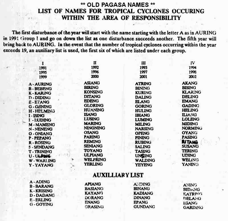
- ^ "**Old PAGASA Names** – List of Names for Tropical Cyclones Occurring with the Area of Responsibility" (JPG). Typhoon 2000. Retrieved June 4, 2015.
- ^ Chih-Mei Lu. "Evaluation of watershed responses to multiple natural disturbance and anthropogenic activities in the Chenyulan Watershed, Taiwan" (PDF). Texas A&M University. Retrieved January 27, 2022.
- ^ "Typhoons kills 98 in China". Dayton Daily News. August 24, 1990. p. 2. Retrieved January 26, 2022 – via Newspapers.com.
- ^ "Typhoon Yancy kills 98 in China". The Star Democrat. August 24, 1990. p. 3. Retrieved January 26, 2022 – via Newspapers.com.
- ^ "Typhoon Yancy kills at least 216 in China". Vancouver Sun. August 29, 1990. p. 3. Retrieved January 26, 2022 – via Newspapers.com.
- ^ a b "The 1990 Central Pacific Tropical Cyclone Season". CENTRAL PACIFIC HURRICANE CENTER. Retrieved 2024-01-25.
- ^ a b c d e f g h i Joint Typhoon Warning Center; Naval Pacific Meteorology and Oceanography Center (1992). Annual Tropical Cyclone Report: 1990 (PDF) (Report). United States Navy, United States Air Force. pp. 111–112. Retrieved June 20, 2017.
- ^ a b Japan Meteorological Agency (October 10, 1992). RSMC Best Track Data – 1990–1999 (.TXT) (Report). Retrieved June 26, 2017.
- ^ a b Typhoon 14W Best Track (TXT) (Report). Joint Typhoon Warning Center. December 17, 2002. Retrieved June 26, 2017.
- ^ a b c d e Kenneth R. Knapp; Michael C. Kruk; David H. Levinson; Howard J. Diamond; Charles J. Neumann (2010). 1990 ZOLA (1990228N15141). The International Best Track Archive for Climate Stewardship (IBTrACS): Unifying tropical cyclone best track data (Report). Bulletin of the American Meteorological Society. Retrieved June 26, 2017.
- ^ a b Hong Kong Observatory (1991). "Part III – Tropical Cyclone Summaries". Meteorological Results: 1990 (PDF). Meteorological Results (Report). Hong Kong Observatory. p. 16. Retrieved June 26, 2017.
- ^ a b c d e Asanobu, Kitamoto. Typhoon 199014 (Zola). Digital Typhoon (Report). National Institute of Informatics. Retrieved June 30, 2017.
- ^ Hong Kong Observatory (1991). "Part III – Tropical Cyclone Summaries". Meteorological Results: 1990 (PDF). Meteorological Results (Report). Hong Kong Observatory. p. 16. Retrieved June 26, 2017.
- ^ "Unseasonal Typhoon Slows Rail, Air Traffic". Associated Press. November 30, 1990. – via Lexis Nexis (subscription required)
- ^ a b c Best Track of Typhoon Abe (JTWC) (TXT) (Report). Pearl Harbor, Hawaii: Joint Typhoon Warning Center. Retrieved June 3, 2015.
- ^ "Philippine landslides". United Press International. August 29, 1990 – via LexisNexis.
- ^ Bank, Asian Development (December 1991). Disaster mitigation in Asia and the Pacific (pp. 193-253) (PDF). Manila, Philippines. p. 10. ISBN 971-561-004-8. Archived from the original (PDF) on June 8, 2015. Retrieved June 4, 2015.
{{cite book}}:|work=ignored (help)CS1 maint: location missing publisher (link) - ^ a b c 1990 Annual Tropical Cyclone Report (PDF) (Report). Pearl Harbor, Hawaii: Joint Typhoon Warning Center. 1991. Retrieved August 19, 2014.
- ^ a b c d Tropical Cyclones in 1990 (PDF) (Report). Hong Kong: Royal Observatory. February 1992. Retrieved June 2, 2015.
- ^ Mariners Weather Log. Environmental Data and Information Service. 1991. Retrieved June 5, 2015.
- ^ DeAngelis, Richard A., ed. (February 1991). Mariners Weather Log: Winter 1991. Vol. 35. National Oceanographic Data Center. pp. 62 & 66.
There was no let–up as Abe came to life, on the 25th, 85 mi west southwest of Guam. Moving northward then west northwestward, Abe reached severe tropical storm strength on the 28th and became a typhoon the following day about 425 mi east southeast of Taipei. Abe moved across the Ryukyu Is and then made landfall about 150 mi south of Shanghai on the last day of the month." & "During Abe, one person was killed in Taiwan. On mainland China it was reported that 108 people lost their lives with another 40 reported missing. Zhejiang and Jiangsu provinces were hardest hit.
- ^ "Commodity Briefs". The Journal of Commerce: 9A. September 7, 1990 – via LexisNexis.
The typhoon hit the major wheat, sugar and cotton growing provinces of Zhejiang, Jiangsu and Anhui, as well as the city of Shanghai, on Aug. 31-Sept. 3, killing 108 people and causing 3.5 billion yuan (4.7 yuan=US$ 1) worth of damage, the China Daily said.
- ^ "Earthweek: A Diary of the Planet". The World. September 8, 1990. Retrieved June 4, 2015.
- ^ a b Kenneth R. Knapp; Michael C. Kruk; David H. Levinson; Howard J. Diamond; Charles J. Neumann (2010). 1990 FLO (1990251N06171). The International Best Track Archive for Climate Stewardship (IBTrACS): Unifying tropical cyclone best track data (Report). Bulletin of the American Meteorological Society. Retrieved July 5, 2017.
- ^ Typhoon 20W Best Track (TXT) (Report). Joint Typhoon Warning Center. December 17, 2002. Retrieved July 5, 2017.
- ^ "Typhoon pounds Japan". The Beaver County Times. September 19, 1990. Retrieved January 15, 2012.
- ^ "Killer Typhoon to March Across Mainland". Jiji Press Ticker Service. September 19, 1990. – via Lexis Nexis (subscription required)
- ^ a b "Typhoon Flo slams into Japan". The Tuscaloosa News. Associated Press. September 20, 1990. p. 2. Retrieved January 15, 2012.
- ^ a b c Asanobu, Kitamoto. Typhoon 199019 (Flo). Digital Typhoon (Report). National Institute of Informatics. Retrieved July 5, 2017.
- ^ Asanobu, Kitamoto. AMeDAS YANASE (74151) @ Typhoon 199019. Digital Typhoon (Report). National Institute of Informatics. Retrieved July 5, 2017.
- ^ Asanobu, Kitamoto. AMeDAS MUROTOMISAKI (74371) @ Typhoon 199019. Digital Typhoon (Report). National Institute of Informatics. Retrieved July 5, 2017.
- ^ Asanobu, Kitamoto. 1990-632-02. Digital Typhoon (Report). National Institute of Informatics. Retrieved July 9, 2017.
- ^ "Thailand Floods Kill 24". Los Angeles Times. Oct 14, 1990.
{{cite news}}: CS1 maint: url-status (link) - ^ "Tropical storm kills 20 people in Thailand and Vietnam - UPI Archives". UPI. Retrieved 2024-01-26.
- ^ "IBTrACS - CMA Tropical Depression 04 (1990)". ncics.org. Retrieved 2024-01-26.
- ^ "IBTrACS - CMA Tropical Depression 05 (1990)". ncics.org. Retrieved 2024-01-26.
- ^ Xiaotu Lei and Xiao Zhou (Shanghai Typhoon Institute of China Meteorological Administration) (February 2012). "Summary of Retired Typhoons in the Western North Pacific Ocean". Tropical Cyclone Research and Review. 1 (1): 23–32. Bibcode:2012TCRR....1...23L. doi:10.6057/2012TCRR01.03. Retrieved May 7, 2013.
- ^ Cimatru, Frank (November 2, 2006). "Typhoon Naming". Pine for Pine. Archived from the original on February 10, 2015. Retrieved December 20, 2014.