
User talk:E. Brown/Archive 7
Re: Mysteriousness[edit]
It looks like a tropical storm with the banding features, and it was recorded. The Eastern Pacific Hurricane Center in their year end report classified it as Tropical Depression 21. However, they have it as a TD starting on the 19th, which is odd because it looks much better on the 18th in the visible you showed. Don't worry, you're not crazy. For the record, I think Hurricane Warfare is a very appropriate term for those storms of close proximity in one big blob that makes you scratch your head. So, Eric, congratulations on (re)discovering a tropical depression ;) Speaking of blobbish areas with more than one circulation, are you familiar with Tropical Storm Lisa in 2004 and its interaction with a companion tropical disturbance? I want your opinion on this one.
On September 22, 2004, the Atlantic tropics had a tropical storm in the Gulf of Mexico (so-called Tropical Storm Ivan though I still consider it a separate entity), Jeanne to the east of Florida, Karl in the mid-Atlantic, Tropical Storm Lisa, and a well-organized tropical disturbance to its east. You can clearly see the circulations of Lisa and the well-organized disturbance, which I will hence forth call X. X was likely a tropical depression or tropical storm at the time of that satellite image, and the NHC noted the possibility of tropical cyclogenesis. 3 hours after that image, Lisa weakens as X develops better banding features, and a NHC disco mentions the possibility of X absorbing Lisa. 3 hours later, dusk arrives and we have to rely on the not-so-good IR, but one can still see curvature in X with dwindling organization of Lisa. 3 hours later convection is really developing over X, and based on the satellite loop is clearly a part of X (not Lisa). In a discussion, the NHC admits that the convection developed over X while "convective bands also seem to be wrapping into Lisa". In the same discussion they maintained Lisa as the dominant entity. Why?!?! X is clearly the dominant storm, would you agree based on those images? Further satellite images continue the development of the original system of X, which I truly believe became the ninth hurricane of the season (and not Lisa). Look at the track map. There is no way a storm is executing a loop that far south unless it is being merged. If it were truly the dominant system, its motion wouldn't have been that affected, right? So what do you think of that storm? Hurricanehink (talk) 06:45, 14 January 2007 (UTC)
- Yea, it did look stronger. I guess the EPHC missed the boat on that one. You really think that Lisa was the dominant system? The other system really, really looked like it had a circulation, and was also the bigger one. You can see the two separate circulations in this image. I don't know... Hurricanehink (talk) 16:08, 14 January 2007 (UTC)
- On the other hand, I think that image shows the other disturbance is more organized than Lisa. It's got some curvage and outflow to the north. The convection isn't terribly deep, and it looks like the center might be exposed a bit, but it still looks like a circulation. Hurricanehink (talk) 18:24, 14 January 2007 (UTC)
- You wanna bring it? :P Nah, I'll admit, I'm probably seeing what I want to see, but I see a C-shaped area of convection - a feature caused by a circulation. I still think they were two separate systems... What about the Ivan Part II debate? What's your thought on that? Hurricanehink (talk) 20:21, 14 January 2007 (UTC)
- Oohh, the Ivan debate was a big debate in the meteorological community over whether the system that formed in the Gulf of Mexico on September 23, 2004 was a direct continuation of Ivan or whether it should have been renamed. As you may remember from Ivan II's first discussion, there was "considerable and sometimes animated" discussion in the National Hurricane Center over the classification. Do you think it was appropriate to rename it or not? The primary reason for renaming it was due to reasonable continuity of the surface and low-level circulation. On the other hand, they aren't always consistant with the discontinuation of advisories. Sometimes, they keep it as the same name (Erin 01), whereas other times they rename it due uncertainty (TD 6/7 in 2003, Upana-Chanchu in 2000, TD 10/Katrina in 2005). Reasonable continuity doesn't sound very assuring, and there was some uncertainty. Also, is it appropriate to name a storm Ivan that would be affecting the same area as the devestating hurricane a week before? I'm sure the public was very confused over having two Ivans a week apart from each other. Furthermore, what about the mid-level and upper-level remnants that continued to the northeast? What if they redeveloped a surface circulation? Here's Ivan over the Mid-Atlantic, a day later with little evidence of any surface circulation, and a day later with an extratropical storm over Atlantic Canada developing from Ivan's moisture and producing a severe 4 day storm. The Canadian Hurricane Centre agreed that the circulation was often difficult to find. Based on all of that, do you think it was right they called the GOM storm Ivan II? Hurricanehink (talk) 21:26, 14 January 2007 (UTC)
- I don't think Ivan had too much of an affect on Jeanne. Jeanne never really stalled over Haiti. It moved pretty slowly, and Ivan was over Tennessee by the time Jeanne exited Hispaniola. Ivan could've affected Jeanne's impact on Florida, though. If low pressures from Ivan turned Jeanne northward and aided in the loop, it could've been why Jeanne was so strong. Had it not been for the low pressures, Jeanne might have turned westward and strike Florida as a much weaker hurricane. Heh, any other storms you want to debate? This is pretty fun. Hurricanehink (talk) 00:38, 15 January 2007 (UTC)
- Oh, interesting. For the EPAC reports, I use the Search engine on the Allenpress site. You don't need a password for the EPAC reports. Just type in "1984 Pacific" and search for the year end report. The search engine also has loads of other goodies. I was able to write an article on the 1939 Pacific typhoon season based on those monthly reports! Gotta love the United States's organization for information. Hurricanehink (talk) 18:02, 15 January 2007 (UTC)
- I don't think Ivan had too much of an affect on Jeanne. Jeanne never really stalled over Haiti. It moved pretty slowly, and Ivan was over Tennessee by the time Jeanne exited Hispaniola. Ivan could've affected Jeanne's impact on Florida, though. If low pressures from Ivan turned Jeanne northward and aided in the loop, it could've been why Jeanne was so strong. Had it not been for the low pressures, Jeanne might have turned westward and strike Florida as a much weaker hurricane. Heh, any other storms you want to debate? This is pretty fun. Hurricanehink (talk) 00:38, 15 January 2007 (UTC)
- Oohh, the Ivan debate was a big debate in the meteorological community over whether the system that formed in the Gulf of Mexico on September 23, 2004 was a direct continuation of Ivan or whether it should have been renamed. As you may remember from Ivan II's first discussion, there was "considerable and sometimes animated" discussion in the National Hurricane Center over the classification. Do you think it was appropriate to rename it or not? The primary reason for renaming it was due to reasonable continuity of the surface and low-level circulation. On the other hand, they aren't always consistant with the discontinuation of advisories. Sometimes, they keep it as the same name (Erin 01), whereas other times they rename it due uncertainty (TD 6/7 in 2003, Upana-Chanchu in 2000, TD 10/Katrina in 2005). Reasonable continuity doesn't sound very assuring, and there was some uncertainty. Also, is it appropriate to name a storm Ivan that would be affecting the same area as the devestating hurricane a week before? I'm sure the public was very confused over having two Ivans a week apart from each other. Furthermore, what about the mid-level and upper-level remnants that continued to the northeast? What if they redeveloped a surface circulation? Here's Ivan over the Mid-Atlantic, a day later with little evidence of any surface circulation, and a day later with an extratropical storm over Atlantic Canada developing from Ivan's moisture and producing a severe 4 day storm. The Canadian Hurricane Centre agreed that the circulation was often difficult to find. Based on all of that, do you think it was right they called the GOM storm Ivan II? Hurricanehink (talk) 21:26, 14 January 2007 (UTC)
Heh, what an honor! I've put all of my goodies on my user page at my favorites, which might have some other treasures. Glad you can use that search engine, though. There are tens of thousands of pages that probably have not been seen by normal people since they were published. Hurricanehink (talk) 05:03, 16 January 2007 (UTC)
- PSU is OK, but I think it's copyrighted, and there's usually better GOES images out there. DMSP is a great site, thanks for that! Could you send over the links for the OSEI and HSEI? Hurricanehink (talk) 02:04, 17 January 2007 (UTC)
- Oh yea! I've seen those before. Those are good sites. Hurricanehink (talk) 02:44, 17 January 2007 (UTC)
(lets out a low whistle) I wouldn't want to be in the path for the three of them! Hurricanehink (talk) 21:38, 28 January 2007 (UTC)
- Heh, yea, Wayne was quite a storm. Every season, you can depend on a storm with a crazy path, a storm of crazy strength, and another few just plain weird storms. There's just something very interesting about that basin. Maybe it's the sheer number of landfalls, or the fact going too far west isn't a problem (think of all of the storms that hit southern China and end up over the ocean again). Hurricanehink (talk) 02:33, 29 January 2007 (UTC)
- Well, it depends by what you call Southeast Pacific Ocean. If you consider it east of the dateline, it's fairly common. Is the SEPAC defined as east of 140W? Before, I thought you meant around 100W near the west coast of South America as SEPAC. E of 140 is pretty rare, though, so good find. My computer is being evil now and not letting me open the Gibbs images, so I can't see it, but I can imagine it. Hurricanehink (talk) 22:42, 29 January 2007 (UTC)
- That makes sense. Actually, I was using a stupid Mac at my school's computer lab. I prefer my labtop. Here's a new discussion. What, in your opinion, was the most interesting storm in the last 6 Atlantic hurricane seasons. Interesting is what you see it is. I'll let you know after you post. Hurricanehink (talk) 03:35, 30 January 2007 (UTC)
Re:Silence[edit]
I know! But I too am enjoying the lull. It's keeping me from staying up until 4 in the morning on Wikipedia discussing a weak INVEST and running to the TV every :50 past the hour to check the tropical update on TWC. So, yeah, a chance to get away from my nagging obsession. Still, I would like to see... ... ... something out there. Anywhere! Predioctions call for an above average season this year, but I don't trust pre-season predictions after last year. Sorry, I could have replied much earlier, but I got caught up in a discussion between you and Hink about Mediterranean (spelled right?) storms and mysterious EPAC storms and Ivan and Lisa, an october storm in the Gulf and there was some discussion about emotionally distressed rodents... yeah kinda got off-track. And as you can see, I'm getting off-track again. Honestly, I'm more dissapointed in this El Nino than anything. Isn't an El Nino winter supposed to bring cold weather and heavy rains to the south? I can't speak for Atlanta, but here in Central Florida, we are getting nothing! *sigh* Why did I have to get interested in such a confusing feild? →Cyclone1→ 23:59, 19 January 2007 (UTC)
- Yeah, sorry, Lol. Well, honestly, we need the rain here. We haven't had a decent rain since Christmas. Don't get me wrong, I like good weather, too. But, were running short on rain here. Well, looks that the NRL saw our conversation and issued a new INVEST in the South Pacific. I'd like to see something in the northern hemisphere, though, or the maybe South Atlantic. →Cyclone1→ 13:58, 21 January 2007 (UTC)
The Military history WikiProject Newsletter: Issue XI - January 2007[edit]
The January 2007 issue of the Military history WikiProject newsletter has been published. You may read the newsletter, change the format in which future issues will be delivered to you, or unsubscribe from this notification by following the link. Thank you.
This is an automated delivery by grafikbot 20:31, 23 January 2007 (UTC)
Re: Most fascinating per year[edit]
Actually, I meant per each year, though Catarina is probably the most interesting Atlantic of the 2000s so far. 100% agreed with what you said. I meant North Atlantic, also, but oh well :) Here's my list per year.
- 2006- My vote goes to Gordon. It had real potential to become a European tropical cyclone at landfall, and also swiped through the Azores as a decent hurricane, both rare events. I guess it liked being a difficult storm to forecasters, which I suppose is a good criterion for being interesting. I think it could've been the most interesting storm of the century (so far) if it made it to Europe as a hurricane. It made it pretty close, too.
- 2005- Vince. Epsilon, Delta, and Zeta are close, but Vince gets my vote. It formed where no other storm formed, and ventured into uncharted waters by hitting Spain as a tropical depression. I still can't get over how exciting that was.
- 2004- Alex - A major hurricane that far north was pretty cool. However, I don't find any of them particularly fascinating. Charley was unusual in its rapid strengthening and subsequent last minute turn, and Ivan had a good history, but it's almost as if they tried to hard to impress.
- 2003- This year was interesting, which is why I got every article but two to GA or Featured status. I'll have to go with Ana for its uncharted territory, though others had their moments. Claudette was an unusual July hurricane (unusual pre-2005), Danny got really high as a hurricane at an unusual time of year, Erika with its post upgrade (always interesting due to the debates, though not as interesting after the following two years' Gaston and Cindy), Fabian with its rare Bermuda hit, Isabel with its strength and eye features (truly one of the textbook hurricanes, and thankfully over open waters at peak), Juan with its almost unprecedented Nova Scotia Cat. 2 landfall, Kate with its recurvature and Cat. 3 strength before being predicted to die, Larry with it moving southward, Nicholas being a Cape Verde storm in October and its remnant extratropical storm, Odette as the first Caribbean tropical storm in December, and Peter for the excitement of another off-season storm.
- 2002- Kyle - gotta love the subtropical wanderers. The only other contenders were Isidore (southward movement into Yucatan) and Lili (rapid strengthening and rapid weakening in GOM), but otherwise a boring year.
- 2001- Tough call. This was another interesting year. I'm going with Allison, though others were close. Dean with its reformation and near hurricane status near Nova Scotia, Erin with its reformation and long and interesting track, Gabrielle with its rebirth, Iris with its rapid strengthening and unique Belize landfall (small but deadly, lots of other storms have older duplicates or things reminiscent of older storms, but Iris is the only one I can remember like that), Karen with its interesting formation and track, Lorenzo with formation, Michelle with strength for November, Noel for formation and unusual hurricane status for location (plus, NHC initiated advisories right at hurricane status, first time in a while), and Olga for path and off-season surprise.
- 2000- Not terribly interesting, though I wish more seasons were like this. Two nice Cape Verde fishies, one unfortunately deadly and costly storm Central America (Keith, though every season has its baddies I like it when there is only one really baddy), overall good activity. My vote goes Alberto, for its cool path.
Hurricanehink (talk) 04:39, 30 January 2007 (UTC)
- Are you sure you didn't look at mine? :P We picked 5 of the same. I can see why you chose Ivan and Isidore instead, both were very cool and close seconds. So... wanna go back further? We'll probably pick a lot of the same ones for the previous 10 years, but oh well :) I'll hide my votes so you don't get influenced when you see this. Hurricanehink (talk) 02:32, 1 February 2007 (UTC)
- 1999 - Lenny, hands down. Such a track and intensity just boggles the mind. Bret is the only other one that comes close, due to its small size and low damage for a Cat. 3 at landfall, but Lenny takes the cake.
- 1998 - Nicole. Like yourself, I like the weird or cool storms. A hurricane at that location is just cool in my book. Mitch was very interesting, and is a very close second. It's the strongest storm in my lifetime that I remember, but its path is the best part. For so many advisories, the NHC insisted it would turn northward, even after it started its southward dip. Really, it could've been a clone of Wilma had it not turned southward. Then, after dissipating for a few days, it springs back to life out of nowhere in the Bay of Campeche and hits Florida as a tropical storm.
- 1997 - Danny. It formed from a Meso convective system that moved south from the mainland, and took a path no other July storm ever took. Then, it stalled near Mobile Bay, retained its integrity over the Southeast US, and reforms into a tropical storm over North Carolina before threatening Massachusetts and heading out to sea.
- 1996 - Now we got some options - nothing too blatently obvious. 3rd place - Edouard. It had a good chance of hitting me as a major hurricane, and after days of predicted US hits it turns out to sea. 2nd place - Marco. Crazy path through the SW carib, that's all you gotta say. 1st place - Bertha. At a first glance, it looks like a fairly boring tropical cyclone, but the date is what gets me. It was a Cape Verde storm in July, and hit North Carolina as a Cat. 2 before moving up the coast.
- 1995 - Another fun one with some options. My vote is for Opal, due to its unexpected westward drift allowing it to become a strong Cat. 4 in the GOM before hitting Florida Panhandle as a major in October.
- 1994 - Gordon, nuff said.
- 1993 - Bret. Should've been retired due to its hundreds of deaths and rare track over northern South America.
- 1992 - To avoid what most other people in the Meteorological world will say, I vote for the April Subtropical Storm, though Andrew is a close second.
- 1991 - Hurricane 8 AKA Perfect Storm.
- 1990 - I'm gonna go with Edouard. It formed at a weird location, and then it moved west near the Azores. Just a cool storm IMO without much harm.
- Good picks, good picks. You do realize that Mitch and Katrina were in different centuries? :P I agree 100% that Floyd was a Cat. 5. I think the reason they didn't is because they didn't have absolute certainty it had the necessary winds, and that the 5 mph wouldn't make a difference in getting people's attention. You sure about Grace? Per the TCR, it seemed normal in that it went from extratropical gale to tropical storm, then back to extratropicality. Hurricanehink (talk) 06:03, 2 February 2007 (UTC)
- Heh, whoops about hiding my votes. I forgot Wilma in post-analysis was stronger than Mitch, but prior to the reanalysis Mitch was still the strongest after Gilbert (3 05 gals got to 150 knots, Mitch was 155 knots). Gilbert was in my life, but too far back that I don't remember. Interesting choices. I was about to choose Andrew, but it is the definitive badass hurricane (Cat. 5 to SE Florida), and it wasn't entirely unique. From its Florida landfall to dissipation, it resembled Betsy 65, which made landfall on SE Florida and Louisiana as a major hurricane. The April storm was unique. Just curious, what did you find so interesting about Klaus? It seemed like a fairly typical sheared October storm, like a mixture between Jose 99 and Mindy 03. I really wish Bret should've been retired. As a quick aside, what storms do you think should've been retired? Most likely, we'll have a similar list, but I'm curious on your opinion. I'll hide it after this. From oldest to newest: Hilda 55 (304 deaths), Betsy 56 (27 deaths and one of the worst Puerto Rican hurricanes in recent times), Alma 66 (90 deaths and 210 million in damage), Francelia 69 (100 deaths), Claudette 79 (1 billion in damage 2006 USD), Beryl 82 (100+ deaths), Juan 85 ($1.5 billion 1985 USD in damage), Kate 85 ($700 million damage 1985 USD), Allison 89 ($500 million 1989 USD), Bret 93, Alberto 94, Gordon 94, Bonnie 98 ($700 million in damage to Mid-Atlantic, still well-remembered), Irene 99 ($1 billion in Florida), and Emily 05. If you want to extend back the most interesting storms by year, let me know, I'm in :) Hurricanehink (talk) 05:08, 4 February 2007 (UTC)
- Oh, ok, I consider winds for strength and pressure for intensity. Katrina, Wilma, and Rita all were assessed as 150 knots operationally. I don't remember Gilbert, so Mitch's 155 knots is the strongest I remember before Wilma's reassessment. I'd like to take a quick break from the most interesting by year by you answering the question: what Atlantic storms should have been retired that weren't originally? I listed mine in the previous post. Similarly, what EPAC storms do you think should have been retired that weren't, especially if the standards for EPAC retirement weren't quite as high? Tara 65, Liza 76, Lidia 81, Norma 81, Paul 82 (not just for Central America stuff, but also for Mexico impact) Tico 83, Cosme 89, Calvin 93, and Nora 97 Hurricanehink (talk) 02:00, 6 February 2007 (UTC)
- Yea, I'm fairly sure that strength is just the winds, and intensity is just the pressure, but they are often used interchangeably. Mitch was only the strongest in my lifetime until Wilma's TCR earlier last year. So, I'm in for another 5 years :) I'm going back to 1985.
- Oh, ok, I consider winds for strength and pressure for intensity. Katrina, Wilma, and Rita all were assessed as 150 knots operationally. I don't remember Gilbert, so Mitch's 155 knots is the strongest I remember before Wilma's reassessment. I'd like to take a quick break from the most interesting by year by you answering the question: what Atlantic storms should have been retired that weren't originally? I listed mine in the previous post. Similarly, what EPAC storms do you think should have been retired that weren't, especially if the standards for EPAC retirement weren't quite as high? Tara 65, Liza 76, Lidia 81, Norma 81, Paul 82 (not just for Central America stuff, but also for Mexico impact) Tico 83, Cosme 89, Calvin 93, and Nora 97 Hurricanehink (talk) 02:00, 6 February 2007 (UTC)
- Heh, whoops about hiding my votes. I forgot Wilma in post-analysis was stronger than Mitch, but prior to the reanalysis Mitch was still the strongest after Gilbert (3 05 gals got to 150 knots, Mitch was 155 knots). Gilbert was in my life, but too far back that I don't remember. Interesting choices. I was about to choose Andrew, but it is the definitive badass hurricane (Cat. 5 to SE Florida), and it wasn't entirely unique. From its Florida landfall to dissipation, it resembled Betsy 65, which made landfall on SE Florida and Louisiana as a major hurricane. The April storm was unique. Just curious, what did you find so interesting about Klaus? It seemed like a fairly typical sheared October storm, like a mixture between Jose 99 and Mindy 03. I really wish Bret should've been retired. As a quick aside, what storms do you think should've been retired? Most likely, we'll have a similar list, but I'm curious on your opinion. I'll hide it after this. From oldest to newest: Hilda 55 (304 deaths), Betsy 56 (27 deaths and one of the worst Puerto Rican hurricanes in recent times), Alma 66 (90 deaths and 210 million in damage), Francelia 69 (100 deaths), Claudette 79 (1 billion in damage 2006 USD), Beryl 82 (100+ deaths), Juan 85 ($1.5 billion 1985 USD in damage), Kate 85 ($700 million damage 1985 USD), Allison 89 ($500 million 1989 USD), Bret 93, Alberto 94, Gordon 94, Bonnie 98 ($700 million in damage to Mid-Atlantic, still well-remembered), Irene 99 ($1 billion in Florida), and Emily 05. If you want to extend back the most interesting storms by year, let me know, I'm in :) Hurricanehink (talk) 05:08, 4 February 2007 (UTC)
- 1989- Allison. Nice loop, but its remnants are the most interesting part.
- 1988- Tough choices, but I'll vote for Joan due to its unprecedented Cat. 4 landfall on Nicaragua.
- 1987- Arlene - looks like a roller coaster.
- 1986- I guess Charley, but it was a fairly boring year.
- 1985- Tough choices from another fun year, but I think I'll go for Juan. I tell you, I would have gladly joined you for the "Retirement of Juan 85 and Gordon 94 committee". Hurricanehink (talk) 04:48, 6 February 2007 (UTC)
I can see why you went with Hugo... fairly interesting storm in that it was of the northernmost Cat. 4 landfalls. That's cool about Gilbert.
- 1984- Lili, like yours, though it was obvious.
- 1983- Alicia, mainly due to how it formed. I can only think of one other TC that formed from a MSC (Danny 97).
- 1982- Boring year - I'm glad I wasn't alive then. I'll go for Alberto for its quick strengthening and demise, though none are particularly interesting.
- 1981- More interesting than 82, I'll say Bret for its weirdness in June. An extended westward track at that latitude for that time of year is pretty cool.
- 1980- I have to give it to Allen, though Ivan is an extremely close second.
So, what now? EPAC? WPAC? Further back in Atlantic? :D Hurricanehink (talk) 03:50, 7 February 2007 (UTC)
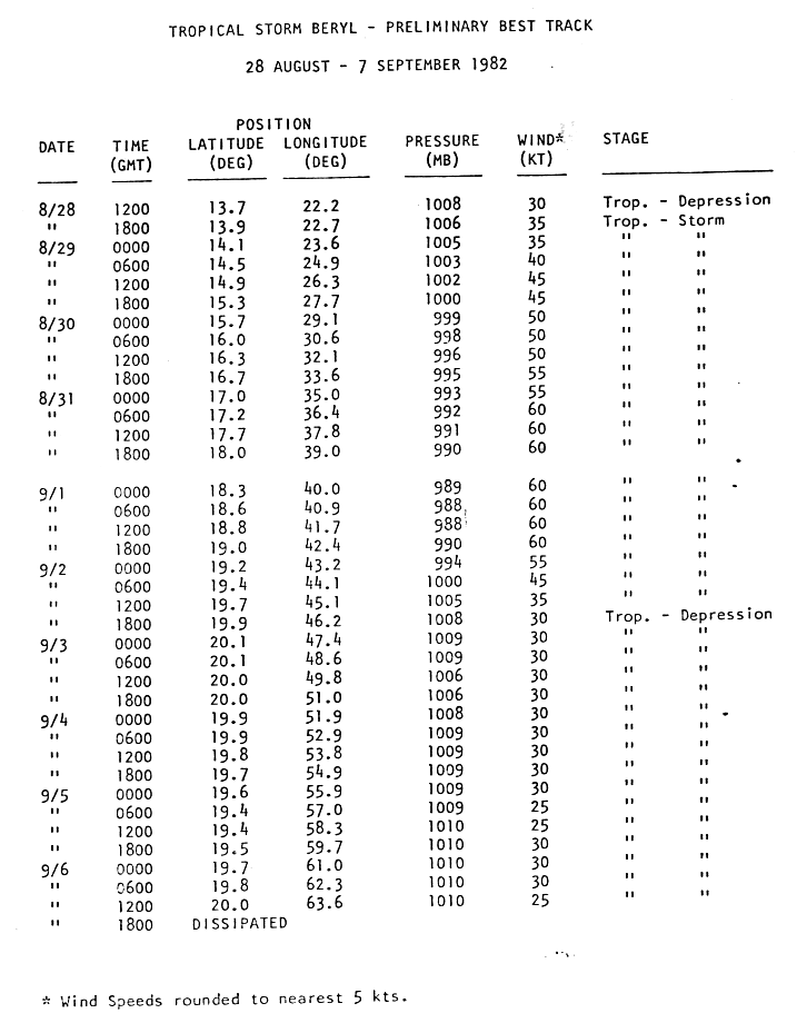
- OK, I did. Dean was cool, but I think Alicia was cooler. MSC is meso convective complex, meaning the storm developed out of a small blob of thunderstorms. Beryl was OK, but it might have just been a glitch in the system that led to the weird intensity stuff. The NHC best track has it peaking at 60 knots. OTOH, the HURDAT best track has it as a 75 mph tropical storm. Unisys probably had a glitch or something. It did the same for Floyd in the previous year for two advisories. Georges 80, yea, that's up there for one of the longest depression stages. What I find interesting about Georges was that it went from tropical to dissipating, then to subtropical, then tropical to hurricane to extratropical. I cannot wait for Ivan to be up in the Satellite archive. I have got to see that in action from precursor disturbance to hurricane. I think that is my favorite place for a storm to form (north of 20 N, east of 40 W). Any storm that formed there is in my favorites list; Vince, Zeta, Unnamed Subtrop 05, Peter, Lorenzo 01, Nicole 98, Charley 92, Edouard 90, and Ivan 80. This little guy is in there, too. How about this - top 5 favorite tracks per decade in the 20th century. First up, 1900s (1900-1909). Here's mine, hidden. Have fun with yours, there are some good ones. Hurricanehink (talk) 17:09, 7 February 2007 (UTC)
- 1 - Gotta biasedly go with only hurdat-recorded NJ landfall.
- 2 - 20 N, 40 W club, what can I say?
- 3 - Never have I ever seen a track southward through Florida, not to mention it struck Florida just before
- 4 - Love the out of seasoners.
- 5 - This one piqued my interest and snuck in there. I love the boomerang action.
- Heh, it's not that tedious. I picked my fav five in a minute. Hurricanehink (talk) 17:19, 7 February 2007 (UTC)
- Oh, I meant just doing 10 years at a time. I started from 1900 to 1909. It's really quick. I just picked a few interesting ones each year and narrowed it down to five. Hurricanehink (talk) 17:36, 7 February 2007 (UTC)
- Heh, it's not that tedious. I picked my fav five in a minute. Hurricanehink (talk) 17:19, 7 February 2007 (UTC)
You should've scrolled down a bit further from Pancho, I think you were looking for this, or was it this? Heh, I still don't get your obsession with Faith. I think my favorite Atlantic track might be Kyle 02. I bet the forecasters had 0 thought in their mind it would end up at the US eventually. Otherwise, you already mentioned all of the good ones. Even before I saw yours, I thought of the ones you mentioned exactly (Olaf, Wayne, 5B in 96, Pancho, and the second one I mentioned above (SPAC's Wayne). However, Fausto 02/1975 H12 is a close second me for favorite EPAC track, due to the northerlyness. This isn't much fun when both of us have similar tastes in interesting tracks :P Hurricanehink (talk) 00:39, 8 February 2007 (UTC)
- Yea, if only our Katrinas could've done something like that. Are you sure you picked 05 from 2000? That link says 1996, and there was no 05B from 2000 :P If you think a South Carolina landfall is weird, check out this one. I don't recall any August storms becoming extratropical east of Florida. If you want to see some cool tracks, check out the storms from 1911 to 1913. 1, 2, 3, 4, 5, 6, 7, and 8. Possibly the most interesting three year period. Hurricanehink (talk) 03:18, 8 February 2007 (UTC)
- I don't mind being right all of the time, I get used to it :P You got that right, the Atlantic rarely gets close to WPAC or SHEM. The thing I like about them is that they don't normally affect land. This one is my favorite type of tropical cyclone - strong, great track, but little to no effects on land. Believe me, I've spend many of hours gawking at the amazingness of the SHEM. Steve from 2000 is one of my favorites, probably. Hurricanehink (talk) 01:05, 10 February 2007 (UTC)
- Of course, they're always the best part :) Hurricanehink (talk) 06:28, 10 February 2007 (UTC)
- I don't mind being right all of the time, I get used to it :P You got that right, the Atlantic rarely gets close to WPAC or SHEM. The thing I like about them is that they don't normally affect land. This one is my favorite type of tropical cyclone - strong, great track, but little to no effects on land. Believe me, I've spend many of hours gawking at the amazingness of the SHEM. Steve from 2000 is one of my favorites, probably. Hurricanehink (talk) 01:05, 10 February 2007 (UTC)
WP:MILHIST Coordinator Elections[edit]
The Military history WikiProject coordinator selection process is starting. We are looking to elect seven coordinators to serve for the next six months; if you are interested in running, please sign up here by February 11!
Delivered by grafikbot 10:26, 31 January 2007 (UTC)
Re: WPAC conundrum[edit]
Hmmm, I don't know. This visible image from a day isn't any good, though the same IR image shows some decent convection with a little bit of a CDO going on. It looks great that night, with some decent banding as well. The first available visible image is dubious, unfortunately, and from there it gets worse and worse until being absorbed. It might have been a tropical cyclone that night, though they probably didn't have the confirmation and decided to go all conservative on it by not classifying it. IMHO, there are probably 10 to 20 more tropical cyclones per year in the northern hemisphere that could've been classified, but weren't due to lack of sufficient data. That might sound high, but consider the borderline subtropical storms, as well as overnight storms that might have been TC's for a matter of hours before losing its circulation. Hurricanehink (talk) 02:47, 1 February 2007 (UTC)
- Bah, it's just your conservative attitude that you don't buy 10 missed storms in the northern hemisphere :P I mean that throughout the entire northern hemisphere, including Mediterranean and the rest of the NHEM basins, I believe there are roughly 10 storms that could have qualified as tropical cyclones, but lack of data prevented it (especially if it was very short lived). That very much looked like one of the missed ones, though. Hurricanehink (talk) 04:51, 4 February 2007 (UTC)
Tropical cyclones WikiProject Newsletter #9[edit]
The February issue of the WikiProject Tropical cyclones newsletter is now available. If you wish to receive the full newsletter or no longer be informed of the release of future editions, please add your username to the appropriate section on the mailing list.--Nilfanion (talk) 18:42, 4 February 2007 (UTC)
Unblock-auto[edit]
Catastrophic Florida hurricane series[edit]
I'm not sure if you're aware of this or not, but I'm working on a List of Florida hurricanes project. As it is going to list every last storm, those pages will become obsolete, and will probably be merged. Are you OK with that? Hurricanehink (talk) 01:47, 8 February 2007 (UTC)
- Cool, just making sure. Hurricanehink (talk) 03:08, 8 February 2007 (UTC)
POV in 1981 Pacific Typhoon Season?[edit]
What point of view was being put forward in that article, out of curiosity? Thegreatdr 02:46, 8 February 2007 (UTC)
Mysterybusters[edit]
I know what the first one was. It was the precursor disturbance to Typhoon Thad (15W). Per the JTWC report, Thad "was initially evident on August 10 when surface synoptic data indicated a weak circulation was embedded in the [monsoon] trough near 18N 130E." That sounds like our system. True, it does look better organized then a weak disturbance, but maybe a circulation hadn't formed by then. That thing off of Japan looks like something, but I doubt it became anything; that image shows a fairly unorganized blob, IMO. Something interesting I noticed was that the first image showed Susan (14W) to the east-southeast of Japan with a very obvious eye. Yet, the JTWC called it a 70 mph tropical storm. The JTWC report said the convection was shallow, but the blatant eye feature makes me question their assessment. Hurricanehink (talk) 03:28, 9 February 2007 (UTC)
- I guess about Susan, but the eye looks too well-organized. Hurricanehink (talk) 00:58, 10 February 2007 (UTC)
Your userboxes on your userpage contain many fair use images, which aren't allowed in user-space per our policy on fair use. Please remove them, convert them into links, or replace them. Thanks. – Chacor 06:26, 10 February 2007 (UTC)
- I see that you reverted one of my changes. Please take the initiative an remove them yourself. As to your rant on your page: you only have two rights here, to fork or to leave. Please consider this a second warning of a fair-use violation. – Chacor 06:34, 10 February 2007 (UTC)
- (edit conflict) You need to remove all the fair use images from your user page as soon as possible, or else you may be blocked and/or the images removed for violating the fair use policy (see criterion 9) and its associated guideline. --Coredesat 06:36, 10 February 2007 (UTC)
Perhaps you should actually read the policies before doing the deed that violates them. Don't accuse me of "targetting" you, I only noticed fair-use images on your page among the clutter today. – Chacor 06:46, 10 February 2007 (UTC)
- To clarify, the Wikimedia Foundation could be sued for the fair use violations, not you. Removing fair use images from your user page protects the project - it's not punishment. --Coredesat 06:59, 10 February 2007 (UTC)
- Fair use images are used here because there is usually no free alternative, and fair use is a limited exception to copyright. However, it is not a full exception to posting the images just everywhere, and policy specifically prohibits using fair use images on your user page. Stop bothering Chacor about this, because as far as I can tell, you are not being targeted or singled out - this is a policy that affects everyone. Any fair use image on a user page is removed accordingly with policy. --Coredesat 07:25, 10 February 2007 (UTC)
Fair use images[edit]
Using "fair use" images in userspace violates copyright law. Since that could get the Foundation sued, we don't allow it. Whether you like that is, I'm afraid, immaterial, Foundation legal counsel have told us it is not allowed and that is an end of it; if you don't stop inserting these images we will have no choice but to block you. Sorry to be blunt, but user preference simply cannot trump legal constraints. Calling those who enforce this policy "nazis" and misrepresenting a policy based on sound legal principles as being in some way opposed to fun, is simply not acceptable. This is not a social network, a playground, an experiment in anarchy or a venue for you to shout your beliefs to the world, it is an encyclopaedia, and if we get sued for copyright infringement it might become an ex-encyclopaedia with a huge bankruptcy bill. I hope you don't want that. Guy (Help!) 09:06, 10 February 2007 (UTC)
- Nazis??? For enforcing copyright law? That is a real stretch. HighInBC (Need help? Ask me) 15:34, 10 February 2007 (UTC)
Eric, I noticed on a talkpage posting that you said that the images were used in articles and should be allowed in your userspace, and that this complies with fair use. Unfortunately, it does not. Fair use does not mean any non-commercial use. It means for commentary and criticism. The images are okay for articles because it complies with the commentary and criticism part. Thats fair use. The same images used to prettify userspace does not comply and are hence illegally used. I hope that makes it clearer and easier to understand. -Mask ![]() 17:03, 10 February 2007 (UTC)
17:03, 10 February 2007 (UTC)
- Thank you, Mask. It makes sense now. Thank you for being reasonable and clearing up the confusion. Are there any free images that can help me fix my userboxes? Martini, Sting, Godfather... -- §HurricaneERIC§ archive 20:00, 10 February 2007 (UTC)
- Saw your post on my user talk, I wasn' lashing out, just pointing out that it's not because we're killjoys but becayse we don't want our asses sued. No big deal if you don't make it one :-) Guy (Help!) 20:20, 10 February 2007 (UTC)
- Hmm... I'm a bit late to this party, but here's the situation: Fair use images are for use only for articles. The reason behind that is that we (as in the Wikimedia Foundation) do not own the rights to them, and are pretty much using them without authorization. However, since we're building an encyclopedia, a work with an inherent educational purpose, U.S. copyright law grants us some leeway to use them under the fair use doctrine. The relevant law, as laid out on 17 USC § 107, tells us that the legality of fair use depends on the purpose and character of the use, including whether such use is of a commercial nature or is for nonprofit educational purposes. If we are using a radar image of Hurricane John making landfall in Mexico, that is a much more acceptable use than us just using an image in our user space. As a result, in order to not get ourselves sued (or perhaps even you sued) by a third party, it's better if we just not use them in user space. It's that simple. Besides, the Foundation weighed in recently asking us to try to avoid fair use, even in articles, whenever necessary, and to try to obtain freely-licensed works to replace fair use, copyrighted media. Titoxd(?!?) 00:02, 11 February 2007 (UTC)
WikiProject Military History elections[edit]
The Military history WikiProject coordinator election has begun. We will be selecting seven coordinators to serve for the next six months from a pool of sixteen candidates. Please vote here by February 25!
Delivered by grafikbot 13:56, 14 February 2007 (UTC)