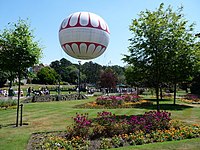
Victoria Park, Dorset
Appearance
This article needs additional citations for verification. (October 2020) |

Victoria Park is an area of Bournemouth, Dorset. The area is south of Moordown, north-west of Winton and east of Talbot Village, Wallisdown and Ensbury Park.
History
[edit]In 2020, an Experimental Traffic Regulation Order (ETRO) was created on Victoria Park Road in order to create a Low Traffic Neighbourhood in Victoria Park.[1]
Facilities
[edit]Victoria Park has a Methodist Church[2] and is residence of the Victoria Park Football Ground, the home of Bournemouth F.C.[3]
Politics
[edit]
Victoria Park is part of the Bournemouth West constituency, and is part of the Wallisdown and Winton West ward for elections to Bournemouth, Christchurch and Poole Council.
References
[edit]- ^ "Victoria Park Road". www.bcpcouncil.gov.uk. Retrieved 16 October 2020.
- ^ "Victoria Park Homepage - Victoria Park Methodist Church". www.vpmc.org.uk. Retrieved 7 October 2020.
- ^ "Bournemouth FC – The Poppies". Retrieved 7 October 2020.
50°44.8′N 1°53.0′W / 50.7467°N 1.8833°W

