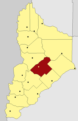
Zapala Department
Zapala | |
|---|---|
Department | |
 | |
| Country | Argentina |
| Province | Neuquén |
| Capital | Zapala |
| Area | |
| • Total | 5,200 km2 (2,000 sq mi) |
| Population | |
| • Total | 35,806 |
| • Density | 6.9/km2 (18/sq mi) |
| Important cities | Zapala |
Zapala is a department located in the center of Neuquén Province, Argentina.
Geography[edit]
The Department limits with Confluencia Department at the East, Añelo Department at the northeast, Picún Leufú Department at southeast, Catán Lil Department at southwest and Picunches Department at northwest.
