
Kline, Colorado
Kline, Colorado | |
|---|---|
 County Road 122 in Kline | |
 Kline Location in Colorado  Kline Location in the United States | |
| Coordinates: 37°08′39″N 108°07′10″W / 37.14417°N 108.11944°W | |
| Country | |
| State | |
| County | La Plata[1] |
| Elevation | 6,942 ft (2,116 m) |
| Time zone | UTC-7 (MST) |
| • Summer (DST) | UTC-6 (MDT) |
| ZIP code[2] | 81326 (Hesperus) |
| Area code | 970 |
| GNIS feature ID | 0179281 |
Kline is an unincorporated community on the Southern Ute Indian Reservation in La Plata County, Colorado, United States.[1] ZIP code 81326 serves Kline, but mail must be addressed to the community of Hesperus.[2]
Geography[edit]
Kline is located at 37°08′39″N 108°07′10″W / 37.14417°N 108.11944°W (37.1441668,-108.1195189).[1]
See also[edit]
References[edit]
- ^ a b c d "US Board on Geographic Names". United States Geological Survey. October 25, 2007. Retrieved January 31, 2008.
- ^ a b "ZIP Code Lookup". United States Postal Service. Archived from the original (JavaScript/HTML) on November 22, 2010. Retrieved November 19, 2007.
External links[edit]
![]() Media related to Kline, Colorado at Wikimedia Commons
Media related to Kline, Colorado at Wikimedia Commons
Municipalities and communities of La Plata County, Colorado, United States | ||
|---|---|---|
| City | 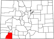 | |
| Towns | ||
| CDPs | ||
| Unincorporated communities | ||
| Ghost towns | ||
| Indian reservations | ||
| Footnotes | ‡This populated place also has portions in an adjacent county or counties | |
This Colorado state location article is a stub. You can help Wikipedia by expanding it. |