
Southern Ute, Colorado
Southern Ute, Colorado | |
|---|---|
 Southern Ute, south of State Highway 151, August 2019. | |
 Location of the Southern Ute CDP in La Plata County, Colorado. | |
 Southern Ute Location of the Southern Ute CDP in the United States. | |
| Coordinates: 37°04′30″N 107°35′36″W / 37.0748875°N 107.5933083°W[1] | |
| Country | |
| State | |
| County | La Plata County |
| Government | |
| • Type | unincorporated community |
| Area | |
| • Total | 15.960 sq mi (41.335 km2) |
| • Land | 15.960 sq mi (41.335 km2) |
| • Water | 0.000 sq mi (0.000 km2) |
| Elevation | 6,562 ft (2,000 m) |
| Population | |
| • Total | 158 |
| • Density | 9.9/sq mi (3.8/km2) |
| Time zone | UTC-7 (MST) |
| • Summer (DST) | UTC-6 (MDT) |
| ZIP Code[4] | Ignacio 81137 |
| Area code | 970 |
| GNIS feature[2] | Southern Ute CDP |
Southern Ute is a census-designated place (CDP) on the Southern Ute Indian Reservation in southern La Plata County, Colorado, United States. The CDP is a part of the Durango, CO Micropolitan Statistical Area. The population of the Southern Ute CDP was 158 at the United States Census 2020.[3] The Ignacio post office (Zip Code 81137) serves the area.[4]
Etymology[edit]
Southern Ute is named for the Southern Ute people and the Southern Ute Indian Reservation.
Geography[edit]
The Southern Ute CDP has an area of 10,214 acres (41.335 km2), all land.[1]
Demographics[edit]
| Year | Pop. | ±% |
|---|---|---|
| 2010 | 177 | — |
| 2020 | 158 | −10.7% |
| Source: United States Census Bureau | ||
The United States Census Bureau initially defined the Southern Ute CDP for the United States Census 2010.
See also[edit]
References[edit]
- ^ a b c "State of Colorado Census Designated Places - BAS20 - Data as of January 1, 2020". United States Census Bureau. Retrieved December 22, 2020.
- ^ a b c "U.S. Board on Geographic Names: Domestic Names". United States Geological Survey. Retrieved December 22, 2020.
- ^ a b United States Census Bureau. "Southern Ute CDP, Colorado". Retrieved April 5, 2023.
- ^ a b "Zip Code 81137 Map and Profile". zipdatamaps.com. 2020. Retrieved December 22, 2020.
External links[edit]
Wikimedia Commons has media related to Southern Ute, Colorado.
Municipalities and communities of La Plata County, Colorado, United States | ||
|---|---|---|
| City | 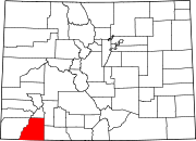 | |
| Towns | ||
| CDPs | ||
| Unincorporated communities | ||
| Ghost towns | ||
| Indian reservations | ||
| Footnotes | ‡This populated place also has portions in an adjacent county or counties | |
| International | |
|---|---|
| National | |