
Puerto Rico Highway 864
Highway 864 | ||||
|---|---|---|---|---|
| Ruta 864 | ||||
| Route information | ||||
| Maintained by Puerto Rico DTPW | ||||
| Length | 2.1 km[1] (1.3 mi) | |||
| Major junctions | ||||
| West end | ||||
| East end | ||||
| Location | ||||
| Country | United States | |||
| Territory | Puerto Rico | |||
| Municipalities | Bayamón | |||
| Highway system | ||||
| ||||

Puerto Rico Highway 864 (PR-864) is an east–west road located in the municipality of Bayamón in Puerto Rico.[2] Located south of PR-2, the entire road is located in Hato Tejas barrio and is 2.1 km (1.3 mi) in length.[1] This route intersects with PR-2 at its eastern and western termini.
Route description[edit]
Puerto Rico Highway 864 has a single lane per direction in the entire length and provides access to several neighborhoods of the western area of Bayamón.[3] It begins at PR-2 in western Hato Tejas barrio and heads to the east, where meets with PR-862. After PR-862 intersection, PR-864 continues to the east, passing through few neighborhoods until its end at PR-2 in eastern Hato Tejas.[4]
-
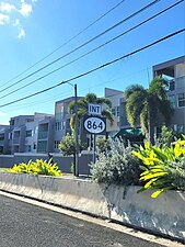
 Sign for PR-864 in Hato Tejas barrio, looking east
 -
 PR-2 west near PR-864 intersection in Hato Tejas barrio
 -
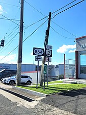 PR-2 west at PR-864 intersection in Hato Tejas barrio

.jpg)
.jpg)
History[edit]
Before its current numerical designation, the entire length of PR-864 belonged to an original segment of PR-2 prior to its current deviation and widening.[5] The current numerical designation corresponds to the 1953 Puerto Rico highway renumbering, a process implemented by the Puerto Rico Department of Transportation and Public Works (Spanish: Departamento de Transportación y Obras Públicas) that increased the insular highway network to connect existing routes with different locations around Puerto Rico.
Major intersections[edit]
The entire route is located in Hato Tejas, Bayamón.
| km[1] | mi | Destinations | Notes | ||
|---|---|---|---|---|---|
| 0.0 | 0.0 | Western terminus of PR-864; access to Toa Baja, Arecibo and San Juan | |||
| 0.4 | 0.25 | Northern terminus of PR-862 | |||
| 2.1 | 1.3 | Eastern terminus of PR-864; PR-2 east exit and entrance; access to Bayamón and San Juan | |||
| 1.000 mi = 1.609 km; 1.000 km = 0.621 mi | |||||
See also[edit]
References[edit]
- ^ a b c Google (29 February 2020). "PR-864" (Map). Google Maps. Google. Retrieved 29 February 2020.
- ^ National Geographic Maps (2011). Puerto Rico (Map). 1:125,000. Adventure Map (Book 3107). Evergreen, Colorado: National Geographic Maps. ISBN 978-1566955188. OCLC 756511572.
- ^ "Tránsito Promedio Diario (AADT)". Transit Data (Datos de Transito) (in Spanish). DTOP PR. p. 133. Archived from the original on 1 April 2019.
- ^ "Carretera 864, Bayamón, Puerto Rico". pr.geoview.info. Retrieved 7 February 2020.
- ^ "Bayamón, Memoria Núm. 24" (PDF). Puerto Rico Planning Board (in Spanish). 1952. Retrieved 14 August 2023.
External links[edit]
 Media related to Puerto Rico Highway 864 at Wikimedia Commons
This Puerto Rico road-related article is a stub. You can help Wikipedia by expanding it. |