
Tauragat Well
| Tauragat Well | |
|---|---|
 Plaque commemorating the Centenary of the well & trough | |
 | |
| General information | |
| Type | water well |
| Location | Coonalpyn, South Australia[1] |
| Address | Coonalpyn-Lameroo Road, Coonalpyn |
| Coordinates | 35°36′56″S 139°58′06″E / 35.615630°S 139.9682°E[1] |
| Construction started | 1876 |
Tauragat Well is a disused well in the Australian state of South Australia located in the locality of Coonalpyn along the Coonalpyn-Lameroo Road approximately 12 kilometres (7.5 mi) north east of the locality's town centre.[1]
The well was built in 1876 on land in what is now section 48 of the cadastral unit of the Hundred of Livingston[2] to water stock on route either to the greater South East or up north east to the Mallee.
The land of an area of 10 acres (4.0 ha) around the well was surveyed in July 1909 and was later dedicated as a water conservation reserve in 1911.[3][4]
In 1931, the reserve was transferred to the control of the District Council of Peake.[5]
A plaque was unveiled in 1976, on its centenary by J.R.Cattle, the chairman of the District Council of Peake.[6][circular reference]
In 1986, the well was described as one of the two "most significant tourist attractions' located within the District Council of Peake.[7]
Prior to 1998, the land is reported as being transferred to the National Trust of South Australia.[3]
In the years 1997 and 1998, it was one of the subjects of a survey of European heritage located in the Murray Mallee carried out on behalf of the Government of South Australia where it was described as "an important reminder of the dependence upon ground water in opening up the district for farming."[3]
The well shares its name with Tauragat Hill, a hill of 65 metres (213 ft) height which adjoins the alignment of the Coonalpyn-Lameroo Road to the well's immediate north and which has a trig point at its summit.[8]
Photo gallery[edit]
-
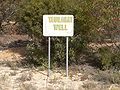 Tauragat Well sign
 -
 Trough at Tauragat Well
 -
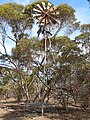 Tauragat Well windmill
 -
 Trig point on Tauragat Hill


References[edit]
- ^ a b c "Search result for 'Tauragat Well, Well' with the following datasets selected - 'Suburbs and Localities', 'Government Towns', 'Hundreds' and 'Gazetteer'". South Australian Government. South Australian Government. Retrieved 12 April 2019.
- ^ Manning, Geoffrey. "South Australian Names - T" (PDF). Manning Index of South Australian History. State Library of South Australia. Retrieved 3 January 2018.
- ^ a b c Kloeden, Andrea; Kloeden, Paul; Bruce Harry & Associates (August 1998), Heritage of the Murray Mallee (PDF), Heritage South Australia, Department for Environment, Heritage and Aboriginal Affairs, pp. 397–398, retrieved 12 April 2019
- ^ Wallis, F.S. (28 September 1911). "RESERVE FOR WATER CONSERVATION PURPOSES (Tauragat Well Reserve)" (PDF). The South Australian Government Gazette. Government of South Australia. p. 673. Retrieved 12 April 2019.
- ^ Whitford, S.R. (16 July 1931). "WATER CONSERVATION RESERVES PLACED UNDER THE CONTROL OF THE DISTRICT COUNCIL OF PEAKE" (PDF). The South Australian Government Gazette. Government of South Australia. p. 64. Retrieved 12 April 2019.
- ^ User:Dalekerrigan (8 December 2006). "File:Tauragatwell plaque.jpg". Wikimedia Foundation, Inc. Retrieved 12 April 2019.
{{cite web}}:|last1=has generic name (help) - ^ Matthews, Penny (1986), South Australia, the civic record, 1836-1986, Wakefield Press, p. 436, ISBN 978-0-949268-82-2
- ^ "Search result for 'Tauragat Hill, Hill' with the following datasets selected - 'Suburbs and Localities' and 'Gazetteer'". South Australian Government. South Australian Government. Retrieved 12 April 2019.