
Portal:World
The World Portal


The world is the totality of entities, the whole of reality, or everything that exists. The nature of the world has been conceptualized differently in different fields. Some conceptions see the world as unique, while others talk of a "plurality of worlds". Some treat the world as one simple object, while others analyze the world as a complex made up of parts.
In scientific cosmology, the world or universe is commonly defined as "[t]he totality of all space and time; all that is, has been, and will be". Theories of modality talk of possible worlds as complete and consistent ways how things could have been. Phenomenology, starting from the horizon of co-given objects present in the periphery of every experience, defines the world as the biggest horizon, or the "horizon of all horizons". In philosophy of mind, the world is contrasted with the mind as that which is represented by the mind.
Theology conceptualizes the world in relation to God, for example, as God's creation, as identical to God, or as the two being interdependent. In religions, there is a tendency to downgrade the material or sensory world in favor of a spiritual world to be sought through religious practice. A comprehensive representation of the world and our place in it, as is found in religions, is known as a worldview. Cosmogony is the field that studies the origin or creation of the world, while eschatology refers to the science or doctrine of the last things or of the end of the world.
In various contexts, the term "world" takes a more restricted meaning associated, for example, with the Earth and all life on it, with humanity as a whole, or with an international or intercontinental scope. In this sense, world history refers to the history of humanity as a whole, and world politics is the discipline of political science studying issues that transcend nations and continents. Other examples include terms such as "world religion", "world language", "world government", "world war", "world population", "world economy", or "world championship". (Full article...)
Selected articles -
-


Painting of a turn-of-century trading fair, Hessisches Volksfest (Hessian Folk Festival), 1887, Louis Toussaint (1826–1887), Öl auf Leinwand
Cultural globalization refers to the transmission of ideas, meanings and values around the world in such a way as to extend and intensify social relations. This process is marked by the common consumption of cultures that have been diffused by the Internet, popular culture media, and international travel. This has added to processes of commodity exchange and colonization which have a longer history of carrying cultural meaning around the globe. The circulation of cultures enables individuals to partake in extended social relations that cross national and regional borders. The creation and expansion of such social relations is not merely observed on a material level. Cultural globalization involves the formation of shared norms and knowledge with which people associate their individual and collective cultural identities. It brings increasing interconnectedness among different populations and cultures. The idea of cultural globalization emerged in the late 1980s, but was diffused widely by Western academics throughout the 1990s and early 2000s. For some researchers, the idea of cultural globalization is reaction to the claims made by critics of cultural imperialism in the 1970s and 1980s. (Full article...) -

Gerardus Mercator (/dʒɪˈrɑːrdəs mɜːrˈkeɪtər/; 5 March 1512 – 2 December 1594) was a Flemish geographer, cosmographer and cartographer. He is most renowned for creating the 1569 world map based on a new projection which represented sailing courses of constant bearing (rhumb lines) as straight lines—an innovation that is still employed in nautical charts.
Mercator was a notable maker of globes and scientific instruments. In addition, he had interests in theology, philosophy, history, mathematics, and geomagnetism. He was also an accomplished engraver and calligrapher. Unlike other great scholars of the age, he travelled little and his knowledge of geography came from his library of over a thousand books and maps, from his visitors and from his vast correspondence (in six languages) with other scholars, statesmen, travellers, merchants and seamen. Mercator's early maps were in large formats suitable for wall mounting but in the second half of his life, he produced over 100 new regional maps in a smaller format suitable for binding into his Atlas of 1595. This was the first appearance of the word Atlas in reference to a book of maps. However, Mercator used it as a neologism for a treatise (Cosmologia) on the creation, history and description of the universe, not simply a collection of maps. He chose the word as a commemoration of the Titan Atlas, "King of Mauretania", whom he considered to be the first great geographer. (Full article...) -

The World Economic Forum (WEF) is an international non-governmental organization, think tank, and lobbying organisation based in Cologny, Canton of Geneva, Switzerland. It was founded on 24 January 1971 by German engineer Klaus Schwab.
The foundation, which is mostly funded by its 1,000 member companies – typically global enterprises with more than five billion US dollars in turnover – as well as public subsidies, state that its own mission is "improving the state of the world by engaging business, political, academic, and other leaders of society to shape global, regional, and industry agendas". (Full article...) -

Atlantic Ocean near the Faroe Islands
A sea is a large body of salty water. There are particular seas and the sea. The sea commonly refers to the World Ocean, the wider body of seawater.
Particular seas are either marginal seas, second-order sections of the oceanic sea (e.g. the Mediterranean Sea), or certain large, nearly landlocked bodies of water.
The salinity of water bodies varies widely, being lower near the surface and the mouths of large rivers and higher in the depths of the ocean; however, the relative proportions of dissolved salts vary little across the oceans. The most abundant solid dissolved in seawater is sodium chloride. The water also contains salts of magnesium, calcium, potassium, and mercury, amongst many other elements, some in minute concentrations. A wide variety of organisms, including bacteria, protists, algae, plants, fungi, and animals live in the seas, which offers a wide range of marine habitats and ecosystems, ranging vertically from the sunlit surface and shoreline to the great depths and pressures of the cold, dark abyssal zone, and in latitude from the cold waters under polar ice caps to the warm waters of coral reefs in tropical regions. Many of the major groups of organisms evolved in the sea and life may have started there. (Full article...) -

The Cricket World Cup (officially known as ICC Men's Cricket World Cup) is the international championship of One Day International (ODI) cricket. The event is organised by the sport's governing body, the International Cricket Council (ICC), every four years, with preliminary qualification rounds leading up to a finals tournament. The tournament is one of the world's most viewed sporting events and considered the "flagship event of the international cricket calendar" by the ICC. It is widely considered the pinnacle championship of the sport of cricket.
The first Cricket World Cup was organised in England in June 1975, with the first ODI cricket match having been played only four years earlier. However, a separate Women's Cricket World Cup had been held two years before the first men's tournament, and a tournament involving multiple international teams had been held as early as 1912, when a triangular tournament of Test matches was played between Australia, England and South Africa. The first three World Cups were held in England. From the 1987 tournament onwards, hosting has been shared between countries under an unofficial rotation system, with fourteen ICC members having hosted at least one match in the tournament. (Full article...) -

Countries by total wealth, 2022 (2023 publication)
National net wealth, also known as national net worth, is the total sum of the value of a country's assets minus its liabilities. It refers to the total value of net wealth possessed by the residents of a state at a set point in time. Despite the name, figures in this article only cover household wealth and exclude government wealth, which may be substantial, as in China, or negative, as in the UK or US, and so does not show total wealth. This figure is an important indicator of a nation's ability to take on debt and sustain spending and is influenced not only by real estate prices, equity market prices, exchange rates, liabilities and incidence in a country of the population, but also by human resources, natural resources, and capital and technological advancements, which may create new assets or render others worthless in the future.
The most significant component by far among most developed nations is commonly reported as household net wealth or worth, and reflects infrastructure investment. National wealth can fluctuate, as evidenced in the United States after the Great Recession and subsequent economic recovery. During periods when equity markets experience strong growth, the relative national and per capita wealth of the countries where people are more exposed on those markets, such as the United States and United Kingdom, tend to rise. On the other hand, when equity markets are depressed, the relative wealth of the countries where people invest more in real estate and bonds, such as France and Italy, tend to rise instead. (Full article...) -

A facsimile of the signature-and-seals page of the 1864 Geneva Convention, which established humane rules of war
The Geneva Conventions are international humanitarian laws consisting of four treaties and three additional protocols that establish international legal standards for humanitarian treatment in war. The singular term Geneva Convention colloquially denotes the agreements of 1949, negotiated in the aftermath of the Second World War (1939–1945), which updated the terms of the two 1929 treaties and added two new conventions. The Geneva Conventions extensively define the basic rights of wartime prisoners, civilians and military personnel; establish protections for the wounded and sick; and provide protections for the civilians in and around a war-zone.
The Geneva Conventions define the rights and protections afforded to non-combatants who fulfill the criteria of being protected persons. The treaties of 1949 were ratified, in their entirety or with reservations, by 196 countries. The Geneva Conventions concern only protected non-combatants in war. The use of wartime conventional weapons is addressed by the Hague Conventions of 1899 and 1907 and the 1980 Convention on Certain Conventional Weapons, while the biological and chemical warfare in international armed conflicts is addressed by the 1925 Geneva Protocol. (Full article...)


.png)

,_Credit_Suisse.png)

General images -
-
 Yggdrasil, an attempt to reconstruct the Norse world tree which connects the heavens, the world, and the underworld. (from World)
 -
 Earth's land use for human agriculture in 2019 (from Earth)
 -

-
 Earth's night-side upper atmosphere appearing from the bottom as bands of afterglow illuminating the troposphere in orange with silhouettes of clouds, and the stratosphere in white and blue. Next the mesosphere (pink area) extends to the orange and faintly green line of the lowest airglow, at about one hundred kilometers at the edge of space and the lower edge of the thermosphere (invisible). Continuing with green and red bands of aurorae stretching over several hundred kilometers. (from Earth)
 -
 Empires of the world in 1898
 -
 Artist's impression of Earth during the later Archean, the largely cooled planetary crust and water-rich barren surface, marked by volcanoes and continents, features already round microbialites. The Moon, still orbiting Earth much closer than today and still dominating Earth's sky, produced strong tides. (from History of Earth)
 -
 Earth's western hemisphere showing topography relative to Earth's center instead of to mean sea level, as in common topographic maps (from Earth)
 -
 First airplane, the Wright Flyer, flew on 17 December 1903.
 -
 An artist's rendering of a protoplanetary disk (from History of Earth)
 -
 Battle during the 1281 Mongol invasion of Japan
 -
 Last Moon landing: Apollo 17 (1972)
 -
 Shanghai. China urbanized rapidly in the 21st century.
 -
 Artist's rendition of an oxinated fully-frozen Snowball Earth with no remaining liquid surface water. (from History of Earth)
 -
 Lithified stromatolites on the shores of Lake Thetis, Western Australia. Archean stromatolites are the first direct fossil traces of life on Earth. (from History of Earth)
 -
 Dinosaurs were the dominant terrestrial vertebrates throughout most of the Mesozoic (from History of Earth)
 -

-

-
 Great Mosque of Kairouan, Tunisia, founded 670 CE
 -
 "Lucy", the first Australopithecus afarensis skeleton found, was only 1.06 m (3 ft 6 in) tall.
 -
 A reconstruction of Pannotia (550 Ma). (from History of Earth)
 -
 A 580 million year old fossil of Spriggina floundensi, an animal from the Ediacaran period. Such life forms could have been ancestors to the many new forms that originated in the Cambrian Explosion. (from History of Earth)
 -
 Peopling of the world, the Southern Dispersal scenario
 -
 A banded iron formation from the 3.15 Ga Moodies Group, Barberton Greenstone Belt, South Africa. Red layers represent the times when oxygen was available; gray layers were formed in anoxic circumstances. (from History of Earth)
 -
 A view of Earth with different layers of its atmosphere visible: the troposphere with its clouds casting shadows, a band of stratospheric blue sky at the horizon, and a line of green airglow of the lower thermosphere around an altitude of 100 km, at the edge of space (from Earth)
 -
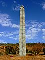 Obelisk of Axum, Ethiopia
 -
 A schematic view of Earth's magnetosphere with solar wind flowing from left to right (from Earth)
 -
 Tracy Caldwell Dyson, a NASA astronaut, observing Earth from the Cupola module at the International Space Station on 11 September 2010 (from Earth)
 -
 Trilobites first appeared during the Cambrian period and were among the most widespread and diverse groups of Paleozoic organisms. (from History of Earth)
 -
 Artist's impression of a Hadean landscape with the relatively newly formed Moon still looming closely over Earth and both bodies sustaining strong volcanism. (from History of Earth)
 -

-
 A composite image of artificial light emissions at night on a map of Earth (from Earth)
 -
 Artist's impression of the enormous collision that probably formed the Moon (from History of Earth)
 -
 Taj Mahal, Mughal Empire, India
 -
 Great Pyramids of Giza, Egypt
 -
 Standing Buddha from Gandhara, 2nd century CE
 -

-

-
 Artist's conception of Hadean Eon Earth, when it was much hotter and inhospitable to all forms of life. (from History of Earth)
 -
 COVID-19 pandemic, 2020 (from Human history)
 -
 Earth's history with time-spans of the eons to scale. Ma means "million years ago". (from History of Earth)
 -
 A map of heat flow from Earth's interior to the surface of Earth's crust, mostly along the oceanic ridges (from Earth)
 -
 Cross-section through a liposome (from History of Earth)
 -
 Graph showing range of estimated partial pressure of atmospheric oxygen through geologic time (from History of Earth)
 -
 Chennakesava Temple, Belur, India
 -

-
 Artist's conception of Devonian flora (from History of Earth)
 -
 Olmec colossal head, now at the Museo de Antropología de Xalapa
 -
 Florence, birthplace of the Italian Renaissance
 -
 Chloroplasts in the cells of a moss (from History of Earth)
 -
 A 2012 artistic impression of the early Solar System's protoplanetary disk from which Earth and other Solar System bodies were formed (from Earth)
 -
 Carving of Persian and Median soldiers, Persepolis, Achaemenid Empire, 5th century BCE
 -
 Pangaea was a supercontinent that existed from about 300 to 180 Ma. The outlines of the modern continents and other landmasses are indicated on this map. (from History of Earth)
 -
 Tiktaalik, a fish with limb-like fins and a predecessor of tetrapods. Reconstruction from fossils about 375 million years old. (from History of Earth)
 -

-
 Japanese depiction of a Portuguese carrack. European maritime innovations led to proto-globalization.
 -
 Satellite time lapse imagery of Earth's rotation showing axis tilt (from Earth)
 -
 Image of the physical world, captured by the Hubble Space Telescope (from World)
 -
 Fall of the Berlin Wall, 1989
 -
 Benin Bronze head from Nigeria
 -
 An animation of the changing density of productive vegetation on land (low in brown; heavy in dark green) and phytoplankton at the ocean surface (low in purple; high in yellow) (from Earth)
 -
 Pale orange dot, an artist's impression of Early Earth, featuring its tinted orange methane-rich early atmosphere (from Earth)
 -
 A reconstruction of human history based on fossil data. (from History of Earth)
 -

-
 Change in average surface air temperature and drivers for that change. Human activity has caused increased temperatures, with natural forces adding some variability. (from Earth)
 -
 Pillar erected by Ashoka, a Mauryan Emperor in India
 -
 Ming dynasty section, Great Wall of China
 -
 Notre-Dame de Paris, France
 -

-

-
 An artist's impression of ice age Earth at glacial maximum. (from History of Earth)
 -
 Cuneiform inscription, eastern Turkey
 -
 A composite image of Earth, with its different types of surface discernible: Earth's surface dominating Ocean (blue), Africa with lush (green) to dry (brown) land and Earth's polar ice in the form of Antarctic sea ice (grey) covering the Antarctic or Southern Ocean and the Antarctic ice sheet (white) covering Antarctica. (from Earth)
 -
 Earth's axial tilt causing different angles of seasonal illumination at different orbital positions around the Sun (from Earth)
 -
 A computer-generated image mapping the prevalence of artificial satellites and space debris around Earth in geosynchronous and low Earth orbit (from Earth)
 -
 A view of Earth with its global ocean and cloud cover, which dominate Earth's surface and hydrosphere; at Earth's polar regions, its hydrosphere forms larger areas of ice cover. (from Earth)
 -
 Angkor Wat temple complex, Cambodia, early 12th century
 -
The pale orange dot, an artist's impression of the early Earth which might have appeared orange through its hazy methane rich prebiotic second atmosphere. Earth's atmosphere at this stage was somewhat comparable to today's atmosphere of Titan. (from History of Earth)
-
An artist's impression of the Archean, the eon after Earth's formation, featuring round stromatolites, which are early oxygen-producing forms of life from billions of years ago. After the Late Heavy Bombardment, Earth's crust had cooled, its water-rich barren surface is marked by continents and volcanoes, with the Moon still orbiting Earth half as far as it is today, appearing 2.8 times larger and producing strong tides. (from Earth)
-
 Machu Picchu, Inca Empire, Peru
 -
 13th-century French historiated initial with the three classes of medieval society: those who prayed (the clergy), those who fought (the knights), and those who worked (the peasantry) (from Human history)
 -
 Ajloun Castle, Jordan
 -
 The replicator in virtually all known life is deoxyribonucleic acid. DNA is far more complex than the original replicator and its replication systems are highly elaborate. (from History of Earth)
 -

-
 Geologic map of North America, color-coded by age. From most recent to oldest, age is indicated by yellow, green, blue, and red. The reds and pinks indicate rock from the Archean.
 -
 Vitruvian Man by Leonardo da Vinci epitomizes the advances in art and science seen during the Renaissance. (from History of Earth)
 -
 A pillar at Göbekli Tepe
 -


.jpg)


.svg)


.jpg)


.jpeg)


.png)


.jpg)


Megacities of the world -

Jakarta (/dʒəˈkɑːrtə/; Indonesian pronunciation: [dʒaˈkarta] , Betawi: Jakartè), officially the Special Capital Region of Jakarta (Indonesian: Daerah Khusus Ibukota Jakarta, abbreviated to DKI Jakarta) and formerly known as Batavia until 1949, is the capital and largest city of Indonesia. Lying on the northwest coast of Java, the world's most populous island, Jakarta is the largest metropole in Southeast Asia and serves as the diplomatic capital of ASEAN. The Special Capital Region has a status equivalent to that of a province and is bordered by two other provinces: West Java to the south and east; and (since 2000, when it was separated from West Java) Banten to the west. Its coastline faces the Java Sea to the north, and it shares a maritime border with Lampung to the west. Jakarta's metropolitan area is ASEAN's second largest economy after Singapore.
Jakarta is the economic, cultural, and political centre of Indonesia. Although Jakarta extends over only 661.23 km2 (255.30 sq mi) and thus has the smallest area of any Indonesian province, its metropolitan area covers 7,076.31 km2 (2,732.18 sq mi), which includes the satellite cities of Bogor, Depok, Tangerang, South Tangerang, and Bekasi, and has an estimated population of 32.6 million as of 2022[update], making it the largest urban area in Indonesia and the second-largest in the world (after Tokyo). Jakarta ranks first among the Indonesian provinces in the human development index. Jakarta's business and employment opportunities, along with its ability to offer a potentially higher standard of living compared to other parts of the country, have attracted migrants from across the Indonesian archipelago, making it a melting pot of numerous cultures. (Full article...)Did you know -

- ... that as a result of the Röhm scandal, a Nazi became the world's first openly gay politician in 1932?
- ... that the Cure's Shows of a Lost World has grossed $37.5 million and become their highest-grossing tour to date, despite the band's refusal to use Ticketmaster's dynamic pricing?
- ... that according to Fodor's Travel, the 16th Avenue Tiled Steps is "possibly the world's largest mosaic staircase"?
- ... that Larry Herndon hit a game-winning home run in the 1984 World Series and a playoff-clinching home run on the last day of the 1987 season?
- ... that the play-by-email game Lords of the Earth takes about 25 years to play?
- ... that the Doctor Who episode "The Devil's Chord" references the events of an episode that aired more than sixty years before?
- ... that singer Henrietta Loveless performed at the New York World's Fair with the Chocolate Éclair Family?
- ... that 13-year-old Michael Artiaga won against his 15-year-old brother Andrew in the final round of the 2020 Classic Tetris World Championship?
Countries of the world -

Suriname (/ˈsʊərɪnæm, -nɑːm/ SOOR-in-A(H)M, Dutch: [syːriˈnaːmə] , Sranan Tongo: [sraˈnãŋ]), officially the Republic of Suriname (Dutch: Republiek Suriname [reːpyˈblik syːriˈnaːmə]), is a country in northern South America, sometimes considered part of the Caribbean and the West Indies. Suriname is a developing country with a medium level of human development; its economy is heavily dependent on its abundant natural resources, namely bauxite, gold, petroleum, and agricultural products. Suriname is a member of the Caribbean Community (CARICOM), the United Nations, and the Organisation of Islamic Cooperation.
Situated slightly north of the equator, over 90% of its territory is covered by rainforests, the highest proportion of forest cover in the world. Suriname is bordered by the Atlantic Ocean to the north, French Guiana to the east, Guyana to the west, and Brazil to the south. It is the smallest country in South America by both population and territory, with around 612,985 inhabitants in an area of approximately 163,820 square kilometers (63,251 square miles).0 The capital and largest city is Paramaribo, which is home to roughly half the population. (Full article...)Related portals
Protected areas of the world -
-

Wales, a country that is part of the United Kingdom, contains protected areas under various designations. The largest designation by land area is Wales' three national parks, followed by the five Areas of Outstanding Natural Beauty (sometimes collectively the "Designated Landscapes of Wales").
Among these protected areas is Snowdonia (Eryri), Wales' first and the UK's third designated national park, and the Gower AONB covering parts of the Gower Peninsula being both Wales' and the UK's first Area of Outstanding Natural Beauty (AONB), as well as smaller designations. (Full article...) -
-
-
This is a list of protected areas of Saudi Arabia, some of which are managed by the Saudi Wildlife Authority.:
- At-Taysiyah Protected Area
- Jabal Shada Nature Reserve
- Majami'al-Hadb Protected Area
- Nafud al-'Urayq
- Raydah Natural Reserve
- 'Uruq Bani Ma'arid
- Saja Umm Ar-Rimth Natural Reserve
- Harrat al-Harrah Protected Area
- Al-Khunfah Natural Reserve
- Ibex Reserve Protected Area
- Mahazat as-Sayd Protected Area
- Umm al-Qamari Islands
- Al-Tubayq Natural Reserve
- Farasan Islands Protected Area
- Jubail Marine Wildlife Sanctuary
- Jabal Aja Protected Area
- Wadi Turabah Nature Reserve
-
The protected areas of South Africa include national parks and marine protected areas managed by the national government, public nature reserves managed by provincial and local governments, and private nature reserves managed by private landowners. Most protected areas are intended for the conservation of flora and fauna. National parks are maintained by South African National Parks (SANParks). A number of national parks have been incorporated in transfrontier conservation areas.
Protected areas may also be protected for their value and importance as historical, cultural heritage or scientific sites. More information on these can be found in the list of heritage sites in South Africa. (Full article...) -
Protected areas of Estonia are regulated by the Nature Conservation Act (Estonian: Looduskaitseseadus), which was passed by the Estonian parliament on April 21, 2004 and entered into force May 10, 2004.
Overall Estonia has 15403 protected areas covering 21% of the country land and 18% of it marine and coastal territory, including 6 national parks: Lahemaa National Park, Karula National Park, Soomaa National Park,Vilsandi National Park, Matsalu National Park, and Alutaguse National Park (Full article...) -

The sun over the Lake Niassa Reserve
Protected areas in Mozambique are known as conservation areas, and are currently grouped into national parks, national reserves, forest reserves, wildlife utilisation areas (coutadas), community conservation areas, and private game farms (fazendas de bravio). There are also a number of areas that have been declared as protected areas under a variety of different legislation, which for reasons of simplicity are here grouped together as "other protected areas." Under the Conservation Law of 2014 (Law 16/2014 of June 20), protected areas will need to be reclassified into a much more flexible series of new categories which are closer to the international system used by the IUCN. International initiatives such as transfrontier parks are grouped at the end of the page. (Full article...) -

Ludaš Lake is a shallow lake in the province of Vojvodina in northern Serbia, near the city of Subotica. It is a special natural preserve and, since 1977, designated as a swamp area of international significance by the Ramsar Convention.
Protected areas cover around 5% of the territory of Serbia. The Law on the Protection of the Nature defines these categories of protected areas:- Strict nature reserve — Area of unmodified natural features with representative ecosystems set aside for the preservation of its biodiversity and for scientific research and monitoring.
- Special nature reserve — Area of unmodified or slightly modified natural features of great importance due to uniqueness and rarity which includes the habitats of endangered species set aside for the preservation of its unique features, education, limited tourism and for scientific research and monitoring.
- National park — Area with large number of diverse ecosystems of national value, with outstanding natural features and/or cultural heritage set aside for the preservation of its natural resources and for educational, scientific and tourist use.
- Natural monument — Small unmodified or slightly modified natural feature, object or phenomenon, easily detectable and unique, with unique natural attributes.
- Protected habitat — Area which includes habitats of one or more wildlife species.
- Landscape of outstanding features — Area of remarkable appearance with important natural and cultural value.
- Nature park — Area of well-preserved natural values with preserved natural ecosystems and picturesque landscape set aside for the preservation of biodiversity and for educational, tourist, recreational and scientific use.
-

Bonampak is an ancient Maya archaeological site in the Mexican state of Chiapas, and is a natural monument.
There are currently 225 Protected Natural Areas in Mexico, covering 93.8 million hectares in total. They are protected and administered by the National Commission of Protected Natural Areas (Comisión Nacional de Áreas Naturales Protegidas, or 'CONANP'), a federal agency. CONANP administers:- 77 Mexican National Parks
- 48 biosphere reserves
- 54 flora and fauna protection areas
- 28 Mexican Nature Sanctuaries
- 13 natural resources protection areas
- 5 natural monuments
-
-
-
As of present, there are around 400 protected areas in Pakistan that are recognized by IUCN. The total protected land area represents 13% of Pakistan's landmass as of 2020, The Government of Pakistan plans to increase it to at least 15% by 2023. As a signatory of the UN Convention on Biological Diversity, Pakistan is committed to expanding its protected areas to encompass 17% of its total territory by the year 2030. This ambitious goal aims to ensure the long-term conservation of nature, safeguard vital ecosystem services, and preserve the cultural values associated with these protected areas. (Full article...)
-

A view of Kaptai National Park
This is a list of protected areas of Bangladesh. Bangladesh is a country in South Asia. It is the eighth-most populous country in the world, with a population exceeding 163 million people in an area of either 148,460 square kilometres (57,320 sq mi) or 147,570 square kilometres (56,980 sq mi), making it one of the most densely populated countries in the world. (Full article...) -

Viru bog in Lahemaa National Park
Protected areas in Estonia are national parks, nature reserves and landscape protection areas (nature parks).
Estonia has five national parks, 167 nature reserves and 152 landscape conservation areas. In addition, there are 116 (118) protected areas with an old (Soviet-era) protection regulation and 537 parks. In total, 18.1% of Estonia are protected nature areas, with Lääne County having the highest percentage (32%) and Põlva County the lowest percentage of protected areas, about 9%. (Full article...) -
The National Parks of Argentina make up a network of 35 national parks in Argentina. The parks cover a very varied set of terrains and biotopes, from Baritú National Park on the northern border with Bolivia to Tierra del Fuego National Park in the far south of the continent. The Administración de Parques Nacionales (National Parks Administration) is the agency that preserves and manages these national parks along with Natural monuments and National Reserves within the country.
The headquarters of the National Parks Service are in downtown Buenos Aires, on Santa Fe Avenue. A library and information centre are open to the public. The administration also covers the national monuments, such as the Jaramillo Petrified Forest, and natural and educational reserves. (Full article...)
.svg)

.jpg)


Selected world maps
-
 1516 map of the world by Martin Waldseemüller
 -
 Mollweide projection of the world
 -
 A plate tectonics map with volcano locations indicated with red circles
 -
 The Goode homolosine projection is a pseudocylindrical, equal-area, composite map projection used for world maps.
 -
 The world map by Gerardus Mercator (1569), the first map in the well-known Mercator projection
 -
 Index map from the International Map of the World (1:1,000,000 scale)
 -
 United Nations Human Development Index map by country (2016)
 -
 Time zones of the world
 -
 Only a few of the largest large igneous provinces appear (coloured dark purple) on this geological map, which depicts crustal geologic provinces as seen in seismic refraction data


World records
- List of Olympic records in athletics
- List of world records in athletics
- List of junior world records in athletics
- List of world records in masters athletics
- List of world youth bests in athletics
- List of IPC world records in athletics
- List of world records in canoeing
- List of world records in chess
- List of cycling records
- List of world records in track cycling
- List of world records in finswimming
- List of world records in juggling
- List of world records in rowing
- List of world records in speed skating
- List of world records in swimming
- List of IPC world records in swimming
- List of world records in Olympic weightlifting
Topics

Continents of Earth | ||||||||
|---|---|---|---|---|---|---|---|---|
| ||||||||
| ||||||||
| ||||||||


| Cenozoic Era (present–66.0 Ma) |
| ||||||||||||
|---|---|---|---|---|---|---|---|---|---|---|---|---|---|
| Mesozoic Era (66.0–252 Ma) |
| ||||||||||||
| Paleozoic Era (252–539 Ma) |
| ||||||||||||
| Proterozoic Eon (539 Ma–2.5 Ga) |
| ||||||||||||
| Archean Eon (2.5–4 Ga) | |||||||||||||
| Hadean Eon (4–4.6 Ga) | |||||||||||||
ka = kiloannum (thousands years ago); Ma = megaannum (millions years ago); Ga = gigaannum (billions years ago). See also: Geologic time scale • | |||||||||||||
| Locations | ||
|---|---|---|
| Related | ||

| |||||||||||||||||||
| |||||||||||||||||||
| |||||||||||||||||||

Economic classification of countries | |||||
|---|---|---|---|---|---|
| Three-World Model | |||||
| Gross domestic product (GDP) |
| ||||
| Gross national income (GNI) | |||||
| Wages | |||||
| Wealth | |||||
| Other national accounts | |||||
| Human development | |||||
| Digital divide | |||||
| Net international investment position (NIIP) | |||||
| Technological |
| ||||
|---|---|---|---|---|---|
| Sociological | |||||
| Ecological |
| ||||
| Biological |
| ||||
| Astronomical | |||||
| Eschatological |
| ||||
| Others |
| ||||
| Fictional | |||||
| Organizations | |||||
Categories

Wikimedia
The following Wikimedia Foundation sister projects provide more on this subject:
-
 Commons
Free media repository -
 Wikibooks
Free textbooks and manuals -
 Wikidata
Free knowledge base -
 Wikinews
Free-content news -
 Wikiquote
Collection of quotations -
 Wikisource
Free-content library -
 Wikispecies
Directory of species -
 Wikiversity
Free learning tools -
 Wikivoyage
Free travel guide -
 Wiktionary
Dictionary and thesaurus


