User:Rfc1394/sandbox1
List of counties[edit]
| County |
FIPS code [1] |
County seat [2] |
Established [2] |
Formed from [3] |
Etymology [3] |
Population [2][4] |
Area [2][4] |
Map
|
|---|---|---|---|---|---|---|---|---|
| Adams County | 001 | Friendship | 1848 | Portage County | John Quincy Adams (1767-1848), President of the United States 1825-1829 | 20,875 | 648 sq mi (1,678 km2) |

|
| Ashland County | 003 | Ashland | 1860 | unorganized territory | Ashland, Henry Clay's estate in Kentucky | 16,157 | 1,044 sq mi (2,704 km2) |

|
| Barron County | 005 | Barron | 1859 | Dallas and Polk counties | Henry D. Barron, state senator and circuit court judge. | 45,870 | 863 sq mi (2,235 km2) |

|
| Bayfield County | 007 | Washburn | 1845 | Ashland County | Henry Bayfield, Royal naval officer and first to survey the Great Lakes area | 15,014 | 1,476 sq mi (3,823 km2) |

|
| Brown County | 009 | Green Bay | 1818 | unorganized territory | Major General Jacob Brown (1775-1828), a commanding general of the United States Army during the War of 1812 | 248,007 | 529 sq mi (1,370 km2) |

|
| Buffalo County | 011 | Alma | 1853 | Trempealeau County | The Buffalo River, which flows through the county. | 13,587 | 684 sq mi (1,772 km2) |

|
| Burnett County | 013 | Siren | 1856 | Polk County | Thomas P. Burnett, state legislator | 15,457 | 822 sq mi (2,129 km2) |

|
| Calumet County | 015 | Chilton | 1836 | unorganized territory | The French word for a Menominee peace pipe. | 48,971 | 320 sq mi (829 km2) |

|
| Chippewa County | 017 | Chippewa Falls | 1845 | Crawford County | The Ojibwe nation of Native Americans (historically referred to as Chippewa) | 62,415 | 1,010 sq mi (2,616 km2) |
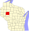
|
| Clark County | 019 | Neillsville | 1853 | Crawford County | George Rogers Clark (1752-1812), Revolutionary War general | 34,690 | 1,216 sq mi (3,149 km2) |

|
| Columbia County | 021 | Portage | 1846 | Portage County | Christopher Columbus (1451-1506), navigator and explorer | 56,833 | 774 sq mi (2,005 km2) |

|
| Crawford County | 023 | Prairie du Chien | 1818 | unorganized territory | William Harris Crawford (1772-1834), United States Senator from Georgia 1807-1813 and Secretary of the Treasury 1816-1825 | 16,644 | 573 sq mi (1,484 km2) |

|
| Dane County | 025 | Madison | 1836 | unorganized territory | Nathan Dane (1752-1835), delegate to the First Continental Congress 1785-1788 | 488,073 | 1,202 sq mi (3,113 km2) |

|
| Dodge County | 027 | Juneau | 1836 | unorganized | Henry Dodge (1782-1867), Territorial Governor of Wisconsin 1848-1857 | 88,759 | 882 sq mi (2,284 km2) |

|
| Door County | 029 | Sturgeon Bay | 1851 | Brown County | A dangerous water passage near Door Peninsula known as porte des morts, or "door of the dead" in French | 27,785 | 483 sq mi (1,251 km2) |

|
| Douglas County | 031 | Superior | 1854 | unorganized | Stephen Douglas (1813-1861), United States Senator 1847-1861 | 44,159 | 1,309 sq mi (3,390 km2) |
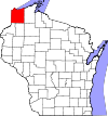
|
| Dunn County | 033 | Menomonie | 1854 | Chippewa County | Charles Dunn, state senator and chief justice of Wisconsin Territory | 43,857 | 852 sq mi (2,207 km2) |

|
| Eau Claire County | 035 | Eau Claire | 1856 | Chippewa County | City of Eau Claire, itself French for "clear water" | 98,736 | 638 sq mi (1,652 km2) |

|
| Florence County | 037 | Florence (CDP) | 1882 | Marinette and Oconto Counties | Florence Julst, the first white woman to settle in the area | 4,423 | 488 sq mi (1,264 km2) |

|
| Fond du Lac County | 039 | Fond du Lac | 1836 | unorganized territory | French for "foot of the lake" | 101,633 | 723 sq mi (1,873 km2) |
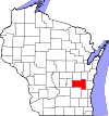
|
| Forest County | 041 | Crandon | 1885 | Langlade and Oconto Counties | Forest which covered the area when it was settled | 9,304 | 1,014 sq mi (2,626 km2) |

|
| Grant County | 043 | Lancaster | 1836 | unorganized territory | Probably a trader named Grant, who made contact with area natives in 1810, but about whom little else is known | 51,208 | 1,148 sq mi (2,973 km2) |

|
| Green County | 045 | Monroe | 1836 | unorganized territory | Nathanael Greene (1742-1786), quartermaster general during the American Revolutionary War | 36,842 | 584 sq mi (1,513 km2) |

|
| Green Lake County | 047 | Green Lake | 1858 | Marquette District | Green Lake, located within the county | 19,051 | 354 sq mi (917 km2) |

|
| Iowa County | 049 | Dodgeville | 1829 | unorganized territory | Iowa tribe of Native Americans | 23,687 | 763 sq mi (1,976 km2) |

|
| Iron County | 051 | Hurley | 1893 | Ashland and Oneida Counties | Local iron deposits | 5,916 | 757 sq mi (1,961 km2) |

|
| Jackson County | 053 | Black River Falls | 1853 | La Crosse County | Andrew Jackson (1767-1845), President of the United States 1829–1837 | 20,449 | 987 sq mi (2,556 km2) |

|
| Jefferson County | 055 | Jefferson | 1836 | Milwaukee County | Thomas Jefferson (1743-1826), President of the United States (1801-1809) | 83,686 | 557 sq mi (1,443 km2) |

|
| Juneau County | 057 | Mauston | 1856 | Adams County | Solomon Juneau (1793-1856), founder of what would become Milwaukee | 26,664 | 768 sq mi (1,989 km2) |

|
| Kenosha County | 059 | Kenosha | 1850 | Racine County | A Native American word meaning "place of the pike" | 166,426 | 273 sq mi (707 km2) |

|
| Kewaunee County | 061 | Kewaunee | 1852 | Manitowoc County | Either a Potawatomi word meaning "river of the lost" or an Ojibwe word meaning "prairie hen", "wild duck" or "to go around" | 20,574 | 343 sq mi (888 km2) |
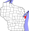
|
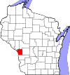
| La Crosse County | 063 | La Crosse | 1851 | unorganized territory | The Native American game of lacrosse | 114,638 | 453 sq mi (1,173 km2) |
|
| Lafayette County | 065 | Darlington | 1846 | Iowa County | Gilbert du Motier, marquis de La Fayette (1757-1834), a French general in the American Revolutionary War | 16,836 | 634 sq mi (1,642 km2) |

|
| Langlade County | 067 | Antigo | 1879 | unorganized territory | Charles de Langlade (1729 – c.1800), American Revolutionary War veteran and United States Indian Agent in Green Bay | 19,977 | 873 sq mi (2,261 km2) |

|
| Lincoln County | 069 | Merrill | 1874 | Marathon County | Abraham Lincoln (1809-1865), President of the United States 1861-1865 | 28,743 | 883 sq mi (2,287 km2) |

|
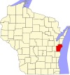
| Manitowoc County | 071 | Manitowoc | 1836 | unorganized territory | Munedoo-owk, a Ojibwe word meaning "the place of the good spirit" | 81,442 | 592 sq mi (1,533 km2) |
|
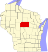
| Marathon County | 073 | Wausau | 1850 | Portage County | Marathon, Greece | 134,063 | 1,545 sq mi (4,002 km2) |
|
| Marinette County | 075 | Marinette | 1879 | Oconto | Marie Antoinette Chevalier, Native American wife of early an fur trapper | 41,749 | 1,402 sq mi (3,631 km2) |

|
| Marquette County | 077 | Montello | 1836 | Marquette District | Father Pere Jacques Marquette, missionary and explorer | 15,404 | 456 sq mi (1,181 km2) |

|
| Menominee County | 078 | Keshena | 1961 | Menominee Indian Reservation,Shawano, and Oconto | Menominee nation of Native Americans | 4,232 | 358 sq mi (927 km2) |

|
| Milwaukee County | 079 | Milwaukee | 1835 | unorganized territory | Mahnawaukee-Seepe, a Native American word meaning "gathering place by the river" | 947,735 | 242 sq mi (627 km2) |

|
| Monroe County | 081 | Sparta | 1854 | La Crosse County | James Monroe (1758-1831), President of the United States 1817-1825 | 44,673 | 901 sq mi (2,334 km2) |

|
| Oconto County | 083 | Oconto | 1851 | unorganized territory | A Native American settlement and the Oconto River, whose name means "plentiful with fish" | 37,660 | 998 sq mi (2,585 km2) |

|
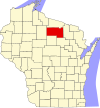
| Oneida County | 085 | Rhinelander | 1885 | Lincoln County | Oneida nation of Native Americans | 35,998 | 1,125 sq mi (2,914 km2) |
|
| Outagamie County | 087 | Appleton | 1851 | Brown County | Outagamie nation of Native Americans | 176,695 | 640 sq mi (1,658 km2) |

|
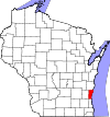
| Ozaukee County | 089 | Port Washington | 1853 | Milwaukee County | The Ojibwe word for the Sauk nation | 86,395 | 232 sq mi (601 km2) |
|
| Pepin County | 091 | Durand | 1858 | Dunn County | Pierre and Jean Pepin du Chardonnets, explorers | 7,469 | 232 sq mi (601 km2) |

|
| Pierce County | 093 | Ellsworth | 1853 | Saint Croix County | Franklin Pierce (1804-1869), President of the United States 1853-1857 | 41,019 | 576 sq mi (1,492 km2) |

|
| Polk County | 095 | Balsam Lake | 1853 | Saint Croix County | James Polk (1795-1849), President of the United States (1845-1849) | 44,205 | 917 sq mi (2,375 km2) |

|
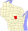
| Portage County | 097 | Stevens Point | 1836 | unorganized territory | Passage between the Fox and Wisconsin Rivers | 70,019 | 806 sq mi (2,088 km2) |
|
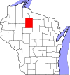
| Price County | 099 | Phillips | 1879 | Chippewa and Lincoln Counties | William T. Price, president of the Wisconsin Senate | 14,159 | 1,253 sq mi (3,245 km2) |
|
| Racine County | 101 | Racine | 1836 | unorganized territory | Racine, the French word for "root", after the Root River, which flows through the county | 195,408 | 333 sq mi (862 km2) |

|
| Richland County | 103 | Richland Center | 1842 | Iowa County | The rich soil of the area | 18,021 | 586 sq mi (1,518 km2) |

|
| Rock County | 105 | Janesville | 1836 | unorganized territory | Rock River, which flows through the county | 160,331 | 720 sq mi (1,865 km2) |

|
| Rusk County | 107 | Ladysmith | 1901 | Chippewa County | Jeremiah McLain Rusk (1830-1893), Governor of Wisconsin 1882-1889 | 14,755 | 913 sq mi (2,365 km2) |

|
| Sauk County | 111 | Baraboo | 1840 | unorganized territory | Sauk nation of Native Americans | 61,976 | 838 sq mi (2,170 km2) |

|
| Sawyer County | 113 | Hayward | 1883 | Oconto County | Philetus Sawyer (1816-1900), United States Representative (1865-1875) and Senator (1881-1893) from Wisconsin | 16,557 | 1,256 sq mi (3,253 km2) |

|
| Shawano County | 115 | Shawano | 1853 | Oconto County | A Ojibwe word meaning "southern" | 41,949 | 893 sq mi (2,313 km2) |

|
| Sheboygan County | 117 | Sheboygan | 1836 | unorganized territory | Shawb-wa-way-kun, a Native American word meaning "great noise underground" | 115,507 | 514 sq mi (1,331 km2) |

|
| Saint Croix County | 109 | Hudson | 1840 | unorganized territory | An early French explorer named St. Croix, about whom little is known | 84,345 | 722 sq mi (1,870 km2) |

|
| Taylor County | 119 | Medford | 1875 | Clark, Lincoln, Marathon and Chippewa Counties | William Robert Taylor (1820-1909), Governor of Wisconsin 1874-1876 | 20,689 | 975 sq mi (2,525 km2) |

|
| Trempealeau County | 121 | Whitehall | 1854 | Crawford and La Crosee Counties | Trempealeau Mountain (from the French for "mountain with its foot in the water"), a bluff located in a bend of the Trempealeau River,[5] which flows through the county[3] | 28,816 | 734 sq mi (1,901 km2) |

|
| Vernon County | 123 | Viroqua | 1851 | Richland and Crawford Counties | Mount Vernon, home of George Washington | 29,773 | 795 sq mi (2,059 km2) |

|
| Vilas County | 125 | Eagle River | 1893 | Oneida County | William Vilas (1840-1908), officer in the Civil War, United States Postmaster General (1885-1888), United States Secretary of the Interior (1888-1889), and Senator from Wisconsin (1891-1897) | 21,430 | 874 sq mi (2,264 km2) |

|
| Walworth County | 127 | Elkhorn | 1836 | unorganized territory | Reuben Hyde Walworth (1788-1867), jurist from New York | 102,228 | 555 sq mi (1,437 km2) |

|
| Washburn County | 129 | Shell Lake | 1883 | Burnett County | Cadwallader Washburn (1818-1882), Governor of Wisconsin 1872–1874 and Representative from Wisconsin 1867–1871 | 15,911 | 810 sq mi (2,098 km2) |

|
| Washington County | 131 | West Bend | 1836 | unorganized territory | George Washington (1732-1799), American Revolutionary War leader (1775–1783), and first President of the United States (1789–1797) | 131,887 | 431 sq mi (1,116 km2) |

|
| Waukesha County | 133 | Waukesha | 1846 | Milwaukee County | Waugooshance, a Pottawatomi word meaning "little foxes" | 389,891 | 556 sq mi (1,440 km2) |

|
| Waupaca County | 135 | Waupaca | 1851 | Brown and Winnebago Counties | wau-pa-ka-ho-nak, a Menominee word meaning "white sand bottom" or "brave young hero" | 52,410 | 751 sq mi (1,945 km2) |

|
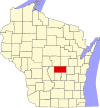
| Waushara County | 137 | Wautoma | 1851 | Marquette County | A Native American word meaning "good earth" | 24,496 | 626 sq mi (1,621 km2) |
|
| Winnebago County | 139 | Oshkosh | 1840 | unorganized territory | Winnebago nation of Native Americans | 166,994 | 439 sq mi (1,137 km2) |

|
| Wood County | 141 | Wisconsin Rapids | 1856 | Portage County | Joseph Wood (1809-1890), state legislator (1856-1858) | 74,749 | 793 sq mi (2,054 km2) |

|
- ^ a b Cite error: The named reference
epawas invoked but never defined (see the help page). - ^ a b c d e f g h "NACo - Find a county". National Association of Counties. Retrieved 2008-02-11.
- ^ a b c d e "WCA : County Directory". Wisconsin Counties Association. Retrieved 2008-02-11.
- ^ a b c d "Wisconsin QuickFacts". U.S. Census Bureau. Retrieved 2008-02-11. (2000 Census)
- ^ Elkins, Winston (1985). Trempealeau and the Mississippi River Dam. Trempealeau County, WI: Trempealeau County Historical Society.
