
Washington State Route 548
 State Route 548 | ||||
|---|---|---|---|---|
 A map of northwestern Whatcom County with SR 548 highlighted in red | ||||
| Route information | ||||
| Auxiliary route of I-5 | ||||
| Maintained by WSDOT | ||||
| Length | 13.85 mi[1] (22.29 km) | |||
| Existed | 1991–present | |||
| Major junctions | ||||
| South end | ||||
| North end | ||||
| Location | ||||
| Country | United States | |||
| State | Washington | |||
| Counties | Whatcom | |||
| Highway system | ||||
| ||||
State Route 548 (SR 548) is a state highway in Whatcom County, Washington, United States. It travels for 14 miles (23 km) between Ferndale and Blaine, terminating at interchanges with Interstate 5 (I-5) at both ends. SR 548 in Blaine, named Peace Portal Drive, follows the route of the Pacific Highway, later U.S. Route 99 (US 99) and Primary State Highway 1 (PSH 1). US 99 was decommissioned during the 1964 highway renumbering and the highway was maintained by Whatcom County until it was designated as SR 548 in 1991.
Route description
[edit]
SR 548 begins north of Ferndale at a diamond interchange with I-5, signed as exit 266.[2] The highway travels west on Grandview Road, crossing over a railroad carrying the BNSF Railway's Bellingham Subdivision,[3][4] and passes through a rural area while following Fingalson Creek. SR 548 passes north of Lake Terrell and part of the Whatcom Wildlife Area before crossing another set of railroad tracks and reaching the Cherry Point Refinery complex, the state's largest oil refinery.[5][6] The highway turns north onto Blaine Road at a roundabout near the complex's main entrance,[7] located east of Birch Bay State Park.[8][9]
SR 548 continues north through the beach community of Birch Bay, overlooking a section of Boundary Bay. The highway then crosses over California Creek near the Loomis Trail Golf Club and Dakota Creek at the southern city limit of Blaine. The highway crosses over the BNSF Bellingham Subdivision and turns northwest onto Peace Portal Drive, traveling parallel to I-5 and the railroad through Blaine.[4][10] The highway and the railroad move onto the shore of Drayton Harbor, part of Semiahmoo Bay, and travel north through downtown Blaine.[11] SR 548 reaches its terminus at a dogbone interchange with I-5, signed as exit 276, near the city's marina, approximately 1⁄2 mile (0.8 km) from the Peace Arch crossing of the Canadian border.[8] The interchange also includes ramps to D Street, which continues east to SR 543,[11] and 2nd Street, which connects to a parking lot for Peace Arch State Park.[9][12]
SR 548 is maintained by the Washington State Department of Transportation (WSDOT), which conducts an annual survey of average traffic volume on state highways that is measured in terms of annual average daily traffic. Traffic volumes on SR 548 range from a minimum of 2,100 vehicles near the Cherry Point Refinery to a maximum of 12,000 vehicles near its Ferndale terminus.[13]
History
[edit]SR 548 between Birch Bay and Blaine follows the route of a wagon road built in the 1900s parallel to a Great Northern rail line.[14] The wagon road was codified in 1913 as the northernmost segment of the Pacific Highway,[15] which later became State Road 1 during a 1923 restructuring of the highway system.[16] The United States Numbered Highways were created in 1926 and US 99 was assigned to the Pacific Highway,[17] becoming concurrent with the entire highway,[18] which was replaced by PSH 1 in 1937.[19] PSH 1 and US 99 were replaced during the 1964 highway renumbering by I-5 and Peace Portal Drive was removed from the highway system.[20][21]
SR 548 was created in 1991 from the county- and city-maintained Peace Portal Drive, Blaine Road, and Grandview Road between Ferndale and Blaine.[22][23] In 2010, WSDOT improved the I-5 interchange in Blaine at a cost of $13.2 million by converting it to a dogbone interchange using two new roundabouts.[24] A roundabout was constructed at the Cherry Point Refinery in 2018.[7]
Major intersections
[edit]The entire highway is in Whatcom County.
| Location | mi[1] | km | Destinations | Notes | |
|---|---|---|---|---|---|
| Ferndale | 0.00 | 0.00 | Southern terminus, interchange | ||
| Blaine | 11.80 | 18.99 | |||
| 13.85 | 22.29 | Northern terminus, interchange | |||
| 1.000 mi = 1.609 km; 1.000 km = 0.621 mi | |||||
References
[edit]- ^ a b Multimodal Planning Division (January 3, 2018). State Highway Log Planning Report 2017, SR 2 to SR 971 (PDF) (Report). Washington State Department of Transportation. pp. 1658–1661. Retrieved December 14, 2018.
- ^ "SR 5 – Exit 266: Junction SR 548/Grandview Road" (PDF). Washington State Department of Transportation. May 14, 2012. Retrieved February 1, 2013.
- ^ 2015 Washington State Rail System by Owner (PDF) (Map). Washington State Department of Transportation. January 2016. Retrieved December 14, 2018.
- ^ a b BNSF Railway Company Northwest Operating Division (PDF) (Map). BNSF Railway. January 10, 2013. Retrieved December 14, 2018.
- ^ "Whatcom Wildlife Area: Lake Terrell Unit". Washington State Department of Fish and Wildlife. Retrieved December 14, 2018.
- ^ Gallagher, Dave (September 14, 2017). "BP Cherry Point refinery to host open house". The Bellingham Herald. Retrieved December 14, 2018.
- ^ a b "Roundabout to be built on Grandview at Kickerville". Lynden Tribune. July 13, 2018. Retrieved December 14, 2018.
- ^ a b "State Route 548" (Map). Google Maps. Retrieved December 14, 2018.
- ^ a b Mueller, Marge; Mueller, Ted (2004). Washington State Parks: A Complete Recreation Guide (3rd ed.). Seattle: Mountaineers Books. pp. 127–129. ISBN 0-89886-893-9. OCLC 55800990. Retrieved December 14, 2018 – via Google Books.
- ^ "SR 5 – Exit 274: Junction Peace Portal Drive" (PDF). Washington State Department of Transportation. October 18, 2010. Retrieved December 14, 2018.
- ^ a b City of Blaine Comprehensive Plan 2016: Transportation Element – Functional Classification Central Blaine, 2013 (Map). City of Blaine. June 3, 2016. Retrieved December 14, 2018.
- ^ "SR 5 – Exit 276: Junction SR 548/D St/Blaine City Center" (PDF). Washington State Department of Transportation. May 14, 2012. Retrieved February 1, 2013.
- ^ 2016 Annual Traffic Report (PDF) (Report). Washington State Department of Transportation. 2017. pp. 212–213. Retrieved December 14, 2018.
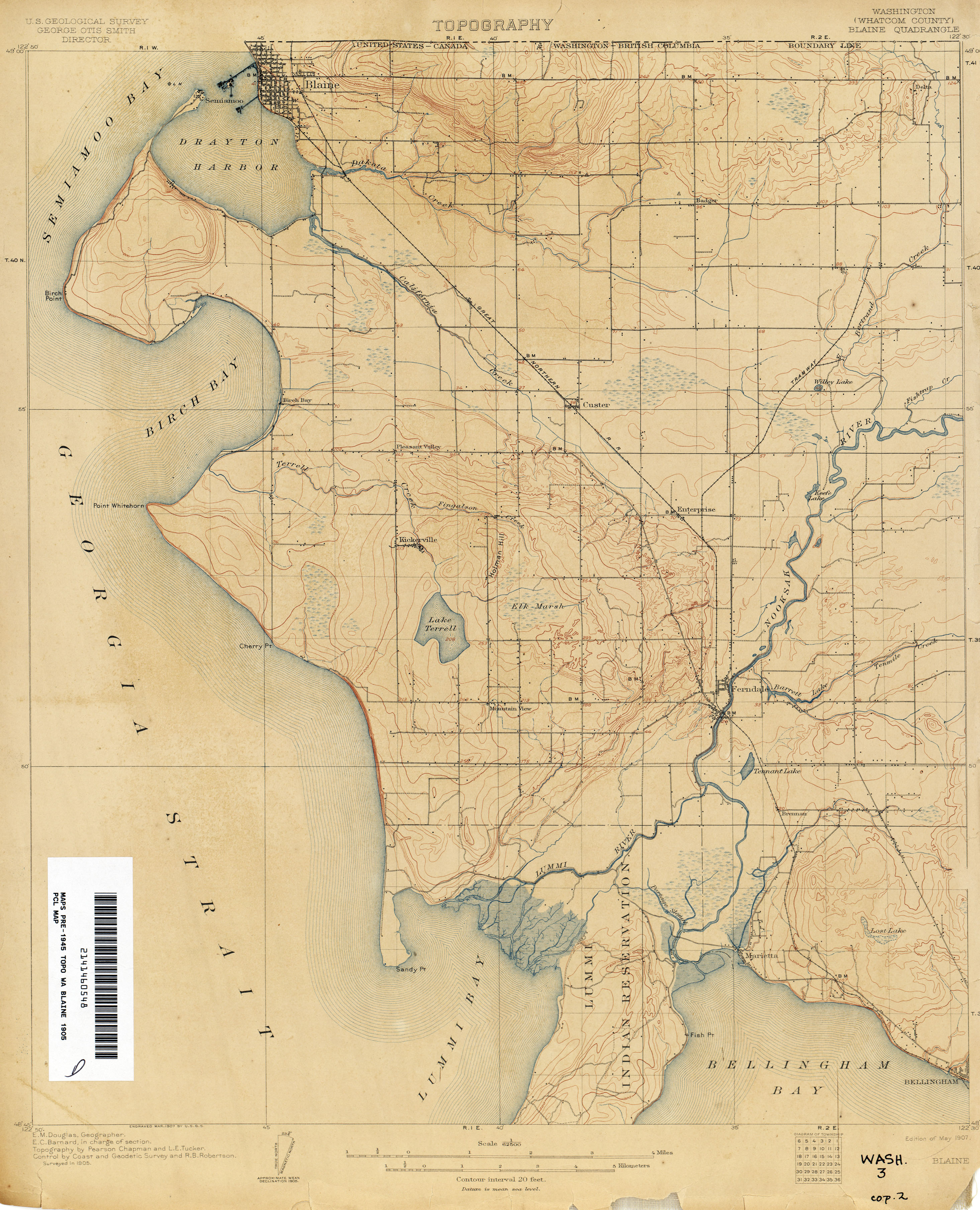
- ^ Washington (Whatcom County): Blaine Quadrangle (JPG) (Map). 1:250,000. United States Geological Survey. May 1907. Retrieved February 1, 2013.
- ^ Washington State Legislature (March 12, 1913). "Chapter 65: Classifying Public Highways". Session Laws of the State of Washington (1913 ed.). Olympia, Washington: Washington State Legislature. p. 221. Retrieved February 1, 2013.
A highway starting at the international boundary line at Blaine, Washington; thence southerly by the most feasible route through the cities of Bellingham, Mount Vernon, Everett, Seattle, Renton, along the easterly side of the White River Valley through Kent, Auburn, Tacoma, Olympia, Tenino, Centralia, Chehalis, to the southern boundary line at the city of Vancouver, Washington, to be known as The Pacific Highway.
- ^ Washington State Legislature (March 19, 1923). "Chapter 185: Primary and Secondary State Highways". Session Laws of the State of Washington (1923 ed.). Olympia, Washington: Washington State Legislature. pp. 627–628. Retrieved February 1, 2013.
SECTION 1. A primary state highway, to be known as State Road No. 1 or the Pacific Highway, is established as follows: Beginning at the international boundary line at Blaine in the County of Whatcom; thence by the most feasible route in a southerly direction to the interstate bridge over the Columbia River between Vancouver and Portland.
- ^ Bureau of Public Roads & American Association of State Highway Officials (November 11, 1926). United States System of Highways Adopted for Uniform Marking by the American Association of State Highway Officials (Map). 1:7,000,000. Washington, DC: United States Geological Survey. OCLC 32889555. Retrieved November 7, 2013 – via Wikimedia Commons.
- ^ Rand McNally Junior Road Map of Washington (Map). Rand McNally. 1926. Retrieved February 1, 2013.
- ^ Washington State Legislature (March 17, 1937). "Chapter 190: Establishment of Primary State Highways". Session Laws of the State of Washington (1937 ed.). Olympia, Washington: Washington State Legislature. p. 933. Retrieved February 1, 2013.
Beginning at the international boundary line in the vicinity of Blaine in Whatcom county, thence in a southerly direction by the most feasible route to the Washington-Oregon boundary line on the interstate bridge over the Columbia river.
- ^ Prahl, C. G. (December 1, 1965). "Identification of State Highways" (PDF). Washington State Highway Commission, Department of Highways. Retrieved February 1, 2013.
- ^ Victoria, 1966 (JPG) (Map). 1:250,000. United States Geological Survey. 1966. Retrieved February 1, 2013.
- ^ "47.17.807: State route No. 548". Revised Code of Washington. Washington State Legislature. 1991. Retrieved February 1, 2013.
- ^ "SR-548 Route Development Plan". Washington State Department of Transportation. February 1997. p. 2-1. Retrieved October 7, 2021 – via WSDOT Library Digital Collections.
- ^ "I-5 - Blaine Exit Interchange Improvements - Complete September 2010". Washington State Department of Transportation. September 2010. Retrieved February 1, 2013.