Portal:Utah
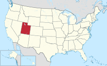
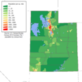
The Utah Portal  Utah (/ˈjuːtɑː/ YOO-tah, /ˈjuːtɔː/ YOO-taw; Navajo: Áshįįh Biiʼtó Hahoodzo) is a landlocked state in the Mountain West subregion of the Western United States. It borders Colorado to its east, Wyoming to its northeast, Idaho to its north, Arizona to its south, and Nevada to its west. Utah also touches a corner of New Mexico in the southeast. Of the fifty U.S. states, Utah is the 13th-largest by area; with a population over three million, it is the 30th-most-populous and 11th-least-densely populated. Urban development is mostly concentrated in two areas: the Wasatch Front in the north-central part of the state, which is home to roughly two-thirds of the population and includes the capital city, Salt Lake City; and Washington County in the southwest, with more than 180,000 residents. Most of the western half of Utah lies in the Great Basin. Utah has been inhabited for thousands of years by various indigenous groups such as the ancient Puebloans, Navajo, and Ute. The Spanish were the first Europeans to arrive in the mid-16th century, though the region's difficult geography and harsh climate made it a peripheral part of New Spain and later Mexico. Even while it was Mexican territory, many of Utah's earliest settlers were American, particularly Mormons fleeing marginalization and persecution from the United States via the Mormon Trail. Following the Mexican–American War in 1848, the region was annexed by the U.S., becoming part of the Utah Territory, which included what is now Colorado and Nevada. Disputes between the dominant Mormon community and the federal government delayed Utah's admission as a state; only after the outlawing of polygamy was it admitted in 1896 as the 45th. People from Utah are known as Utahns. Slightly over half of all Utahns are Mormons, the vast majority of whom are members of the Church of Jesus Christ of Latter-day Saints (LDS Church), which has its world headquarters in Salt Lake City; Utah is the only state where a majority of the population belongs to a single church. The LDS Church greatly influences Utahn culture, politics, and daily life, though since the 1990s the state has become more religiously diverse as well as secular. (Full article...) Entries here consist of Good and Featured articles, which meet a core set of high editorial standards.
 There are 29 counties in the U.S. state of Utah. There were originally seven counties established under the provisional State of Deseret in 1849: Davis, Iron, Sanpete, Salt Lake, Tooele, Utah, and Weber. The Territory of Utah was created in 1851 with the first territorial legislature meeting from 1851–1852. The first legislature re-created the original counties from the State of Deseret under territorial law as well as establishing three additional counties: Juab, Millard, and Washington. All other counties were established between 1854 and 1894 by the Utah Territorial Legislature under territorial law except for the last two counties formed, Daggett and Duchesne. They were created by popular vote and by gubernatorial proclamation after Utah became a state. Present-day Duchesne County encompassed an Indian reservation that was created in 1861. The reservation was opened to homesteaders in 1905 and the county was created in 1913. Due to dangerous roads, mountainous terrain, and bad weather preventing travel via a direct route, 19th century residents in present-day Daggett County had to travel 400 to 800 miles (640 to 1,290 km) on both stage and rail to conduct business in Vernal, the county seat for Uintah County a mere 50 miles (80 km) away. In 1917, all Uintah County residents voted to create Daggett County. Based on 2022 United States Census data, the population of Utah was 3,417,734. Just over 75% of Utah's population is concentrated along four Wasatch Front counties: Salt Lake, Utah, Davis, and Weber. Salt Lake County was the largest county in the state with a population of 1,185,813, followed by Utah County with 719,174, Davis County with 373,207 and Weber County with 271,926. Daggett County was the least populated with 992 people. The largest county in land area is San Juan County with 7,821 square miles (20,260 km2) and Davis County is the smallest with 304 square miles (790 km2). (Full article...)Selected image -June selected anniversaries
Selected biography -
Herbert Wells Wilkinson (born December 13, 1923) is an American former college basketball player who won the 1944 NCAA Men's Division I Basketball Tournament as a freshman while playing for Utah, then transferred to Iowa as a sophomore and became a three-time All-American. (Full article...)
Selected article -The 2002 Winter Olympics, officially the XIX Olympic Winter Games and commonly known as Salt Lake 2002 (Arapaho: Niico'ooowu' 2002; Gosiute Shoshoni: Tit'-so-pi 2002; Navajo: Sooléí 2002; Shoshoni: Soónkahni 2002), were an international winter multi-sport event that was held from February 8 to 24, 2002, in and around Salt Lake City, Utah, United States. Salt Lake City was selected as the host city in June 1995 at the 104th IOC Session. They were the eighth Olympics to be hosted by the United States, and the most recent to be held in the country until 2028, when Los Angeles will host the 34th Summer Olympics. The 2002 Winter Olympics and Paralympics were both organized by the Salt Lake Organizing Committee (SLOC), the first time that both events were organized by a single committee, and inspiring other Olympic and Paralympic Games to be organized by such since then. (Full article...)Did you know -
Selected panorama - Downtown Salt Lake City, Utah in 1913, looking east along 200 South from West Temple Street. To the far left is the Salt Lake Temple. The very white building right of the Temple is Hotel Utah, about one year old at the time. Just visible on the right side of the photo is the Salt Lake City and County Building clocktower. The Wasatch Mountains are in the background.
TopicsCategoriesGeneral imagesThe following are images from various Utah-related articles on Wikipedia.
State facts
State symbols:
Featured contentArticles:
Lists:
Pictures: Related portals
Lists
Related WikiProjectsNew articlesThis list was generated from these rules. Questions and feedback are always welcome! The search is being run daily with the most recent ~14 days of results. Note: Some articles may not be relevant to this project.
Rules | Match log | Results page (for watching) | Last updated: 2024-06-15 21:45 (UTC) Note: The list display can now be customized by each user. See List display personalization for details.
Things you can doAssociated WikimediaThe following Wikimedia Foundation sister projects provide more on this subject:
Discover Wikipedia using portals |


